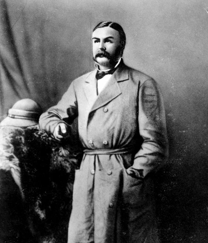
Sproat Lake is named for Gilbert Malcolm Sproat, scholar, author, anthropologist, businessman, and avid British Columbian from his arrival in 1860. He co-founded Port Alberni's first sawmill in 1861, was British Columbia's first agent-general in . . . — — Map (db m188030) HM
[Upper Marker]:
Pedro de Alberni, Captain of the Catalan Volunteers and Commander of the Spanish Establishment at Santa Cruz de Nootka, 1790-1792.
Offered by the Government of Spain on the occasion of the visit of the Spanish . . . — — Map (db m9155) HM
Harvesting of the forest has long been an important aspect of life on the Pacific Coast. The native people were the first to utilize this valuable resource in the construction of dwellings, canoes, and implements. In the nineteenth . . . — — Map (db m9192) HM
Amphitrite Point was named after the naval warship, H.M.S. Amphitrite, in 1859 by Captain George H. Richards of the Royal Navy. Captain Richards was responsible for surveying much of Vancouver Island's coastline during this period.
The original . . . — — Map (db m198567) HM
Cumberland was a coal mining centre from 1888 until the 1960's.
Union Bay was the coal port that shipped Cumberland's coal to the rest of the world. At least 260 people, most of them recent immigrants from China, Japan, Britain & Europe, died in . . . — — Map (db m187940) HM
Spars cut for Capt. Cook's ships in 1778; logs skidded by oxen in 1860; whistles blown on “steam-pots” and “locies” in 1900; countless products made by complex machines; all recall the continued use of B.C.'s forests and growth of the industry. . . . — — Map (db m187995) HM
An “instant” town of the past. In 1898 James Dunsmuir, the coal baron, moved buildings by rail from Wellington to establish this coal shipping port. Nearby copper mines added a smelter in 1902, but only pilings mark that site. Railroad logging aided . . . — — Map (db m187985) HM
The Oregon Treaty of 1846 set the United States and British North American border at the 49th parallel from Lake of the Woods, Ontario westward to Vancouver, British Columbia. Vancouver Island, which is intersected by the 49th parallel at Ladysmith . . . — — Map (db m187891) HM
Scottish-born botanist David Douglas identified over 200 new plant species in North America, including the famous Douglas fir. Primarily a collector rather than a published scientist, he sent more plants to Europe than any other . . . — — Map (db m284470) HM
On November 12, 1892, the first Snuneymuxw vs. European soccer match was played here. One of the star players "Xul-si-malt" Harry Manson, went on to win British Columbia and Nanaimo championships. His legacy of overcoming prejudice in sport is . . . — — Map (db m187894) HM
Nanaimo was founded as a coal-mining settlement in 1852. Its most productive mine, No. 1, opened in 1881. From the bottom of the main shaft, one-half mile south of here, a labyrinth of workings extended for miles under the sea. These operations were . . . — — Map (db m187983) HM
In 1869 Robert Dunsmuir discovered coal in this area. The settlement of Wellington developed after 1871 when coal was transported first by wagon and later by rail to wharves at Departure Bay. When the mines closed in 1900, many of Wellington's . . . — — Map (db m187948) HM
Saint Anne's Anglican Church, the Island's oldest surviving log church, was founded in July 1894. Gravestones honour many new settlers who helped in its construction. In October 1896, the first wedding was celebrated by the Rev. Charles Cooper, the . . . — — Map (db m187911) HM
Israel W. Powell, M.D., 1836-1915, whose name is honoured here, was a consistent supporter of the movement which led B.C. into Confederation with Canada in 1871.
The plant, Western Canada's pioneer producer of wood pulp newsprint, started in . . . — — Map (db m187970) HM
Irish-born Victoria lawyer John Foster McCreight was selected by Lieutenant-Governor Trutch to be British Columbia's first premier. Entering the Executive Council in July 1871, he laid the legislative base for the new province from November 1871 . . . — — Map (db m187957) HM
On a hot day in July 1938, an ominous smoke pillar near Gosling Lake signalled a forest fire which was to ravage 115 square miles of logged and timbered land. Over 1500 firefighters battled grimly for weeks to save timber and communities. Costs and . . . — — Map (db m188023) HM
On July 13, 1792, the sloop Discovery, commanded by Captain George Vancouver, R.N., skirted Cape Mudge and entered the narrow, tide-ripped channels leading northward to the open Pacific. This perilous voyage through Discovery Passage and . . . — — Map (db m187975) HM
Treacherous currents, swirling eddies, and turbulent tide-rips still harass vessels, despite the blasting away in 1958 of the twin peaks of Ripple Rock. Charted in 1792 by Captain George Vancouver, the Narrows has claimed numerous ships and lives . . . — — Map (db m9077) HM
Strategically located at the narrowing of Johnstone Strait lie the intact remains of Canadian artillery defences. Built in 1937-1945, they deterred seaborne attacks on Vancouver during World War II. The island and its military legacy are protected . . . — — Map (db m187888) HM