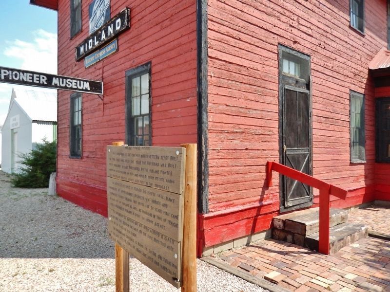
This building is the Chicago Northwestern Depot built in 1906. This was also the year the railroad was built into Midland. It was purchased by the Midland Pioneer Museum Association in 1974 and moved from its site along the railroad tracks about . . . — — Map (db m124093) HM
1/2 mile west this old trail went up the steep canyon.
This famous Old Spotted Tail Trail was used by both chiefs
Sitting Bull and Hump traveled this road to Rosebud and back.
Original wagon wheel ruts can still be seen after 100+ years. . . . — — Map (db m168897) HM
In 1889 South Dakota was admitted to the union and western
South Dakota was opened for settlement. The next year surveying was conducted throughout the summer and the town of Midland, named for its location halfway between the Missouri and the . . . — — Map (db m124087) HM
Mighty few towns have one of them hi-faluting, swank Rolls-Royce type of hyphenated names. In 1904, Murdo Mackenzie, head of the Matador brand, with herds from Mexico to Canada, shipped trainload after trainload of Texas steers to Evarts to graze on . . . — — Map (db m134517) HM
Reading Brands
Two old cowpokes reading twenty brands wont agree on all of them but generally speaking this is how to read a brand.
A letter like this (image of backwards letter F) is a reverse F. But this (image of letter F leaning . . . — — Map (db m134569) HM
Iron Nation was born in February 1815. Though details of his youth are scarce, he grew up at a time when the Sioux were a powerful force on the northern plains. His life spanned an era of unprecedented transition, stretching from a period of Sioux . . . — — Map (db m242452) HM
This place of memory honors the ancestors, people and lands of the Kui Wicasa Oyate. We are related families of the Sicangu (burnt thigh) band, people to the Tetonwan (Lakota) nation, dwellers on the plains. Long ago, we lived among rivers and lakes . . . — — Map (db m288918) HM
White River has been so called since Perrin de Lac camped near mouth and met Cheyennes in 1802. 16 Sept. 1804 Sgt. Patrick Gass and Reuben Fields reconnoitering were at this point. — — Map (db m184643) HM
Camp SCS-2 (DPE-22 in 1934): in city park at SW corner of Presho. Companies: 2756—8/1/34-10/20/34; 758—5/29/35-10/25/35; 2737—4/3-/36-10/15/36; 4726—5/15/38-10-15-38; 2770 detachment from Huron—late 1935 and early 1936.
The Civilian . . . — — Map (db m184640) HM
Flowing just north of here, Medicine Creek runs through the center of Lyman County, emptying into the Missouri River 27 miles (43 kilometers) to the northeast. The place-names of this Central South Dakota area read like an index to early state . . . — — Map (db m184639) HM
Mitchell is home to the World's Only Corn Palace. It was originally constructed in 1892 to celebrate the harvest and stimulate the economic growth of the community. Today, visitors can still enjoy celebrations at the Corn Palace and can continue to . . . — — Map (db m161881) HM