On Perth Line 34 (Hwy 8), 2.7 kilometers east of Perth County Road 107, on the right when traveling east.
Erected 1928
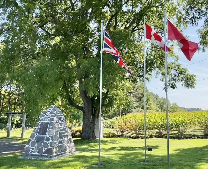
To commemorate
opening Huron Road
by the Canada Company
1828
This marks place of
log building occupied by
Sebastian & Mary
Fryfogel
first settlers in
Perth County 1829 — — Map (db m233404) HM
On Line 34 (Hwy 8), 2.8 kilometers east of Perth Road 107, on the right when traveling west.
Erected about 1844-5, this building was situated on the Huron Road, a pioneer highway which opened up the Canada Company's Huron Tract. Its original owner,
Sebastian Fryfogel, said to be the first settler in Perth County, was operating a . . . — — Map (db m233351) HM
On Glass Street just north of Samuel Street, on the right when traveling north.
The Grand Trunk was incorporated in 1853 to run from
Sarnia to Portland, Maine, Although it took in existing
lines, new ones had to be built, including the Toronto to
Sarnia section which was undertaken by the Canadian firm
of Gzowski and . . . — — Map (db m193016) HM
On Grand Trunk Trail, 0.4 kilometers east of Ingersoll Street, on the left when traveling east.
In 1857, the Grand Trunk Railway announced plans to extend its main line from Toronto to Sarnia. As it passed through St. Marys, it was necessary to build two high trestle bridges, one across the Thames River, the other across Trout Creek to carry a . . . — — Map (db m198280) HM
On James Street North just north of Queen Street East (Provincial Highway 9), on the right when traveling north.
This station was constructed in the summer of 1907 for the Grand Trunk Railway. It was the third depot on the line at St. Marys, following the Junction Station erected in 1858 and the station at “The Switch” erected in 1879. The general contractor . . . — — Map (db m198301) HM
On Church Street North just north of Queen Street East (Provincial Highway 9), on the right when traveling north.
In 1904 Andrew Carnegie donated $10,000 for this limestone library. Town Council agreed to provide a site and to maintain library at $1,000 a year.
J.A. Humphris was the architect, and Robert Clyde, local stonemason, was the builder.
The . . . — — Map (db m198286) HM
On Queen Street East (Provincial Highway 9) at James Street South, on the right when traveling east on Queen Street East.
In April of 1899 a delegation of concerned citizens approached St. Marys Town Council to request a plebiscite for the purpose of installing a municipal water system. Council granted their request and prepared the necessary by-law. Three months later . . . — — Map (db m198287) HM
On Church Street North, 0.1 kilometers north of Queen Street East (Provincial Highway 9), on the right when traveling north.
Designed by Mr. W. Williams, this bridge was built by local stonemasons Messers James Clyde and James Elliot and completed on October 13, 1884, at a cost of $3,800.
Restored in 1979 by the Town of St. Marys with a grant from The Ontario Heritage . . . — — Map (db m198283) HM
On Queen Street East (Provincial Highway 9) at Church Street North, on the right when traveling west on Queen Street East.
In 1891, after the frame town hall on this site burned, Town Council ran a competition for the design of the new town hall. Toronto architect G.W. Gouinlock's plans for a Richardson Romanesque building were chosen.
The structure, of St. Marys . . . — — Map (db m198284) HM
On Wellington Street at Downie Street, on the left when traveling south on Wellington Street.
Opened 1899
Designers
G.W. King J.W. Siddall
Contractors Cawsey & Youngs
A floorplan of
geometric shapes
replaced earlier city
hall burnt in 1897
Refurbished 1973-74
A property designated under the
Ontario . . . — — Map (db m198310) HM
On Wellington Street at Downie Street, on the left when traveling south on Wellington Street.
[English] Stratford's spacious civic square has been the site of the city's municipal buildings since 1857. Construction began on the present city hall after the destruction of the first town hall and market by fire in 1898. The plans were . . . — — Map (db m198303) HM
On Huron Road (Highway 8) at Blanchard Street, on the right when traveling west on Huron Road.
In 1836 the Canada Company, a large private land settlement agency, laid out a town plot (Mitchell) here on the Huron Road. Within a year John Hicks, one of Logan Township's earliest settlers, had erected a hotel near this point where the road . . . — — Map (db m233501) HM