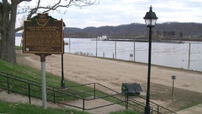
On 1st Avenue north of Court Street, on the right when traveling north.
The Ohio River, the southeast border of Gallia County, played a significant role in the development of Gallipolis and Gallia County. One of the state's first thoroughfares, this waterway enabled pioneers to settle in what was known as the Northwest . . . — — Map (db m312390) HM
On Jackson Street (Ohio Route 160/325) at Main Street, on the left when traveling east on Jackson Street.
During the American Civil War 1860-1865, a Confederate cavalry, led by Brigadier General John Hunt Morgan, infiltrated the states of Kentucky, southern Indiana, and southeastern Ohio as a diversionary tactic to draw northern troops from eastern . . . — — Map (db m308667) HM
On 2nd Street (Ohio Route 7) south of State Street, on the left when traveling south.
Begun as a land speculation project of William Duer, the Scioto
Company had hoped to encourage European investors to purchase lands
in its grant in the Ohio country. The project proved especially attractive
to the French middle class, who were . . . — — Map (db m122995) HM
On Ohio Route 160 at Thompson Road (County Route 123), on the left when traveling south on Ohio Route 160. Reported missing.
In November 1843 former slave Frank Lambert, along with 29 other former slaves, purchased 265.5 acres of land in Morgan Township. These African American settlers had once belonged to Charles Lambert Jr. of Bedford County, Virginia, but had been . . . — — Map (db m243194) HM
On Ohio Route 554 at Depot Road, on the left when traveling west on Ohio Route 554.
Side A:
The village of Bidwell, once known as Heatly, was surveyed in 1881 after the arrival of the Columbus, Hocking Valley, and Toledo Railroad. A depot (Porter Station) was soon built on this site for passenger and freight service. By . . . — — Map (db m30492) HM
On Ewington Road (County Route 149), on the right when traveling west.
The Ewington Citizens' Literary Institute purchased this site and sponsored the construction of Ewington Academy which opened in 1859. The building, designed by George Ewing, was financed by popular subscription with much labor and materials . . . — — Map (db m30466) HM
On Ohio Route 160 at Alice Road (County Route 151), on the right when traveling north on Ohio Route 160.
The previous bridge carrying State Route 160 over Raccoon Creek north of Ewington, in Gallia County was constructed in 1934. The 3-span, 191-foot long, continuous steel deck beam bridge was designed by the Ohio Department of Highways Bridge Bureau . . . — — Map (db m309373) HM
Side A:
Dr. Charles Elmer Holzer came to Gallipolis in 1909, as a resident surgeon at the Ohio Hospital for Epileptics. Recognizing the need for a community hospital, he returned in May 1910, after completing his training. With a local loan, . . . — — Map (db m30508) HM
On Pine Street (Ohio Route 160), on the right when traveling north.
A native of South Hadley, Massachusetts, he came to Gallipolis ca. 1818. An eminent lawyer and member of U.S. Congress 22 years, he was chairman of the House Ways and Means Committee during the Mexican War, founding father of the U.S. Department of . . . — — Map (db m30494) HM
On Pine Street (Ohio Route 160), on the right when traveling south.
Side A:
This 4-acre plot, established ca. 1860 by John Gee, is a burial ground for local colored citizens. John Gee was a religious leader as well as a skilled carpenter who built houses in early Gallipolis. Some Gallipolis colored pioneers . . . — — Map (db m30493) HM
On Mill Creek Road just south of Ohio Avenue, on the left when traveling south.
These three stone water towers were erected
by local craftsmen in 1892 and serviced the
Ohio Hospital for Epileptics until 1950. The
sandstone of the uncoursed masonry walls
was quarried from the surrounding hills. The
hospital facility, a . . . — — Map (db m122906) HM
Near Ohio Route 7 0.1 miles north of Georges Creek Road.
The Silver Bridge Disaster
On December 15, 1967, about one mile downstream from this historic marker, a national tragedy occured. Forty-six interstate travelers lost their lives when the Silver Bridge collapsed into the Ohio River during five . . . — — Map (db m244945) HM
Near Farmview Road (Local Road 71) north of State Route 588.
The Village of Adamsville commemorates life in this area as it was
during the early to mid-19th century. The original Adamsville settlement was located on the banks of Raccoon Creek. roughly one-half
mile east of this site. Adam Rickabaugh . . . — — Map (db m123072) HM
On Farmview Road, on the right when traveling east.
Heavy rains that occurred March 1-2, 1997, in parts of southern Ohio resulted in floods that caused widespread damage to public and private property. Record peak stages (water levels) and stream flows occurred at U.S.Geological Survey (USGS) stream . . . — — Map (db m242627) HM
On Pine Street (Ohio Route 160), on the right when traveling north.
Side A:
The African Methodist Episcopal Church was organized in 1818 as the Bethel Church. In 1868 its present name, John Gee, was adopted when the church was erected and rededicated at this present site on land donated by Gee. Founders of . . . — — Map (db m30582) HM
On Rieth Road near Jane Street, on the left when traveling west.
David R. Koontz was a born in Gallia County, Ohio on September 20, 1829, and was buried here about September 10, 1852. He was the seventh child and youngest son of Martin V. Koontz, bridge builder and carpenter, and Lydia Rickabaugh. The Koontz . . . — — Map (db m111938) HM
On 3rd Avenue (Ohio Route 7) at Court Street, on the right when traveling east on 3rd Avenue.
"Morning Dawn" was the first lodge to be chartered, on January 5, 1810, by the Grand Lodge of Ohio. Andrew Lewis was the first Worshipful Master. Meetings were originally held in J. B. Ferrard's house on the north corner of Locust and Third Streets. . . . — — Map (db m243169) HM
On West College Street (Ohio Route 325) south of North Collge Avenue, on the left when traveling south.
This historic marker is on the western boundary
of the original 10 acre Rio Grande, College Campus,
founded and endowed by Nehemiah and Permelia
Atwood. The campus was located on the southeast
corner of the Atwood Farm. Construction of . . . — — Map (db m123087) HM
On Waterloo-Mt Vernon Road (County Route 14) west of Route 141, on the right when traveling west.
Waterloo was home to the legendary Waterloo Wonders. Coach
Magellan Hairston and his Wonder Five captured consecutive Ohio
state high school Class B basketball championships in 1934 & 1935,
winning 94 out of 97 games, and defeating many Class A . . . — — Map (db m132543) HM
On Moonville Rail Trail near Moonville Hope Road (County Road 18).
The previous bridge carrying State Route 160 over
Raccoon Creek north of Ewington, in Gallia County was constructed in 1934.
The 3-span, 191-foot long,
continuous steel deck beam bridge was designed by the
Ohio Department of Highways . . . — — Map (db m248271) HM
On Pine Street (Ohio Route 160) at Ohio River Scenic Byway ( Route 7), on the right when traveling north on Pine Street.
Founded circa 1818 by free African Americans as Bethel A.M.E. Church, this site served as the first stop on an Underground Railroad route from the Kanawha Valley of Virginia (now West Virginia), just across the Ohio River. Church leaders and members . . . — — Map (db m310586) HM
On 2nd Street at Mulberry Avenue, on the left when traveling east on 2nd Street.
Side A: Morgan's Raid Route
Pursuers converge at Pomeroy
As Morgan's Raiders rode eastward across southern Ohio during the third week of July 1863, the scattered defensive forces pursuing him consolidated and drew closer. Four regiments . . . — — Map (db m28480) HM
On East Main Street (Ohio Route 93) west of Broadway Street, on the right when traveling west.
The advanced guard of Brigadier General John Hunt
Morgan's Confederate raiders arrived in Jackson about
9:30 pm on July 16, 1863, and found a tree barricade
near the Isham House on Main Street defended by old
men and boys. Local militia forces . . . — — Map (db m108267) HM
On Moriah Road at Cherry Fork Road, on the right when traveling north on Moriah Road.
Moriah Church "The Mother of Welsh Churches". Moriah Calvinistic Methodist Church was organized on November 23, 1835, in the home of Daniel Edwards, Brynele. Although Welsh settled Gallia County in 1818, they did not build a . . . — — Map (db m308607) HM
Here lies “Mad Ann” Bailey, heroine of the Virginia frontier. Ann Hennis came to Virginia at age 19. She married Richard Trotter who was killed at the Battle of Point Pleasant on October 10, 1774. “Mad Ann” dressed in buckskins and galloped off . . . — — Map (db m23878) HM
On Main Street at North Locust Street, on the left when traveling east on Main Street.
Grandma Gatewood. In 1953, at the age of 67, Emma Rowena “Grandma” Gatewood
became the first woman to hike the 2,050 mile Appalachian Trail
alone and in one season. The Gallia County, Ohio resident hiked
the Appalachian Trail . . . — — Map (db m122892) HM
Thin black lines indicate changes in relevance. Between each pair of lines entries are ordered geographically but all have the same relevance.
* Inflectional forms of words are their plurals, singulars, and possessives as well as gramatical tenses and similar variations.