Near Federal Lane, on the right when traveling east.
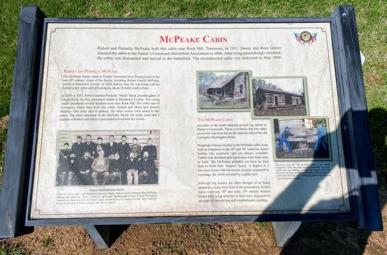
Robert and Permelia McPeake built this cabin near Rock Hill, Tennessee, in 1851. Danny and Rose Garner donated the cabin to the Parker's Crossroads Battlefield Association in 2006. After being painstakingly recorded, the cabin was dismantled and . . . — — Map (db m20539) HM
Near Tennessee Route 114 0.3 miles south of Route 100, on the left when traveling south.
(preface)
Gen. Nathan Bedford Forrest led his cavalry brigade on a raid through West Tennessee, Dec 15, 1862-Jan 3, 1863, destroying railroads and severing Gen. Ulysses S. Grant's supply line between Columbus, Kentucky, and Vicksburg, . . . — — Map (db m142782) HM
On Montgomery Way south of Barnhill Street, on the right when traveling north.
Preceded by Lexington Colored School, which operated at Pilgrim Rest Baptist Church, Montgomery School was established in 1923 for the education of Negro boys and girls of Lexington and Henderson County, a Rosenwald facility, it was organized as . . . — — Map (db m153432) HM
On Yates Avenue north of Old U.S. 70, on the left when traveling north. Reported permanently removed.
(preface) On March 24, 1865, Union Gen. George Stoneman led 6,000 cavalrymen from Tennessee into southwestern Virginia and western North Carolina to disrupt the Confederate supply line by destroying sections of the Virginia and . . . — — Map (db m284170) HM
On State Highway 114 at milepost 0 at Church Street, on the right when traveling north on State Highway 114.
Farmers State Bank was founded in 1906 by a small group of Scotts Hill investors. In the early years, the bank financed ventures and supported the mainly rural, agricultural communities it served. Even as the economic focus of the area shifted . . . — — Map (db m157622) HM
On West Tyler Street at North Prairieville Street, on the right when traveling east on West Tyler Street.
Thomas Murchison was born in Tennessee and grew up in Marshall, Mississippi before moving with his parents to Houston County, Texas around 1848. Murchison moved to Athens around 1855 and worked in a general store. Around 1858, Murchison began his . . . — — Map (db m232805) HM
On East Tyler Street at South Carrol Street, on the right when traveling east on East Tyler Street.
The Rev. Robert H. Hodge (1805-1866), a native of Tennessee, immigrated in 1850 to Anderson County, Texas. After two years he came to Henderson County. He began Science Hill Academy (15 mi. S). The only classical high school in the area during that . . . — — Map (db m247189) HM
On Market Street (U.S. 83) south of Main Street, on the right when traveling north.
Tennessee native John Leakey (1824-1900) came to Texas in 1847, settling for a time in Henderson County where he was a brickmason and rancher. He and his wife Nancy (Patterson) moved to Uvalde County in 1852 near present day Sabinal. A desire to . . . — — Map (db m111322) HM
On State Highway 64 0.2 miles north of Veterans Memorial Parkway (State Highway 243), on the right when traveling north.
A portion of the original
Mercer Grant created from
Henderson County in 1848
Named in honor of the illustrious
statesman Isaac Van Zandt
Born in Tennessee, July 10, 1813
Delegate to the Annexation
Convention in 1845
Died in . . . — — Map (db m187059) HM
Near Tennessee Route 22 0.6 miles north of Interstate 40, on the right when traveling north.
This area was named for the Parker farm whose residence was located just south of here. John M. Parker, both a practicing physician and a Baptist preacher, was known as both Doctor and Reverend Parker. His farm straddled the intersection of . . . — — Map (db m72241) HM
Thin black lines indicate changes in relevance. Between each pair of lines entries are ordered geographically but all have the same relevance.
* Inflectional forms of words are their plurals, singulars, and possessives as well as gramatical tenses and similar variations.