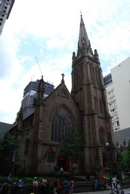
On Sixth Avenue 0.1 miles south of Wood Street, on the right when traveling south.
This whole city block at one time held as many as 4,000 graves. An ancient Indian tumulus (burying ground) originally occupied part of the site and, subsequently, the French of Fort Duquesne (1754) and the British from Fort Pitt (1758), along with . . . — — Map (db m74735) HM
On Gallows Hill Road at Durham Road (Pennsylvania Route 412), on the left when traveling north on Gallows Hill Road.
Here, Edward Marshall and his associates of the famous Indian Walk of a day and a half, September 19-20, 1737, left the Old Durham Road on the first day and followed the well-beaten Indian path which led Northwesterly through present Hellertown, . . . — — Map (db m193428) HM
The famous Indian Walk of a day and a half from Wrightstown, Bucks County, to near the present Mauch Chunk was performed for the Penn Proprietors of Pennsylvania September 19-20, 1737 by Edward Marshall and his associates who slept at the end of the . . . — — Map (db m188225) HM
On Williams Road just east of Gossard Drive, on the right when traveling east.
Barnhart Rice Homestead
The Barnhart Rice house is one of two original farmhouses occupying this 320-acre hilltop farmstead from the early days of the settlement. Started in the spring of 1822, the house was built of hand-cut sandstone . . . — — Map (db m66463) HM
On Church Road just north of Church Road, on the left when traveling east.
Born in Grabs, Switzerland. Chaplain of the first battalion Northampton County Militia, 1781, is buried in this cemetery. He ministered to the Reformed congregations of Jordan, Union Egypt and Allentown from 1771 to 1801. Lorentz Guth in 1752 . . . — — Map (db m133881) HM
On North Krocks Road 0.1 miles south of Fred Jaindl Memorial Highway (U.S. 222), on the right when traveling north.
Barns in this area, with their distinctive decorations, are widely admired. Nowhere else can you find as many fine barns of the type known as "Pennsylvania standard" barns. Their signature features are symmetrical rooflines and a forebay that . . . — — Map (db m252166) HM
Near Hamilton Boulevard east of North Krocks Road, on the right when traveling west.
William Penn's 1681 charter from King Charles II of England authorized Penn to create counties and towns or townships in Pennsylvania. Philadelphia, Bucks, and Chester, all created in 1682, were the first three counties. If you were standing on . . . — — Map (db m252211) HM
Easton is situated at the confluence of the Lehigh and Delaware Rivers. Founded in the early 1750s, it became an important river community and transportation junction. Opened by 1834, the Lehigh, Morris, and Delaware Canal systems carried . . . — — Map (db m109572) HM
On Saint Johns Road 0.3 miles east of Jonesboro Quarry Road, on the right when traveling west.
St. John's Cemetery contains the graves of four Revolutionary War Soldiers.
Jacob Hileman, born July 20, 1762 in Northampton Co., Pennsylvania. As a private he served in the 4th company, 3rd battalion. Northampton County Militia in 1778 . . . — — Map (db m207797) HM WM
On Route 236 at Carey Road, on the right when traveling south on Route 236.
The original Liberty Tree was a stately elm in Boston, Massachusetts. It was a rallying point for the Sons of Liberty, an organization of Patriots who played a key role in resisting British tyranny and creating support for rebellion against Great . . . — — Map (db m306867) HM
On Hamilton Street at Church Street, on the right when traveling east on Hamilton Street.
In commemoration of the saving of the
Liberty Bell
from the British, September 1777
Erected to the memory of
John Jacob Mickley
Commissary of Issues, and member of the General
Committee from Whitehall . . . — — Map (db m124214) HM
On 3rd Street/College Avenue at Bushkill Drive, on the right when traveling north on 3rd Street/College Avenue.
On Christmas Eve 1824, the Easton Centinel carried a notice calling upon residents of Northampton County "friendly to the establishment of a COLLEGE at Easton" to meet three days later at White's Hotel on Center Square. Local lawyers James Madison . . . — — Map (db m136107) HM
On Market Street (Business U.S. 13) near Franklin Street, on the right when traveling east. Reported permanently removed.
In November 1861, a force of about 4,500 United States officers, soldiers, cavalrymen, and artillerists assembled in and around Snow Hill. Some of the troops camped here on the Worcester County Courthouse yard. Gen. Henry H. Lockwood commanded . . . — — Map (db m74867) HM
The first proclamation of the American Declaration of Independence took place on the Court House steps in this Circle in Easton at 12:O’Clock noon in July 8, 1776, simultaneously with similar proclamation at that appointed hour in Philadelphia . . . — — Map (db m86216) HM
Near NW Railroad Street near NW Curtis Street, on the left when traveling west.
Delaware, 1st State
December 7, 1787
1609 • Henry Hudson visited Delaware Bay
1638 • Swedish colonists established Fort Christina, Delaware's first permanent settlement, and founded the colony of New Sweden
1655 • Dutch captured New . . . — — Map (db m47214) HM
On North 3rd Street north of Church Street, on the right when traveling north.
Chipman Mansion (252 Spring Garden Street) was built c.1907 and was designed by William Michler. It served as a residence for Easton Industrialist W. Evan Chipman, a partner with his brother in the Charles Chipman Sons Hosiery Mills.
. . . — — Map (db m114659) HM
On Franklin Street at Bridge Street, on the right when traveling north on Franklin Street.
Almost 250 years before President George Bush designated a department of homeland security to help protect Americans from terrorist attack, Pennsylvania's colonial governor, Robert H. Morris, selected someone known for his great ingenuity to . . . — — Map (db m252095) HM
Near Schoenersville Road 0.2 miles east of Eaton Avenue, on the right when traveling east.
“The philosophy of farming has left the lasting and profound mark on our national landscape and it has made an enduring cradle for the things we now accept as Americana. America will always cherish the arts of farm life as mirrored . . . — — Map (db m258688) HM