THE HISTORICAL
MARKER DATABASE
“Bite-Size Bits of Local, National, and Global History”


9 entries match your criteria.  


Historical Markers and War Memorials in Brighton

 
By William Fischer, Jr., December 5, 2024
Brighton Agricultural Society Marker
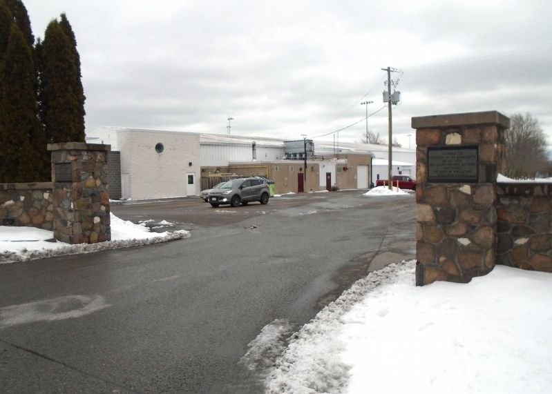
1 ► Ontario, Northumberland County, Brighton — Brighton Agricultural Society — 1853 to 1953 —
On Pinnacle Street South at Elizabeth Street (Provincial Highway 2), on the left when traveling south on Pinnacle Street South.
Presented by Ont. Department of Agriculture in recognition of one hundred years of service [Dedicated] August 28, 1957 — — Map (db m262506) HM
2 ► Ontario, Northumberland County, Brighton — Brighton District Pioneers and Farmers —
On Pinnacle Street South at Elizabeth Street (Provincial Highway 2), on the right when traveling south on Pinnacle Street South.
To honour the Pioneers of the Community and all those who during the past 100 years have served the cause of agriculture in Brighton District — — Map (db m262502) HM
3 ► Ontario, Northumberland County, Brighton — Brighton Public School —
On Elizabeth Street (Provincial Highway 2) just west of Terry Fox Drive/Pinnacle Street South, on the right when traveling west.
The original school on this site was officially opened as the Union High and Public School on September 4, 1915. The construction of such an imposing building at a cost of over $52,000 during the First World War was a remarkable act of faith in . . . — — Map (db m262531) HM
4 ► Ontario, Northumberland County, Brighton — Brighton Town Hall Bell —
On Main Street (Provincial Highway 2) at Veterans Way, on the right when traveling west on Main Street.
Original bell from Brighton Town Hall Erected 1884 Destroyed by tornado July 13th, 1973 — — Map (db m262508) HM
5 ► Ontario, Northumberland County, Brighton — Memorial Park —
On Main Street (Provincial Highway 2) at Veterans Way, on the right when traveling west on Main Street.
This Memorial Parkland was generously donated to the Village of Brighton in 1923 by Ida Lockwood. — — Map (db m262518) HM
6 ► Ontario, Northumberland County, Brighton — Memorial Park: The Centre of Town —
On Main Street (Provincial Highway 2) at Veterans Way, on the right when traveling west on Main Street.
Memorial Park is the heart of Downtown Brighton. Used in all seasons, residents and visitors alike gather in this space for concerts, movies, special events, parades, and many community celebrations. During World War I, before it was 'Memorial . . . — — Map (db m262529) HM
7 ► Ontario, Northumberland County, Brighton — Van Sicklen Cemetery —
On County Road 64 at Boes Road, on the right when traveling west on County Road 64.
Van Sicklen families emigrated from Holland to America before New Amsterdam became New York City. In 1805, a branch of one of those families, Cornelius and his wife Hannah van Sicklen together with their children Mary, Ferdinand, Sarah and . . . — — Map (db m275537) HM
8 ► Ontario, Northumberland County, Brighton — War Memorial Cenotaph — "Lest We Forget" — "N'oublions jamais" —
On Kingsley Avenue just north of Main Street (Provincial Highway 2), on the right when traveling north.
In the service of Canada in war and peace Au service du canada en temps de guerre et de paix World War I • Premier guerre mondiale 1914 - 1918 John Baxter · Sidney Betts · William . . . — — Map (db m262549) WM
9 ► Ontario, Northumberland County, Brighton — WWI Battle Honours — Honneurs de bataille premier guerre mondiale —
On Kingsley Avenue just north of Main Street (Provincial Highway 2), on the right when traveling north.
Dardanelles • Zeebrugge • Jutland • Ostend St. Eloi • Cambrai • Somme • Mons Passchendaele • Courcelette • Vimy Ridge • St. Julien Ypres • Amiens • Hill 70 • Arras — — Map (db m262517) WM
Paid Advertisement
 
 
CeraNet Cloud Computing sponsors the Historical Marker Database.
This website earns income from purchases you make after using our links to Amazon.com. We appreciate your support.
Paid Advertisement
Nov. 11, 2026
