Corbridge
The scene of stormy events in the past.
In 796 Ethelred, King of Northumbria was slain here.
In 918 King Regnald the Dane defeated the English and Scots armies here.
In 1138 King David I of Scotland occupied the town.
In 1201 it . . . — — Map (db m125635) HM
Corbridge Roman Site
The first Roman fort at Corbridge was built about a kilometre to the west of here. It was built as a supply base for the Roman advance into Scotland in about AD 80. Five years after the fort was abandoned, the first of a series . . . — — Map (db m125529) HM
To the Greater Glory of God
And in Never Fading Memory of All
Who the Noble Sons of This Parish
Who Laid Down Their Lives
For God King and Country in the
Great War 1914 – 1918
This Lychgate was Erected 1920
“A People That . . . — — Map (db m125634) WM
The Courtyard Building
About AD 165 a new layout for Corbridge was planned. The earlier fort buildings were mostly demolished and a little later work began on this large courtyard building. We do not know with certainty the original function of the . . . — — Map (db m125540) HM
The Early Forts
The earliest forts at Corbridge were built largely of timber. It was not until the middle of the second Century, when the last fort was built, that extensive use was made of stone.
The remains which you can see here belong to . . . — — Map (db m125541) HM
The East Military Compound
You are now standing in the east military compound, some of which lies buried in the field behind you. The most substantial remains within the compound belong to a pair of residential houses to your left, in the . . . — — Map (db m125542) HM
The Fountain House
An aqueduct brought water into the site from the north to feed a fountain here. The water flowed through an ornamental fountain-head into a large basin surrounded with decorated stone screens and from there into the stone trough . . . — — Map (db m125539) HM
The Golden Lion was built from stones from Dilston Hall, demolished in 1768 during the break up and sale of the property after Lord Derwent-Waters execution for his part in the Jacobite Rebellion. The stone originally came from the Roman bath . . . — — Map (db m125631) HM
The Granaries
In front of you are the remains of two large granaries. They were designed to store grain to make bread, an important part of a Roman soldier's diet.
Inside the buildings the stone floors rest on low stone walls with channels . . . — — Map (db m125538) HM
The Main Street
This was the main street of the town. It formed part of an important Roman road known as the Stanegate which ran all the way from Corbridge to Carlisle. To your left are the remains of shops, a fountain, and two granaries. On its . . . — — Map (db m125531) HM
The Old Market Cross
Which, mounted on a Roman altar from Corstopitum, stood for some 6oo years in the market place it was removed in 1807, and restored and re-erected on its present site in 1975. — — Map (db m125639) HM
The Side Street
This is the side street which divides the two military compounds. Originally it joined the Stanegate (the main street), but sometime in the third or fourth centuries a wall was built which closed off the far end and also linked the . . . — — Map (db m125543) HM
The West Headquarters Building
This building is thought to have been the administrative headquarters of the west compound. It was divided internally into six rooms probably with arched openings between them. The room in the centre at the back of . . . — — Map (db m125546) HM
The West Military Compound
You are now standing in the west military compound some of which lies buried in the field behind you. To your left. opposite the main gate, is the Headquarters building. There is a small underground chamber which is . . . — — Map (db m125544) HM
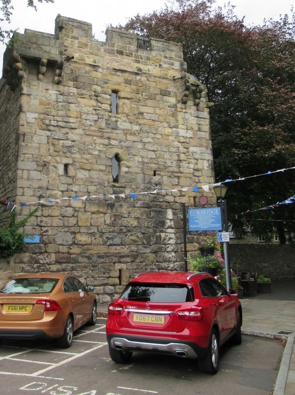
Vicar’s Pele
This tower, the finest of its kind, was built about AD 1300 for a Vicar of Corbridge and was lived in as a fortified vicarage until the early seventeenth century. — — Map (db m125637) HM