By Bill Coughlin, April 21, 2007
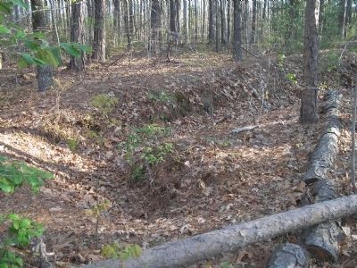
Confederate Earthworks
SHOWN IN SOURCE-SPECIFIED ORDER
| On Washington Highway (U.S. 1), on the right when traveling south. |
| On Massaponax Church Road (County Route 608) 0 miles west of U.S. 1, on the right when traveling west. |
| On Massaponax Church Road (County Route 608) 0 miles west of U.S. 1, on the right when traveling west. |
| On Jefferson Davis Highway (U.S. 1) 0.1 miles south of Massaponax Church Road (County Route 608), on the left when traveling south. |
| On Guinea Station Road, on the right when traveling east. |
| Near Stonewall Jackson Road (Virginia Route 606) near Guinea Station Road (Virginia Route 634). |
| On South River Road, on the right when traveling south. |
| On North Main Street (Virginia Route 2) at Courthouse Lane (Local Route 1204), on the right when traveling north on North Main Street. |
| On Colonial Road at Antioch Road, on the right when traveling south on Colonial Road. |
| On Jefferson Davis Highway (U.S. 1) 2.4 miles south of Guinea Station Road (County Route 607), on the left when traveling south. |
| On U.S. 1, 0.1 miles south of Morris Road (County Route 606). |
| On Jefferson Davis Highway (U.S. 1), on the right when traveling north. |
| On Jefferson Davis Hwy (U.S. 1) at Paige Road (Virginia Route 605), on the right when traveling north on Jefferson Davis Hwy. |
| On Jefferson Davis Highway (U.S. 1) at Virginia Route 639, on the right when traveling south on Jefferson Davis Highway. |
| On Jefferson Davis Highway (U.S. 1) 0.7 miles south of C C C Road (County Route 683), on the right when traveling north. |
| On Jefferson Davis Highway (U.S. 1) at Jericho Road (Virginia Route 207), on the right when traveling south on Jefferson Davis Highway. |
| On Jericho Road (Virginia Route 207) at Jefferson Davis Highway (U.S. 1), on the left when traveling south on Jericho Road. |
| On Washington Highway (U.S. 1) at Oxford Road, on the right when traveling north on Washington Highway. |
| On Washington Highway (U.S. 1), on the right when traveling north. |
| Near Verdon Road (Virginia Route 685) 0.2 miles west of New Market Mill Road, on the right when traveling west. |
| Near Verdon Road (Virginia Route 685) 0.2 miles west of New Market Mill Road, on the right when traveling west. |
| Near Verndon Road (Virginia Route 684) 0.2 miles west of New Market Mill Road (Virginia Route 685), on the right when traveling west. |
| Near Verndon Road (Virginia Route 684) 0.2 miles west of New Market Mill Road (Virginia Route 685), on the right when traveling west. |
| Near Verndon Road (Virginia Route 684) 0.2 miles west of New Market Mill Road (Virginia Route 685), on the right when traveling west. |
| Near Verndon Road (Virginia Route 684) 0.2 miles west of New Market Mill Road (Virginia Route 685), on the right when traveling west. |
| Near Verndon Road (Virginia Route 684) 0.2 miles west of New Market Mill Road (Virginia Route 685), on the right when traveling west. |
| Near Verndon Road (Virginia Route 684) 0.2 miles west of New Market Mill Road (Virginia Route 685), on the right when traveling west. |
| Near Verndon Road (Virginia Route 684) 0.2 miles west of New Market Mill Road (Virginia Route 685), on the right when traveling west. |
| Near Verndon Road (Virginia Route 684) 0.2 miles west of New Market Mill Road (Virginia Route 685), on the right when traveling west. |
| Near Verndon Road (Virginia Route 684) 0.2 miles west of New Market Mill Road (Virginia Route 685), on the right when traveling west. |
| Near Verndon Road (Virginia Route 864) 0.2 miles west of New Market Mill Road (Virginia Route 865), on the right when traveling west. |
| On Washington Highway (U.S. 1), on the left when traveling south. |
| On Virginia Route 30, on the left when traveling east. Reported missing. |
| On Washington Highway (U.S. 1) 0.2 miles south of Kings Dominion Boulevard (Virginia Route 30), on the right when traveling north. |
| On North Washington Highway (U.S. 1) 0.2 miles north of Cross Corner Road, on the right when traveling north. |