7 entries match your criteria.
Related Historical Markers
Greenville Treaty Line Markers
By Christopher Busta-Peck, March 29, 2009
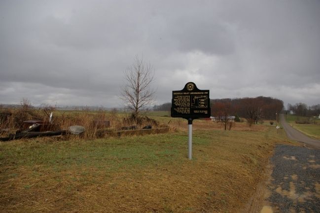
Greenville Treaty Line Marker and the land to the east of it
SHOWN IN SOURCE-SPECIFIED ORDER
| | This starred line marks the crossing in Knox County of the Greenville Treaty Line as surveyed by Israel Ludlow between 1797 and 1799; that part running from near Fort Laurens in the eastern part of the state, to a point near Fort Recovery, thence . . . — — Map (db m17478) HM |
| | Greenville Treaty Line | Organized 1797
The starred line marks the
crossing of Knox County of the
Greenville Treaty Line as
surveyed by Israel Ludlow between
1797 and 1799; that part running
from near Fort Laurens in the
eastern part . . . — — Map (db m77401) HM |
| | Greenville Treaty Line / Organized 1797
The starred line marks the
crossing of Knox County of the
Greenville Treaty Line as
surveyed by Israel Ludlow between
1797 and 1799; that part running
from near fort Laurens in the
eastern part . . . — — Map (db m77337) HM |
| | Greene Ville Treaty Line
Surveyed by Israel Ludlow, 1797- 1799
The southern boundary of Ashland County is a portion
of the original Greene Ville Treaty. The line was
established at the Treaty of Greene Ville signed August 3,
1795 by . . . — — Map (db m77342) HM |
| | Blockhouse built here, 1789, by
Gen. Charles Scott for protection
of settlers against Indians who
had massacred and driven off
earlier families. Scott came
from Va., 1785. He was in the
French and Indian Wars. Organized
first company south of . . . — — Map (db m77353) HM |
| | At this spot was found the original surveyor's stake which marked the western terminus of that part of the Greene Ville Treaty line running from near Fort Laurens, in the eastern part of the state, to Fort Recovery. From this point the line ran . . . — — Map (db m20265) HM |
| | On June 18, 1797 from a sycamore tree
near the fork of Loramie Creek, Israel
Ludlow surveyed a random line east
130.6 miles to the Muskingum River.
On August 3, 1799, a short distance
east of this spot, Ludlow commenced
the Greenville Treaty . . . — — Map (db m77542) HM |
May. 2, 2024