25 entries match your criteria.
Related Historical Markers
This marker is trail head for a set of markers along the Balls Bluff Battlefield walking trail. Please use the related markers list here to see a "virtual tour" of the battlefield by markers.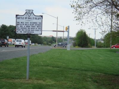
By J. J. Prats, April 30, 2007
Battle of Ball’s Bluff Marker
SHOWN IN SOURCE-SPECIFIED ORDER
| 1 ► Virginia, Loudoun County, Leesburg — F-1 — Battle of Ball’s Bluff |
| On James Monroe Highway (U.S. 15) at Battlefield Parkway, on the right when traveling south on James Monroe Highway. Reported missing. | |||
| 2 ► Virginia, Loudoun County, Leesburg — A Divided America, A Divided Loudoun County — |
| Near Ball’s Bluff Road, on the left when traveling east. | |||
| 3 ► Virginia, Loudoun County, Leesburg — The Battle at Ball’s Bluff — |
| Near Ball’s Bluff Road, on the left when traveling east. | |||
| 4 ► Virginia, Loudoun County, Leesburg — Battle of Balls Bluff — October 21, 1861 — |
| On Ball’s Bluff Road, on the right when traveling east. | |||
| 5 ► Virginia, Loudoun County, Leesburg — Additional Area Civil War Sites — |
| On Ball’s Bluff Road, on the right when traveling east. | |||
| 6 ► Virginia, Loudoun County, Leesburg — 8th Virginia Infantry — |
| Near Ball’s Bluff Road, on the left when traveling east. | |||
| 7 ► Virginia, Loudoun County, Leesburg — Jenifer’s Cavalry — |
| Near Ball’s Bluff Road, on the left when traveling east. | |||
| 8 ► Virginia, Loudoun County, Leesburg — 15th Massachusetts Infantry — |
| Near Ball’s Bluff Road, on the left when traveling east. | |||
| 9 ► Virginia, Loudoun County, Leesburg — Union Artillery — |
| Near Ball’s Bluff Road, on the left when traveling east. | |||
| 10 ► Virginia, Loudoun County, Leesburg — Ball’s Bluff Overlook — |
| Near Ball’s Bluff Road, on the right when traveling east. | |||
| 11 ► Virginia, Loudoun County, Leesburg — 20th Massachusetts Infantry — |
| Near Ball’s Bluff Road, on the left when traveling east. | |||
| 12 ► Virginia, Loudoun County, Leesburg — 1st California Regiment — |
| Near Ball’s Bluff Road, on the right when traveling east. | |||
| 13 ► Virginia, Loudoun County, Leesburg — Edward D. Baker — |
| Near Ball’s Bluff Road, on the right when traveling east. | |||
| 14 ► Virginia, Loudoun County, Leesburg — Ball’s Bluff National Cemetery |
| Near Ball’s Bluff Road, on the left when traveling east. Reported permanently removed. | |||
| 15 ► Virginia, Loudoun County, Leesburg — The North: Union Leaders at Ball's Bluff |
| Near Ball’s Bluff Road, on the left when traveling east. Reported permanently removed. | |||
| 16 ► Virginia, Loudoun County, Leesburg — The South: Confederate Leaders at Ball’s Bluff — |
| Near Ball’s Bluff Road, on the left when traveling east. | |||
| 17 ► Virginia, Loudoun County, Leesburg — Battle of Ball’s Bluff, October 21, 1861 |
| Near Ball’s Bluff Road, on the left when traveling east. Reported permanently removed. | |||
| 18 ► Virginia, Loudoun County, Leesburg — Thomas Clinton Lovett Hatcher — 20 December, 1839 – 21 October, 1861 — |
| Near Ball’s Bluff Road, on the left when traveling east. | |||
| 19 ► Virginia, Loudoun County, Leesburg — 42nd New York Infantry — |
| Near Ball’s Bluff Road, on the right when traveling east. | |||
| 20 ► Virginia, Loudoun County, Leesburg — 17th Mississippi Infantry — |
| Near Ball’s Bluff Road, on the right when traveling east. | |||
| 21 ► Virginia, Loudoun County, Leesburg — 18th Mississippi Infantry — |
| Near Ball’s Bluff Road, on the right when traveling east. | |||
| 22 ► Virginia, Loudoun County, Leesburg — Aftermath of Ball’s Bluff — |
| Near Ball’s Bluff Road, on the right when traveling east. | |||
| 23 ► Virginia, Loudoun County, Leesburg — Ball’s Bluff Masked Battery — …held to the bluff without room to retire. |
| On Edward’s Ferry Road at Battlefield Parkway North East, on the left when traveling east on Edward’s Ferry Road. Reported damaged. | |||
| 24 ► Virginia, Loudoun County, Leesburg — T-51 — Ball’s Bluff Masked Battery — |
| On Edwards Ferry Road at Battlefield Parkway, on the right when traveling west on Edwards Ferry Road. | |||
| 25 ► Virginia, Loudoun County, Leesburg — Battlefield Historic Restoration Project — |
| Near Ball’s Bluff Road, on the left when traveling east. | |||