On Plank Road / Germania Highway (State Highway 3) at Elys Ford Road (County Route 610), on the right when traveling west on Plank Road / Germania Highway.
Vicious fighting surged back and forth across this large clearing on the morning of May 3. From here, you can clearly see the two key Union positions; Fairview, to your right front near the brick wall of the Chancellor Cemetery; and the . . . — — Map (db m3785) HM
On Plank Road (State Highway 3) at Elys Ford Road (County Route 610), on the right when traveling west on Plank Road.
The intersection in front of you was the focal point of the Chancellorsville Battlefield. From here roads radiated in five directions. Four of them are visible; the fifth, River Road, lies just beyond the trees to your left. From this . . . — — Map (db m3800) HM
On Plank Road / Germania Highway (State Highway 3) at Elys Ford Road (County Route 610), on the right when traveling west on Plank Road / Germania Highway.
On the morning of May 3, 1863, more than 17,500 men fell killed or wounded in the woods and fields around you - one man shot every second for five hours. Entrenched Union lines in front of you collapsed, and the Confederates surged forward to seize . . . — — Map (db m3801) HM
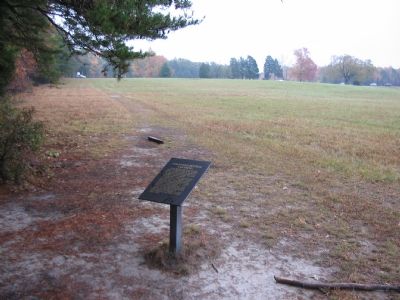
On Plank Road / Germania Highway (State Highway 3) near Elys Ford Road (County Route 610), on the right when traveling west.
As Union resistance around the Chancellor house dissolved, Robert E. Lee rode into the clearing behind his victorious battalions. Though badly outnumbered, Lee in three days had stopped the initial Union advance, brazenly split his own army to . . . — — Map (db m3818) HM
On Plank Road / Germania Highway (State Highway 3) at Elys Ford Road (County Route 610), on the right when traveling east on Plank Road / Germania Highway.
Their names are unrecorded, their labors are rarely noted. No images of them survive. But slaves outnumbered Chancellor family members when Frances Chancellor moved into this house in 1861. Likely only a few of the 20 slaves owned by the . . . — — Map (db m5618) HM
On Plank Road / Germania Highway (State Highway 3) at Elys Ford Road (County Route 610), on the right when traveling west on Plank Road / Germania Highway.
In seventy-two hours the Chancellor family's world was turned upside down. A Union soldier described the Chancellor women on April 30:
"Upon the upper porch was quite a bevy of ladies in light, dressy, attractive spring costumes. They were not . . . — — Map (db m159166) HM
On Elys Ford Road (County Route 610) at Plank Raod (Virginia Highway 3), on the right when traveling south on Elys Ford Road.
Hooker reached this point, April 30, 1863; Next day he entrenched, with his left wing on the river and his right wing on this road several miles west. That wing was surprised by Jackson and driven back here, May 2. The Confederates stormed the . . . — — Map (db m3511) HM
On Plank Road / Germania Highway (State Highway 3) at Wiles Drive, on the right when traveling west on Plank Road / Germania Highway.
April 10 - May 3, 1863. These trenches were part of Hooker's original line. On May 2, Couch's II Corps skirmishers, under command of Col. Nelson A. Miles, beat off repeated Confederate attacks launched to draw attention from Jackson's flanking . . . — — Map (db m159157) HM
On Hooker Drive, on the right when traveling north.
Men of Maj. Gen. Winfield Scott Hancock's division manned the earthworks which are located just inside this woodline. Hancock's troops confronted two Confederate divisions advancing from the south (from your right front) and east as well as the . . . — — Map (db m3867) HM