116 entries match your criteria. Entries 101 through 116 are listed.⊲ Previous 100
Mormon Pioneer Trail Historical Markers
As many as 80,000 people migrated to Utah via the Mormon Pioneer Trail from 1847 until the Transcontinental Railroad was completed. It shares much of its route with the Pony Express Trail, the Oregon Trail, the California Trail, and the Union Pacific portion of the Transcontinental Railroad.
Near State Highway 28, 11.5 miles west of U.S. 191, on the left when traveling west.
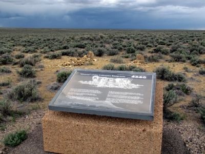
Graves were an all-to-frequent reminder of the dangers of overland travel. Most emigrant journals record death, burial, or passing graves during the day's travel. Most burials along the trail were hasty affairs.
The official Company Journal of . . . — — Map (db m67045) HM
Near State Highway 28, 11.5 miles west of U.S. 191, on the left when traveling west.
Death on the trail did not allow for the fineries of the funerals back home. Emigrants made do with materials available. Black would adorn the clothes of mourners, and care would be taken to provide the best funeral possible. The most travelers . . . — — Map (db m67044) HM
Near State Highway 28, 11.5 miles west of U.S. 191, on the left when traveling west.
Just a few miles from where you're standing, the emigrants would come to the first of several trail "splits" that would take them to a crossing on the Green River where they would camp for the evening.
Even with South Pass behind them, Oregon . . . — — Map (db m67043) HM
Near State Highway 28, 11.5 miles west of U.S. 191, on the left when traveling west.
Death was a constant companion for emigrants headed west. It is estimated that 10,000 to 30,000 people died and were buried along the trails between 1843 and 1869.
Cholera and other diseases were the most common cause of death. People didn't . . . — — Map (db m67046) HM
Near State Highway 28, 11.5 miles west of U.S. 191, on the left when traveling west.
Relations between emigrants using the trails and the Indians were inconsistent during the migration period. While hostile acts and violent confrontation did occur, they have been overemphasized in trail history. During the early migration period of . . . — — Map (db m67049) HM
Near State Highway 28 at milepost 102 near State Highway 372, on the left when traveling west.
If you look down the river about 250 yards on the right side - there's a wooden ferry. The ferry you see was built by Forrest Cramer of Pinedale, Wyoming in 1997 of the 150th anniversary celebrations of the Mormon Pioneer National Historic Trail. . . . — — Map (db m88481) HM
On State Highway 28, 0.1 miles west of U.S. 191, on the right when traveling west.
On Monday evening, June 28, 1847, Brigham Young and the Mormon pioneers met James Bridger and party near this place. Both companies encamped here over night and conferred at length regarding the route and the possibility of establishing and . . . — — Map (db m47138) HM
Near State Highway 28 at milepost 102 near State Highway 372, on the left when traveling west.
The emigration of Mormon (Church of Jesus Christ of Latter-dat Saints) converts to Utah is a fascinating chapter of the overall American westering experience of the 19th century. In search of religious freedom and an end to persecution, Mormon . . . — — Map (db m88477) HM
Near State Highway 28, 11.5 miles west of U.S. 191, on the left when traveling west.
Welcome to the Pilot Butte Emigrant Trails Interpretive Site. The purpose of the site is to help you gain a sense of what life was like for the 400,000 emigrants who left their homes to seek a new life in the West. They were seeking wealth, . . . — — Map (db m67042) HM
Near State Highway 28 at milepost 102 near State Highway 372, on the left when traveling west.
This site of the Lombard Ferry was one of the most used crossings on the Green River, lasting from about 1843 into the early 1900s. First established by mountain men, it was operated by Mormons in the 1850s during the peak years of the westward . . . — — Map (db m88473) HM
On State Highway 150 near County Route 74, on the left when traveling south.
The Oregon and California Trails came into Uinta County from South Pass, whereas the Overland Trail came through Bridger Pass. In 1845, more than 3,000 emigrant were on the Oregon Trail seeking adventure, fortune or religious freedom.
The . . . — — Map (db m90113) HM
On State Highway 150 near County Route 157, on the left when traveling south.
Erected
by the members of
the Woodruff Stake
of the Church of
Jesus Christ of
Latter-Day Saints
in honor of the
Pioneers who
passed this spot
July 12, 1847
under the leadership
of Brigham Young . . . — — Map (db m90124) HM
On State Highway 150 near County Route 75, on the left when traveling south.
This crossing was on the historic Mormon Trail. Lands surrounding the crossing were a welcome rest stop for weary pioneers. John Myers ferried emigrants across the Bear River and provided needed supplies from his store.
In 1858, the Myers Ranch, . . . — — Map (db m165966) HM
On Piedmont Road (County Road 173) 3.4 miles south of Interstate 80, on the right when traveling south.
The Muddy Creek Camp, which was northwest of this marker and on the west side of the Muddy Creek was used by Brigham Young's first group of Mormon pioneers who arrived here on July 9, 1847. Thomas Bullock reported that the brethren sang . . . — — Map (db m36573) HM
Near Business Route 80 near Main Street, on the left when traveling west.
From the late 1840s through the 1860s, an exodus of more than 70,000 Mormons passed by here on their way to their "New Zion" in Utah. Starting from Nauvoo, Illinois in February 1846, the first group of at least 13,000 Mormons crossed into Iowa to . . . — — Map (db m90583) HM
On County Road 274 just west of County Road 281, on the left when traveling west.
Established in November, 1853, by Captain John Nebeker and Captain Isaac Bullock who located here with a number of Latter Day Saints. This was the first place in Wyoming where land was irrigated. The site was given to Wyoming by Anton Hansen . . . — — Map (db m174178) HM
116 entries matched your criteria. Entries 101 through 116 are listed above. ⊲ Previous 100