14 entries match your criteria.
Virginia, Clinch River Forts Circa 1774 Historical Markers Palisaded forts, some built on Virginia Governor Lord Dunmore’s order, for settler protection during “Lord Dunmore’s War” with the Cherokees.
By J. J. Prats, October 18, 2015
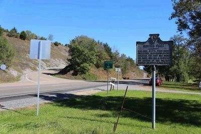
Smith’s Fort Marker on Northbound U.S. 19 at Crossover A
GEOGRAPHIC SORT Title Sort Marker Number Sort Marker Number Sort N Marker Number Sort T Publication Order Sort Publication Order Sort A Erected Year Sort Most Viewed Sort Most Recent-Interest Sort Most Recently Changed Sort SEE FAQ #33 FOR DESCRIPTIONS
On U.S. 19 at Crossover A, on the right when traveling north on U.S. 19.
On Memorial Drive (County Route 683) east of Quarry Road (County Route 694), on the left when traveling east.
On Virginia Route 71 at Lakeview Circle (County Route 785), on the right when traveling south on State Route 71.
On U.S. 19 at Hayters Gap Road (Virginia Route 80), on the right when traveling north on U.S. 19.
On Fincastle Road (Virginia Route 71) just west of Clydesway Road, on the right when traveling east.
On Mew Road (Virginia Route 65) just east of South Brutons Ford Road (County Route 611).
On Virginia Route 65 west of Route 72, on the left when traveling east.
On Kane Street (Business U.S. 421) east of Jones Street, on the right when traveling east.
On U.S. 58, 6.2 miles north of Natural Tunnel Parkway (County Route 871), on the right when traveling west.
On Big Moccasin Road (County Route 613) 6.7 miles east of Nickelsville Highway (Virginia Route 71), on the right when traveling west.
On Crab Orchard Road (Business U.S. 19) east of B F Buchanan Highway (Virginia Route 16), on the left when traveling south.
On Virginia Route 91 just north of Wardell Road (County Route 609), on the right when traveling south.
On Trail of the Lonesome Pine (U.S. 19) at Frog Level Road (Business U.S. 19), on the left when traveling west on Trail of the Lonesome Pine. Reported missing.
On Fincastle Turnpike (Business U.S. 19) at Ben Bolt Avenue, on the left when traveling south on Fincastle Turnpike.
May. 22, 2024