On Martin Luther King Jr. Avenue Southeast south of U Street Southeast, on the right when traveling north.
Follow Good Hope Road under the highway to your left to reach Anacostia Park, a longtime neighborhood oasis.
In 1914, after years of citizen requests, Congress directed the U.S. Army Corps of Engineers to "improve" the Anacostia River by . . . — — Map (db m130717) HM
On Martin Luther King Jr. Avenue Southeast at Good Hope Road Southeast, on the right when traveling north on Martin Luther King Jr. Avenue Southeast.
Late On The Night Of April 14, 1865, a guard at the other end of the Navy Yard Bridge allowed a young man on horseback to cross, despite a wartime curfew. Unbeknownst to the guard, the rider, John Wilkes Booth, had just shot President Abraham . . . — — Map (db m100715) HM
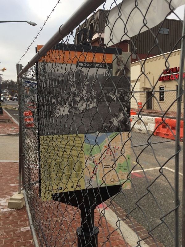
On Martin Luther King Jr. Avenue Southeast north of Morris Road Southeast when traveling north.
Across the street is the former 11th Precinct Police Station. In 1993 it became the Max Robinson Center for Health and Living, providing services for people with HIV/AIDS.
Whether by design or by accident, in 1910 the city built . . . — — Map (db m100763) HM
On 13th Street Southeast, on the right when traveling north.
Across This Intersection is St. Teresa of Avila, the first Catholic Church east of the Anacostia River. It is called the “mother church” because many area congregations are its offshoots.
As Uniontown grew, so did its Catholic . . . — — Map (db m130719) HM
On U Street Southeast at 13th Street Southeast, on the left when traveling west on U Street Southeast.
Across the intersection to your left is Rose's Row, three one-family and three two-family houses built in 1890 by local saloon-keeper William H. Rose. Rose's son Daniel designed them in the popular Italianate style and carefully crafted a . . . — — Map (db m130720) HM
On Martin Luther King Jr. Avenue Southeast at V Street Southeast, on the right when traveling north on Martin Luther King Jr. Avenue Southeast.
This Anacostia icon once marked the entrance to Curtis Brothers Furniture Co. The business dated to 1926, when young Fred and George Curtis acquired a Model T Ford truck to deliver ice, then progressed to moving furniture. They soon rented a . . . — — Map (db m100690) HM
On W Street Southeast at 14th Street Southeast, on the right when traveling east on W Street Southeast.
This imposing property once belonged to Anacostia’s most famous resident: Frederick Douglass. After escaping slavery as a young man, Douglass rose to become a distinguished abolitionist, writer, publisher, and orator. By the 1860s Douglass was . . . — — Map (db m88723) HM
On Martin Luther King Jr. Avenue Southeast at W Street Southeast, on the right when traveling north on Martin Luther King Jr. Avenue Southeast.
The arrival of modern transportation after the Civil War transformed Anacostia. The Baltimore & Ohio Railroad opened a branch line along the river here in 1874, bringing industry. Two years later businessman and developer Henry Griswold . . . — — Map (db m130721) HM
On 14th Street Southeast south of U Street Southeast, in the median.
Today's Anacostia Historic District began in 1854 as Uniontown, Washington's first planned suburb. The Union Land Association saw the large Navy Yard
workforce across the Anacostia River as potential customers for building lots they carved . . . — — Map (db m95972) HM
On Martin Luther King Jr. Avenue Southeast north of Sumner Road Southeast, on the right when traveling south.
Just beyond this sign is the edge of Barry Farm Dwellings, built during World War II for African American families. The war had caused acute housing shortages, so people divided large homes into rooming houses, took in boarders, or crammed into . . . — — Map (db m113608) HM
On Martin Luther King Jr. Avenue Southeast north of Eaton Road Southeast, on the right when traveling south.
You are standing in the middle of what once was a large estate owned by James Barry. The Washington City merchant, land speculator, and councilman purchased part of the "St. Elizabeths" tract hoping to profit as the city expanded eastward.
. . . — — Map (db m152378) HM
On Martin Luther King Jr. Avenue Southeast north of Pomeroy Road Southeast, on the right when traveling south.
The fence and wall ahead of you, on either side of Martin Luther King Jr. Avenue, enclose historic St. Elizabeths Hospital. The pioneering facility opened in 1855 to treat mentally ill members of the armed forces and DC residents. At a time . . . — — Map (db m100694) HM
On Martin Luther King Jr. Avenue Southeast south of Talbert Street Southeast when traveling north.
Across the street is the former Carver Theatre, built in 1948 as the first nonsegregated movie house in Southeast Washington. It closed in 1957 becoming, in turn, a roller rink, a church, and a funeral parlor.
Then a decade later, a . . . — — Map (db m100824) HM
On Howard Road Southeast at Shannon Place Southeast, on the right when traveling east on Howard Road Southeast.
Long before Metro opened a Green Line station here in 1991, the B&O Railroad's Alexandria Branch line ran a block behind you, along the river. The Washington & Anacostia Street Railway ran along Martin Luther King Jr. Avenue a block ahead. . . . — — Map (db m113606) HM WM
On Martin Luther King Jr. Avenue Southeast north of Howard Road Southeast, on the right when traveling north.
The Handsome Italian Renaissance Building. across the street opened as James G. Birney Elementary School in 1901. Its wood-frame predecessor, the original 1889 Birney School, was the first school built with public funds for African American . . . — — Map (db m100669) HM
On Martin Luther King Jr. Avenue Southeast south of Howard Road Southeast, on the right when traveling south.
You are standing at the main crossroads of Barry Farm, a post-Civil War (1861-1865) village settled by the formerly enslaved. Some Barry Farm-era churches still serve the neighborhood.
Macedonia Baptist Church, about a block to your . . . — — Map (db m100825) HM
Near Good Hope Road Southeast at Minnesota Avenue South East.
Anacostia's Ketcham School (across Good Hope Road) opened in 1908 to serve white elementary school children. For junior and senior high school, whites crossed the river until 1935, when Anacostia Junior-Senior High School opened at 16th and R . . . — — Map (db m130718) HM
On Good Hope Road Southeast at 14th Street Southeast on Good Hope Road Southeast.
Good Hope Road originally connected the Navy Yard Bridge to the village of Good Hope, established in the 1820s atop the long hill just ahead. In 1854 the road became the northern border of the new Uniontown subdivision and its commercial . . . — — Map (db m182326) HM
On Martin Luther King Jr. Avenue Southeast south of Eaton Road Southeast, on the right when traveling north.
Vernon Tancil grew up in Northeast D.C., but he so loved summers on his grandfather's small farm in Hillsdale that his parents let him stay on in September 1937 and attend fourth grade at Birney School. Grandpapa Horace Hansborough grew . . . — — Map (db m130722) HM
On Martin Luther King Jr. Avenue Southeast north of Stanton Road Southeast, on the right when traveling north.
In the early evening of November 22, 1963, a clutch of people stood forlornly on this bridge spanning Suitland Parkway. They awaited the procession carrying the body of slain President John F. Kennedy from Andrews Air Force Base to Bethesda . . . — — Map (db m130723) HM