111 entries match your criteria. Entries 101 through 111 are listed.⊲ Previous 100
The Washington-Rochambeau Route Historical Markers
In 1781 the two Generals met in White Plains, New York, crossed the Hudson River and marched 450 miles south to Yorktown in Virginia where their and Lafayette’s armies defeated the British, ending the war.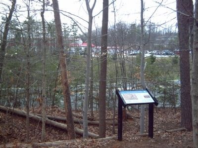
By Kevin W., March 4, 2008
The King's Highway ~ The Potomac Path Marker
| 101 ► Virginia, Prince William County, Woodbridge — The Potomac Path — The King's Highway — |
| The King’s Highway was the first north-south route through Virginia. The road began in Boston and ended in Williamsburg. It may have followed one or more trails that American Indians used before European colonization. The route was first . . . — — Map (db m5959) HM | |||
| 102 ► Virginia, Stafford County, Stafford — E-79 — Peyton’s Ordinary — |
| In this vicinity stood Peyton’s Ordinary. George Washington, going to Fredericksburg to visit his mother, dined here, March 6, 1769. On his way to attend the House of Burgesses, he spent the night here, October 31, 1769, and stayed here again on . . . — — Map (db m2187) HM | |||
| 103 ► Virginia, Virginia Beach, Fort Story — Battle of the Capes — |
| On the morning of September 5, 1781, a line of 19 British warships appeared off this cape, headed for Chesapeake Bay. Surprised at anchor in the mouth of the bay, the crews of 24 French warships scrambled out to challenge them. Both fleets sailed . . . — — Map (db m23139) HM | |||
| 104 ► Virginia, Virginia Beach, Fort Story — Battle of the Capes 1781 — |
| In September 1781, a naval engagement between two powerful fleets denied British forces access to the Chesapeake Bay and trapped Lord Cornwallis at Yorktown. This little known battle helped end British domination in America. What led to this . . . — — Map (db m194646) HM | |||
| 105 ► Virginia, Virginia Beach, Fort Story — François Joseph Paul de Grasse — Cape Henry Memorial, Colonial National Historical Park — |
| This statue, a gift from France is placed here, overlooking the waters where Admiral Comte de Grasse successfully engaged the British Fleet on September 5, 1781. The “Battle of the Capes” prevented crucial reinforcements from reaching . . . — — Map (db m32983) HM | |||
| 106 ► Virginia, Virginia Beach, Fort Story — French British Naval Engagement Off the Virginia Capes — September 5, 1781 — |
| "…I wish it was in my power to express to Congress how much I feel myself indebted to the Count of deGrasse and his fleet…" G. Washington Oct 19, 1781 "…I consider myself infinitely happy to have been of some service to the United . . . — — Map (db m138085) HM | |||
| 107 ► Virginia, Williamsburg — Washington–Rochambeau Route — |
| Generals Washington and Rochambeau and their staffs arrived in Williamsburg on September 14, 1781. Here they gathered their troops and supplies prior to laying siege to Cornwallis at Yorktown 12 miles away on September 28, 1781. The . . . — — Map (db m10123) HM | |||
| 108 ► Virginia, York County, Yorktown — American Encampment — 1781 Siege of Yorktown — Colonial National Historical Park — |
| “The American troops encamped in a wood within a mile of the Enemy’s left line – and the French troops encamped on their right.” Lieutenant William Feltman, Pennsylvania Battalion, September 28, 1781 On September 28, . . . — — Map (db m10862) HM | |||
| 109 ► Virginia, York County, Yorktown — Comte de Rochambeau — 1781 Siege of Yorktown — Colonial National Historical Park — |
| I hasten to impart to you the happiness I feel at the welcome news of your arrival; and as well in the name of the American army as my own name to present you with an assurance of our warmest sentiments for allies who have so generously come to . . . — — Map (db m11071) HM | |||
| 110 ► Virginia, York County, Yorktown — The Washington – Rochambeau Route to Victory — Yorktown Battlefield — Colonial National Historical Park — |
| On August 14, 1781, Generals Washington and Rochambeau received news that a large French fleet under the command of Admiral de Grasse was headed for the Chesapeake Bay carrying 3,000 French soldiers. There the British general, Lord Cornwallis, was . . . — — Map (db m11016) HM | |||
| 111 ► Virginia, York County, Yorktown — Washington-Rochambeau Route — |
| General Washington and the French troops under General Rochambeau began the siege of Great Britain's General Cornwallis at Yorktown on September 28, 1781. Cornwallis surrendered his army on October 19 after a siege of 21 days. — — Map (db m66913) HM | |||
111 entries matched your criteria. Entries 101 through 111 are listed above. ⊲ Previous 100