On DeBaliviere Circle east of Grand Drive, on the right when traveling east.
Since the 1904 World's Fair in St. Louis, Forest Park has been a St. Louis treasure and top tourist destination. Known as the crown jewel of the Midwest, 13 million people visit the the 1,300-acre park each year. The park includes 170 acres of . . . — — Map (db m133309) HM
On DeBaliviere Avenue just south of Pershing Avenue, on the right when traveling north.
This station serves as a connector on the Loop Trolley system, taking passengers directly over the MetroLink light rail system. Here at Forest Park and DeBaliviere, visitors can connect to both the Red and Blue Line trains, traveling as far east as . . . — — Map (db m141949) HM
On DeBaliviere Avenue at Delmar Boulevard, on the right when traveling north on DeBaliviere Avenue.
Called the "knuckle" of the Loop Trolley system, the intersection of Delmar & DeBaliviere is a crucial connector to the neighborhoods and businesses to the community today. This area and others along the 2.2 mile route are the focus of transit . . . — — Map (db m141910) HM
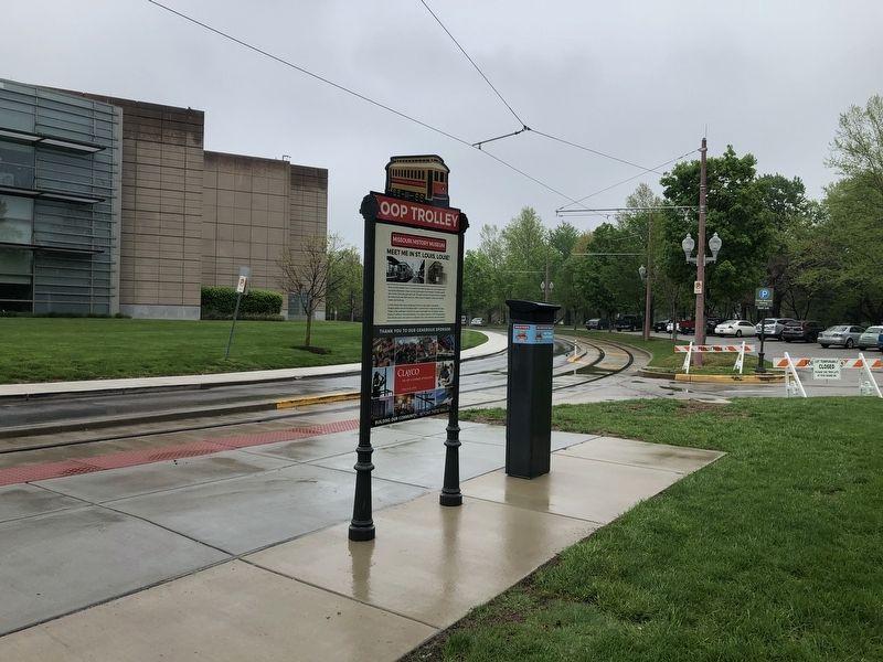
On DeBaliviere Avenue just north of Kingsbury Place, on the right when traveling north.
In its hey-day, DeBaliviere was home to several famous people and hotspots. Many St. Louisans recall their first skating lessons at The Wintergarden indoor icehouse, dinners at Garavelli's and Sorrento's. Others frequented the DeBaliviere Strip know . . . — — Map (db m141943) HM
On Delmar Boulevard just east of Des Peres Avenue, in the median.
The 1928 Wabash Station was once served by the "Delmar" and "City Limits" streetcar lines, buses, and the Wabash railroad's intercity and commuter trains. When St. Louis decommissioned its Delmar streetcar #10 in 1964, service ended on what is . . . — — Map (db m144364) HM
On Delmar Boulevard west of Rosedale Avenue, on the right when traveling west.
From its earliest days, the Delmar Loop was proclaimed for its amazing entertainment. The highly regarded Tivoli Theater focuses on independent films, fan-favorite and spirited midnight specials like "The Rocky Horror Picture Show." Doors opened in . . . — — Map (db m133122) HM
On Delmar Boulevard west of Limit Avenue, on the right when traveling west.
With the introduction of streetcars at the turn of the 20th Century, outlying areas of the City of St. Louis drew the attention of investors and developers plotting out the prairie land. In this picture, you can see the original Delmar streetcar . . . — — Map (db m133106) HM
On Delmar Boulevard at Leland Avenue, on the right when traveling east on Delmar Boulevard.
Named one the 10 Great Streets in America, the Delmar Loop is home to an eclectic mix of restaurants, shops, and entertainment venues. As early as 1902, the the Delmar streetcar system sparked residential and commercial development. As the oldest . . . — — Map (db m144368) HM
On Delmar Boulevard at Leland Avenue, on the right when traveling west on Delmar Boulevard.
In an ever-changing world, it's always interesting to see how trends in transportation come full circle. In this picture from 1923, you can see an example of three different types of streetcars. The #1157 streetcar is preparing to make its loop back . . . — — Map (db m133105) HM
On Delmar Boulevard just west of Limit Avenue, on the right when traveling east.
Named for the streetcar system that "looped" at the West end of Delmar Boulevard, the Delmar Loop is home to more than 250 restaurants, shops, small businesses and entertainment venues. With seven station stops on Delmar Boulevard, you'll always be . . . — — Map (db m147318) HM
On Delmar Boulevard just west of Kingsland Avenue, on the right when traveling west.
The Delmar Loop got its name from the original streetcar system that "looped" through University City. Traveling westbound, streetcars would divert north from Delmar Boulevard to Enright Avenue and then turn south from Kingsland to complete the . . . — — Map (db m144363) HM