Marker Logo HMdb.org THE HISTORICAL
MARKER DATABASE
“Bite-Size Bits of Local, National, and Global History”


27 entries match your criteria.  


Maryland, Washington County Historical Advisory Committee Historical Markers

The distinctive small brown interpretive panels scattered throughout Washington County Maryland.
 
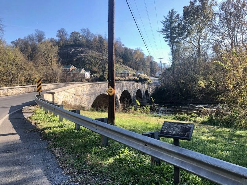
Antietam Iron Works Bridge Marker image, Touch for more information
By Jordan Butler, November 9, 2021
Antietam Iron Works Bridge Marker
1 Maryland, Washington County, Antietam — Antietam Iron Works Bridge
On Harpers Ferry Road at Limekiln Road, on the right when traveling east on Harpers Ferry Road.
2 Maryland, Washington County, Beaver Creek — Christian Newcomer Home
On National Pike (U.S. 40) 0.2 miles west of Mapleville Road (Maryland Route 66), on the right when traveling south.
3 Maryland, Washington County, Benevola — Roxbury Mills Bridge
On Roxbury Road, on the right when traveling south.
4 Maryland, Washington County, Boonsboro — Gettysburg CampaignThe Battle of Boonsboro
On Old National Pike (Alternate U.S. 40), on the right when traveling north.
5 Maryland, Washington County, Funkstown — Claggett’s Millrace Bridge
On Poffenberger Road, on the left when traveling west.
6 Maryland, Washington County, Funkstown — Claggett's Mill Bridge
On Poffenberger Road, on the left when traveling west.
7 Maryland, Washington County, Funkstown — Funkstown Bridge No. 2
On West Baltimore Street / Oak Ridge Drive, on the right when traveling west.
8 Maryland, Washington County, Funkstown — Rose's Mill Bridge
On Garis Shop Road, on the right when traveling west.
9 Maryland, Washington County, Hagerstown — Bench Mark "A"
On Summit Avenue, on the right when traveling north.
10 Maryland, Washington County, Hagerstown — Hagerstown Ransomed
On North Potomac Street (Maryland Route 65) at West Washington Street (U.S. 40), on the left when traveling south on North Potomac Street.
11 Maryland, Washington County, Keedysville — Felfoot Bridge
On Dogstreet Road.
12 Maryland, Washington County, Keedysville — Hess’s Mill Bridge
On Coffman Farm Road, on the right when traveling west.
13 Maryland, Washington County, Keedysville — Hitt Bridge
On Keedysville Road, on the right when traveling west.
14 Maryland, Washington County, Keedysville — Hitt-Cost House
On Keedysville Road, 0.5 miles west of Shepherdstown Pike (Maryland Route 34), on the right when traveling west.
15 Maryland, Washington County, Keedysville — Pry Mill
On Keedysville Road, 0.5 miles west of Shepherdstown Pike (Maryland Route 34), on the right when traveling east.
Paid Advertisement
16 Maryland, Washington County, Keedysville — Pry’s Mill Bridge
On Keedysville Road, 0.1 miles west of Shepherdstown Pike (Maryland Route 34), on the left when traveling west.
17 Maryland, Washington County, Knoxville — Israel Creek Bridge
On Valley Road, 0.2 miles west of Garretts Mill Road, on the right when traveling east.
18 Maryland, Washington County, Lappans Crossroads — Booth’s Mill Bridge
On Lappans Road (Maryland Route 68), on the right when traveling west. Reported damaged.
19 Maryland, Washington County, Leitersburg — Leitersburg Bridge No. 2
On Leiters Mill Road, on the left when traveling north.
20 Maryland, Washington County, Leitersburg — Old Forge Bridge
On Old Forge Road, on the right when traveling east.
21 Maryland, Washington County, Leitersburg — Old Forge Farm
On Old Forge Road.
22 Maryland, Washington County, Locust Grove — Park Hall Road
On Rohrersville Road (State Highway 67) at Park Hall Road, on the right when traveling south on Rohrersville Road.
23 Maryland, Washington County, Sharpsburg — First Methodist Cemetery
On North Hall Street, on the right when traveling south.
24 Maryland, Washington County, Sharpsburg — Lutheran Cemetery
On Boonsboro Pike (State Highway 34), on the right when traveling east.
25 Maryland, Washington County, Sharpsburg — Middle Bridge
On Boonsboro Pike (State Highway 34), on the right when traveling east. Reported missing.
26 Maryland, Washington County, Sharpsburg — Reformed Cemetery
On East Chapline Street, on the right when traveling east.
27 Maryland, Washington County, Smithsburg — Gettysburg Campaign
On North Main Street, on the right when traveling north.
 
 
CeraNet Cloud Computing sponsors the Historical Marker Database.
This website earns income from purchases you make after using our links to Amazon.com. We appreciate your support.
Paid Advertisement
May. 3, 2024