On Sandusky Street at Olentangy Avenue, on the right when traveling south on Sandusky Street.
Near this site, the Union army established two camps on either side of the Olentangy River during the Civil War. Both were known as Camp Delaware. The first camp, situated on the west side of the river in the summer of 1862, was where the white . . . — — Map (db m12816) HM
On East Lincoln Avenue near Blymer Street, on the left when traveling east.
In the late days of September, 1776, negotiators William Wilson and Joseph Nicholson left Fort Pitt which is today Pittsburgh. Their goal was to convince the tribes north and west of the Ohio not to join forces with the British. For support, the . . . — — Map (db m93221) HM
On Central Avenue (Ohio Route 37), on the right when traveling west.
(Side A):
Courthouse Hill
In the early years of Delaware, this area was known as Briar Hill. It is the highest elevation in the city. Situated facing south and approximately at the center of the existing Courthouse, was the site of the first . . . — — Map (db m18247) HM
On Sandusky Street at Park Avenue, on the right when traveling north on Sandusky Street.
Edwards Gymnasium
The gym was dedicated February 22, 1906. It is named in memory of OWU Trustee John Edwards whose initial gift made its construction possible. At the time of its completion it was considered the largest and finest basketball . . . — — Map (db m12854) HM
On Sandusky Street, on the right when traveling south.
In 1850, this eighty acre tract known as the Kilbourne farm was purchased for use as a cemetery. The “Old Burial Grounds,” located where Ohio Wesleyan's Selby Stadium now stands, had deteriorated and most of those remains were removed to . . . — — Map (db m12851) HM
On Sandusky Street at William Street (U.S. 36), on the right when traveling north on Sandusky Street.
The old city hall opened in 1882. Its clock tower rose to a height of 92ft. The first floor housed administrative offices, the police department, the jail, and the fire department. A 1,050 seat auditorium known as the Opera House graced the second . . . — — Map (db m12852) HM
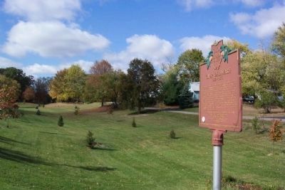
On East Lincoln Avenue east of Blymer Street, on the left when traveling east.
Near this location was a large Mingo town of significance during the Revolutionary period of the 1770's. The chief was Te-caugh-ye-te-righ-to, known to the settlers as Pluggy. The village consisted of perhaps 300 inhabitants. Among them were . . . — — Map (db m93220) HM
Near South Henry Street south of East William Street (U.S. 36), on the right when traveling south.
On the morning of May 3, 1890, Ohio Wesleyan University and The Ohio State University met at this location for a football game. It was the first game in Ohio State football history. Ohio Wesleyan had invited the newly organized team to a contest as . . . — — Map (db m18316) HM
Side A The Delaware County Fairground June 28, 1833 a meeting of the citizens of Delaware County convened under an act of the Ohio Legislature to establish The Delaware County Agricultural Society. Officers were elected with Milo Pettibone . . . — — Map (db m18301) HM
University Hall was completed in 1893. It is constructed of Amherst Sandstone. The bell tower rises to a height of 148 feet. The structure houses administrative offices, classrooms, and the legendary Gray Chapel. Among the celebrities who have . . . — — Map (db m12845) HM