On Martinsburg Pike (U.S. 11) at Brooke Road (Local Route 1322), on the right when traveling south on Martinsburg Pike.
In Mar. 1748, George Washington first visited Winchester, then known as Fredericktown, as a surveyor for Lord Fairfax. Washington purchased property in Winchester in 1753 and was an unsuccessful candidate for a House of Burgesses seat here in 1755. . . . — — Map (db m2663) HM
On Caroline Street, 0.1 miles north of Lewis Street, on the left when traveling north.
Four blocks west stands Kenmore, built in 1775 by Col. Fielding Lewis for his wife, Betty, sister of George Washington. Near here, between Kenmore and the Rappahannock River, stood Lewis’s warehouses and docks. Kenmore’s intricate plasterwork is the . . . — — Map (db m1149) HM
On Sophia Street at Rocky Lane, on the right when traveling north on Sophia Street.
A young George Washington grew to manhood at his home on the broad upland terrace directly across the river. He moved there with his family in 1738, at the age of six. Augustine Washington, his father, owned several plantations and part of an . . . — — Map (db m148513) HM
On William Street (Virginia Route 3) at Caroline Street, on the right when traveling east on William Street. Reported permanently removed.
Constructed shortly after Fredericksburg’s founding in 1728, the tavern across the intersection became a popular gathering place under the proprietorship of its first owner, John Gordon, and then of his son-in-law, George Weedon. George Washington . . . — — Map (db m1060) HM
On Seminole Trail (U.S. 29) at Wolftown-Hood Road (Virginia Route 230), on the right when traveling south on Seminole Trail.
One mile west was the home of Joseph Early, Revolutionary soldier. Washington, in going west and returning, stopped at Early’s overnight. His diary for October 2, 1784, shows that he spent the night before at “Widow Early’s.” — — Map (db m218881) HM
On North Main Street (U.S. 15/33) at East Gordon Avenue (U.S. 15), on the right when traveling north on North Main Street.
Built by Nathaniel Gordon, 1787. Visited by Washington, Jefferson, Madison, Monroe, Philip and James Barbour, Clark, Rives, Randolph, Wirt, Waddell, and other celebrities of Revolutionary, post-Revolutionary, and Confederate War periods. Lafayette . . . — — Map (db m4794) HM
Near Grove Avenue at North Market Street, on the left when traveling east.
You are standing within Lot Number One of the Old town of Petersburg, as laid out for Abraham Jones, Jr., in December of 1783. The first owner was William Byrd II of Westover. William Pride purchased the lot in 1745, and, entrepreneur that he was, . . . — — Map (db m48486) HM
On U.S. 29 Bypass, on the right when traveling north.
Nearby to the east once stood the community
of Peytonsburg a part of Halifax County when
the county was formed in 1752. Peytonsburg
was incorporated as a town in 1759 by the Virginia
General Assembly and became part of Pittsylvania
County in . . . — — Map (db m20774) HM
On Forest Grove Drive at Rippon Boulevard (County Route 784), on the right when traveling north on Forest Grove Drive.
The Old Potomac Path
Originally an Indian Trail and traversed by early settlers, it later became the first coach and post road between Northern and Southern Colonies, and was called
The King’s Highway
General Washington often stopped . . . — — Map (db m241858) HM
On South Wilton Road, 0.1 miles south of Kenmore Road, on the left when traveling south.
Wilton, an impressive example of Colonial American architecture and celebrated for its fully paneled interiors, was built c. 1753 for William Randolph Ill and his wife Anne Carter Harrison Randolph, both members of politically active families. This . . . — — Map (db m86726) HM
On Rockbridge Road / Wert Faulkner Highway (Virginia Route 130), on the right when traveling east.
Natural Bridge holds a unique place in American history as one of the natural wonders and first tourist attractions in the New World. Artists and illustrators popularized its image. This natural semielliptical arch is made of limestone carved by . . . — — Map (db m48) HM
On Kings Highway (Virginia Route 3) at Georg Washington Way, on the right when traveling east on Kings Highway.
The Washington family moved to a plantation here in 1738 when George Washington was six years old. Along with his three brothers and sister, young Washington spent most of his early life here, where, according to popular fable, he cut down his . . . — — Map (db m206787) HM
On Jefferson Davis Highway (U.S. Rt 1), on the right when traveling south.
In this vicinity stood Peyton’s Ordinary. George Washington, going to Fredericksburg to visit his mother, dined here, March 6, 1769. On his way to attend the House of Burgesses, he spent the night here, October 31, 1769, and stayed here again on . . . — — Map (db m2187) HM
On Cork Street at Braddock Street (U.S. 11), on the right when traveling west on Cork Street.
In March of 1748, George Washington, at age sixteen, arrived in Winchester, then called Frederick Town. During the next four years, he worked as a surveyor throughout the colonial Virginia frontier. — — Map (db m2647) HM
On National Avenue (State Highway 7) at North Pleasant Valley Road, on the right when traveling west on National Avenue.
Here was located George Washington’s five-acre out-lot from Thomas Lord Fairfax, Baron of Cameron, by grant of 15 May 1753. Fairfax also granted him a companion in-lot 77 at North Braddock Street and Fairfax Lane. The out-lot was number 16 of 80 in . . . — — Map (db m2661) HM
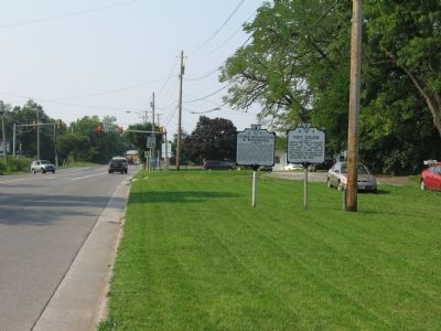
On Cork Street at Braddock Street (U.S. 11) on Cork Street.
While constructing Fort Loudoun, George Washington used the center room of this building as an office from the fall of 1755 until he moved into the fort in December 1756. He was a Colonel in the Virginia Militia and responsible for protecting . . . — — Map (db m2648) HM
On Historical Tour Drive, on the right when traveling west.
General George Washington established his headquarters in this area at the junction of the American encampments to the east and the French encampments to the north. Here he set up two tents: a large one for meeting with his staff and for dining, . . . — — Map (db m10865) HM
On West Virginia Route 68, 0.2 miles east of U.S. 33, on the left when traveling north.
Ravenswood. These lands were surveyed, 1771, for George Washington by Colonel William Crawford, who later was taken captive by the Indians and burned at the stake. Washington camped here in 1770. Here is grave of Jesse Hughes, noted scout. . . . — — Map (db m39625) HM
On Mordington Ave. at Mordington Rd., on the left when traveling north on Mordington Ave..
Now called Mordington, home of Colonel Charles Washington, founder of Charles Town, Virginia (now West Virginia). His brother General George Washington often visited him here. Colonel Washington died in September 1799. He and his wife Mildred are . . . — — Map (db m12070) HM
On Middleway Pike (West Virginia Route 51) east of Earle Road (West Virginia Route 51/1).
Erected in 1771. The home of Colonel Samuel Washington, County Lieutenant. His brother General George Washington visited here and General Lafayette and Luis Phillipe of France were entertained here. In this house James Madison and Dolly Payne Todd . . . — — Map (db m1914) HM
On Old Cheat Road at Canyon Road on Old Cheat Road.
John Pierpont, Revolutionary soldier and the son-in-law of Zackquill Morgan, built a fort in 1769. Washington was his guest in 1784. Here was born Francis H. Pierpont, who played an important part in the formation of West Virginia. — — Map (db m117095) HM
On Old Cheat Road at Canyon Road (County Route 67) on Old Cheat Road.
One half mile north of this marker stood the house where George Washington stopped in September 1784 and conferred with leading men of this section “pursuing my inquiries respecting the navigation of the western waters”. Eager to . . . — — Map (db m117094) HM
On Congress Street at North Washington Street (U.S. 522), on the right when traveling west on Congress Street.
The historic spa town of Bath is known to the world by its post office name of Berkeley Springs.
From the time he was 16 through the reading of his will in 1799, George Washington ate, slept, owned land and bathed in and around Berkeley . . . — — Map (db m117301) HM
On South Washington Street (U.S. 522) south of Liberty Street, on the right when traveling south.
For more than 200 years, the area bordering the park and springs on which the Country Inn stands, has been the historic spa town's center of hospitality.
In September 1784, George Washington stayed at Sign of the Liberty Pole and Flag . . . — — Map (db m117309) HM
On Fairfax Street at Mercer St., on the right when traveling east on Fairfax Street.
George Washington, surveyor for Lord Fairfax, visited "ye fam'd warm springs" first, Mar. 17, 1748. Later he brought his family "to try the effect of the waters" in 1768. When "Ye Town of Bath" was incorporated in October 1776, Washington bought . . . — — Map (db m117310) HM
On West Virginia Route 9 at Winchester Street, on the right when traveling east on State Route 9. Reported unreadable.
The Washington Heritage Trail is a 136-mile national scenic byway inspired by the prominent footsteps of George Washington through the three historic counties of West Virginia’s Eastern Panhandle. Compelling history, spectacular scenery, geologic . . . — — Map (db m450) HM
On West Virginia Route 7 at Lime Plant Road (County Route 46), on the right when traveling west on State Route 7.
In 1784 George Washington, Bushrod Washington, James Craik and his son made a horseback journey to inspect their western lands and investigate the feasibility of building a canal from the Potomac River to westward waters. On their return trip, they . . . — — Map (db m20842) HM
On Garrison Road just east of Bush Hill, on the left when traveling east.
Engineer’s Office & Quarters
Built circa 1720
The oldest ‘house’ within the Garrison. Known today as the ‘Bush Hill House’ or the George Washington House and Museum. George Washington stayed here in 1751. Acquired for the ‘New’ Garrison . . . — — Map (db m134545) HM
228 entries matched your criteria. Entries 201 through 228 are listed above. ⊲ Previous 100