After filtering for British Columbia, 27 entries match your criteria.
Environment Topic
By William Fischer, Jr., May 21, 2014
Above The Sunken Garden Marker
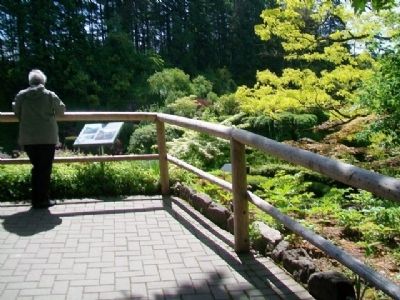
| 1 ► British Columbia, Capital, Brentwood Bay — Above The Sunken Garden — |
| Near Benvenuto Avenue. | |||
| 2 ► British Columbia, Capital, Brentwood Bay — Coast Salish Totem Poles — |
| 3 ► British Columbia, Capital, Brentwood Bay — Ross Fountain Lookout — |
| 4 ► British Columbia, Capital, Brentwood Bay — Ross Fountain Lookout — |
| 5 ► British Columbia, Capital, Brentwood Bay — Seed & Fireworks Fields — |
| 6 ► British Columbia, Capital, Brentwood Bay — The Quarry Walls — |
| 7 ► British Columbia, Capital, Sidney — Year of the Ocean — |
| On 1st Street just north of Bevan Avenue, on the left when traveling north. | |||
| 8 ► British Columbia, Capital, Victoria — Chinese Cemetery — |
| On Penzance Road just south of Crescent Road. | |||
| 9 ► British Columbia, Capital, Victoria — Get Your Bearings / S'Orienter — |
| 10 ► British Columbia, Capital, Victoria — Spewhung — |
| On Beach Drive just south of Orchard Avenue, on the left when traveling south. | |||
| 11 ► British Columbia, Capital, Victoria — Tlikwaynung — |
| On Beach Drive, 0.4 kilometers west of Newport Avenue, on the left when traveling west. | |||
| 12 ► British Columbia, Capital, Victoria, Fairfield — William (Billy) Barker — 1817 - 1894 — |
| 13 ► British Columbia, Capital, Victoria, Gonzales — Abkhazi Garden — The Garden that Love Built — |
| On Fairfield Road at Shotbolt Road, on the left when traveling east on Fairfield Road. | |||
| 14 ► British Columbia, Capital, Victoria, James Bay — A Natural Harbour — Fisherman's Wharf Park — |
| 15 ► British Columbia, Capital, Victoria, James Bay — From Mudflat to Rain Garden — Fisherman's Wharf Park — |
| 16 ► British Columbia, Capital, Victoria, James Bay — Giants Rooted Among Us — |
| On Circle Drive just east of Chestnut Row, on the right when traveling east. | |||
| 17 ► British Columbia, Capital, Victoria, James Bay — 5 — Signs of Lekwungen — We Are Still Here — Beside the "Lookout" on Beacon Hill - míqən — |
| On Beacon Hill Loop. | |||
| 18 ► British Columbia, East Kootenay, Sparwood — Crowsnest Pass — |
| On Crowsnest Highway (Provincial Highway 3) 0.8 kilometers north of British Columbia-Alberta boundary line, on the left when traveling west. | |||
| 19 ► British Columbia, Fraser Valley, Abbotsford, Sumas Prairie — Sumas Lake Reclamation — |
| Near Cole Road just south of South Parallel Road, on the right when traveling south. | |||
| 20 ► British Columbia, Fraser-Fort George, Jasper — Yellowhead Pass — |
| Near Yellowhead Highway (Provincial Highway 16) at British Columbia-Alberta boundary line, on the right when traveling west. | |||
| 21 ► British Columbia, Kootenay Boundary, Rossland — The Rossland Mines — |
| On Provincial Highway 3B at Paterson-Trail Highway (Provincial Highway 22), on the right when traveling west on Provincial Highway 3B. | |||
| 22 ► British Columbia, North Okanagan, Vernon — Spallumcheen Valley — |
| On Vernon-Sicamous Highway (Provincial Highway 97A) just west of Creamery Road, on the left when traveling west. | |||
| 23 ► British Columbia, Okanagan-Similkameen, Fairview — Fairview Gold — |
| On Fairview Road, 0.2 kilometers east of Willowbrook Road, on the right when traveling east. | |||
| 24 ► British Columbia, Okanagan-Similkameen, Osoyoos — Southern Crossroads — |
| On Crowsnest Highway (Provincial Highway 3) 0.2 kilometers west of Observatory Road, on the right when traveling west. | |||
| 25 ► British Columbia, Okanagan-Similkameen, Osoyoos — Spotted Lake — |
| On Crowsnest Highway (Provincial Highway 3) at Kobau Look-Out Forest Service Road, on the right when traveling south on Crowsnest Highway. | |||
| 26 ► British Columbia, Squamish-Lillooet, Britannia Beach — Britannia Mine — |
| On Sea-to-Sky Highway (Provincial Highway 99) 1.2 kilometers north of Copper Drive, on the left when traveling north. | |||
| 27 ► British Columbia, Strathcona, Campbell River — Campbell River Fire — |
| Near Elk Falls Park Road, 0.2 kilometers north of Brewster Lake Road, on the right when traveling north. | |||