After filtering for United States of America, 18 entries match your criteria.
Historical Markers and War Memorials in Dayton OH 45433
By Don Morfe, July 19, 2013
A Starting Device Marker
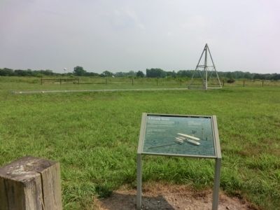
| 1 ► Ohio, Greene County, Dayton — A Starting Device — Huffman Prairie Flying Field — Dayton Aviation Heritage National Historic Park — |
| On Pylon Road north of Springfield Street. | |||
| 2 ► Ohio, Greene County, Dayton — Birthplace of Flight — |
| On Marl Road at Symmes Road, on the left when traveling east on Marl Road. | |||
| 3 ► Ohio, Greene County, Dayton — Commuter Flyers — The Wright Brothers — |
| On Marl Road at Symmes Road, on the left when traveling east on Marl Road. | |||
| 4 ► Ohio, Greene County, Dayton — Flying Field to Air Force Base — Huffman Prairie Flying Field — Dayton Aviation Heritage National Historic Park — |
| On Mart Road north of Springfield Street (Ohio Route 444). | |||
| 5 ► Ohio, Greene County, Dayton — Follow the Flight Path — Huffman Prairie Flying Field — Dayton Aviation Heritage National Historic Park — |
| On Pylon Road, 0.3 miles south of Marl Road, on the right when traveling south. | |||
| 6 ► Ohio, Greene County, Dayton — Huffman Prairie Flying Field — AIAA Historic Aerospace Site — |
| On Symmes Road just east of Marl Road, on the right when traveling east. | |||
| 7 ► Ohio, Greene County, Dayton — In Commemoration of the Courage, Perseverance and Achievement of Wilbur and Orville Wright — |
| On Memorial Drive. | |||
| 8 ► Ohio, Greene County, Dayton — Miss that Tree! — Huffman Prairie Flying Field — Dayton Aviation Heritage National Historic Park — |
| On Pylon Road, 0.2 miles south of Marl Road, on the right when traveling south. | |||
| 9 ► Ohio, Greene County, Dayton — The First Airport — Huffman Prairie Flying Field — Dayton Aviation Heritage National Historic Park — |
| On Marl Road, 1.5 miles north of Springfield Street (Ohio Route 444), on the right when traveling north. | |||
| 10 ► Ohio, Greene County, Dayton — They Had Done It! — Huffman Prairie Flying Field — Dayton Aviation Heritage National Historic Park — |
| On Pylon Road, 0.3 miles south of Marl Road, on the left when traveling south. | |||
| 11 ► Ohio, Greene County, Dayton — Trials in an Old Swamp — Huffman Prairie Flying Field — Dayton Aviation Heritage National Historic Park — |
| Near Marl Road at Symmes Road, on the right when traveling east. | |||
| 12 ► Ohio, Greene County, Wright-Patterson Air Force Base — 13-29 — Huffman Prairie Flying Field — |
| On Marl Road at Symmes Road, on the right when traveling east on Marl Road. | |||
| 13 ► Ohio, Greene County, Wright-Patterson Air Force Base, Bath Township — Biplanes to Rocket Science — |
| Near Memorial Road. | |||
| 14 ► Ohio, Greene County, Wright-Patterson Air Force Base, Bath Township — Cow Pasture to Flight School — |
| Near Memorial Road. | |||
| 15 ► Ohio, Greene County, Wright-Patterson Air Force Base, Bath Township — In Case of Floods ... — |
| Near Memorial Road. | |||
| 16 ► Ohio, Montgomery County, Dayton — P-47 Thunderbolt — |
| On Springfield Street at Bong Street, on the right when traveling east on Springfield Street. | |||
| 17 ► Ohio, Montgomery County, Dayton — The Belly Tank — |
| Near Springfield Street at Bong Street, on the right when traveling east. | |||
| 18 ► Ohio, Montgomery County, Wright-Patterson Air Force Base — 34th Bomb Group (Heavy) — Valor To Victory — |