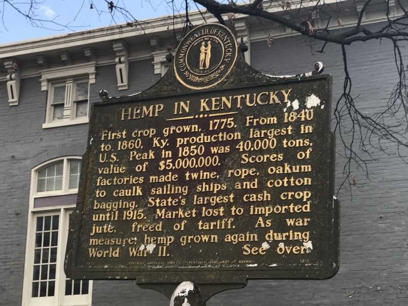
Jessamine County Hemp
One of chief producing counties,
it was third in value of product :
and also in the number of cordage
factories, with 14 in 1840. Peak
production reached in late 1800s,
yielding over 1,000 tons per year,
with a . . . — — Map (db m169918) HM
Son of an Influential Kentucky Family
The Nelson family counted among its friends some of the most important families in Kentucky. William Nelson, born in 1824, near Maysville, Kentucky, grew up in an atmosphere of influence and wealth. . . . — — Map (db m70658) HM
Stone culverts and bridges spanned many watercourses on the early Kentucky turnpikes. The stone bridges did not wash out when flooded. The strength of the arch comes from the stones wedged against each other so that they cannot move. The early . . . — — Map (db m194236) HM
One of the greatest jockeys in the history of American racing, Isaac Burns Murphy was born on a farm in the Bluegrass not far from Lexington in 1861. His parents were enslaved. His mother, America Murphy, was a domestic servant on the farm. His . . . — — Map (db m119100) HM
During the 19th century, the road from Mackville to Perryville crossed Wilson's Creek here (Wilson's Creek is located behind you). The entire Union First Corps, mumbering nearly 15,000 men, approached the battle from this road.
After the . . . — — Map (db m288314) HM
Son of an Influential Kentucky Family
The Nelson family counted among its friends some of the most important families in Kentucky. William Nelson, born in 1824, near Maysville, Kentucky, grew up in an atmosphere of influence and wealth. . . . — — Map (db m86288) HM
While Kentucky slaves were not freed by the Emancipation Proclamation in January 1863, which only affected the enslaved community under Confederate control, Union military policy in Kentucky did provide opportunities for slaves to liberate . . . — — Map (db m291002) HM
Look across the river toward
Benson Creek and you will see
two bridges. Both are steel span
bridges, and both share one
common aspect - they are
supported by dry-laid
abutments.
Many bridges across Kentucky,
including covered bridges . . . — — Map (db m194222) HM
Officially, 23,703 African Americans in Kentucky responded to the call to arms by President Lincoln and Frederick Douglass to join the ranks of the newly organized United States Colored Troops. Units were organized with men from across the . . . — — Map (db m84675) HM
When the Battle of Perryville ended, hundreds of dead soldiers were left on the battlefield. The Confederates, who attacked the Union battle lines, lost 532 killed, 2,641 wounded, and 228 missing (3,401 total). Federal losses were just as . . . — — Map (db m46421) HM
This quarry was most likely the primary source
of rock used to build the rock fences, building
foundations and dam in the park. The exposed rock
is limestone, the dominant bedrock of the Bluegrass.
The limestone was easily chipped out 'or . . . — — Map (db m194584) HM
The bridge you see dates to 1929 but its story begins much earlier, when merchants in Lexington and Cincinnati began to demand a direct route to Southern markets, one that did not necessitate shipping goods by way of the Ohio and Mississippi rivers. . . . — — Map (db m218252) HM
The 436 members of the 38th Indiana Infantry Regiment deployed here, in a cut cornfield, next to the 10th Wisconsin Infantry. These men supported Captain Peter Simonson’s six cannon, which were located to your right. It was a crucial position; . . . — — Map (db m46482) HM
Jessamine County
Formed from Fayette County, 1798.
Named by Col. John Price, one of
Representatives in Legislature,
who stated he named it for flower
which flourishes in region and for
Jessamine Creek. A moving legend
tells that the . . . — — Map (db m169945) HM
Thin black lines indicate changes in relevance. Between each pair of lines entries are ordered geographically but all have the same relevance.
* Inflectional forms of words are their plurals, singulars, and possessives as well as gramatical tenses and similar variations.