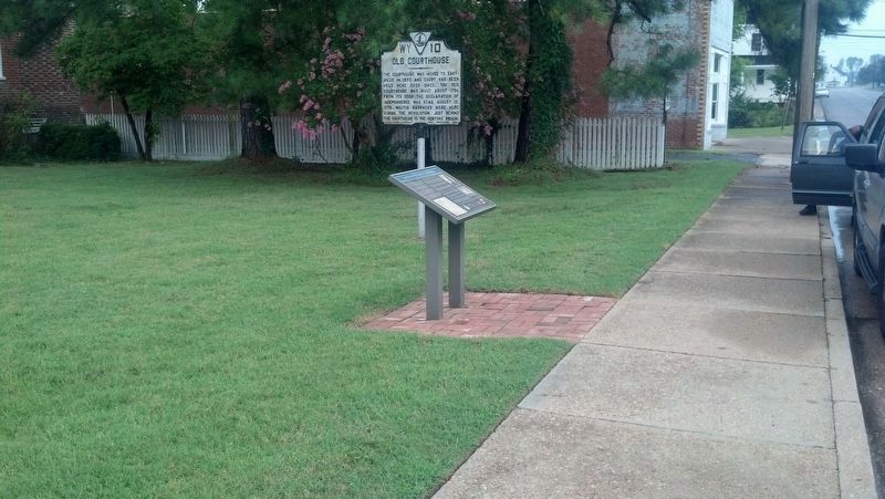
The Northampton County Court Green is one of the earliest and most complete in Virginia. It includes outstanding examples of early court buildings as well as later structures reflecting the continuity of government in Eastville for well over 300 . . . — — Map (db m7589) HM
In November 1861, a force of about 4,500 United States officers, soldiers, cavalrymen, and artillerists assembled in and around Snow Hill. Some of the troops camped here on the Worcester County Courthouse yard. Gen. Henry H. Lockwood commanded . . . — — Map (db m74867) HM
"I met one boy with a flint-lock rifle and a Confederate uniform. He acknowledged to have been in Confederate service, but that last night they all dispersed. I could see them running in every direction, hiding their arms." . . . — — Map (db m206338) HM
From 1879-1880, Peter Jacob Carter was a keeper of the Cherrystone Bar lighthouse that was located just offshore in front of you. It was the third federal job for a remarkable man who was born into enslavement just a few miles north of here in . . . — — Map (db m302133) HM
The first documented Africans to arrive in Virginia landed at Old Point Comfort in August 1619. From Angola, they were captured from a Portuguese slave ship near Veracruz, Mexico, by the Dutch privateers Treasurer and White Lion. . . . — — Map (db m276513) HM
This preserve is the culmination of years of effort by several groups to ensure its permanent protection. It is now owned by The Archaeological Conservancy, and contains the remains of archaeological sites ranging from prehistoric settlement . . . — — Map (db m302099) HM
On October 9, 1803, William and Grace Eyre provided 51½ acres of land, the northeast corner of Eyre's "Hungars Plantation", to Northampton County to establish an almshouse. Shortly after 1804, the first almshouse for whites was built at this . . . — — Map (db m107019) HM
The original Liberty Tree was a stately elm in Boston, Massachusetts. It was a rallying point for the Sons of Liberty, an organization of Patriots who played a key role in resisting British tyranny and creating support for rebellion against Great . . . — — Map (db m306867) HM
A Changing Way of Life…
Growth Followed the Rails
The Eastern Shore of Virginia, one of the earliest colonized areas in North America, remained a seafood and agricultural region with scattered small towns until the 1880s.
The . . . — — Map (db m206447) HM
Constructed in 1953 as the county’s first purpose-built African American high school,
Northampton County High School reflects the desires of local African Americans to
obtain modern educational facilities. It is an example of the statewide efforts . . . — — Map (db m61057) HM
The Town of Cape Charles was founded in 1884 by Alexander Cassatt and William L. Scott as the southern terminusof the New York, Philadelphia & Norfolk Railroad. The extension of tracks south from Maryland to Cape Charles opened the Northeastern . . . — — Map (db m48952) HM
Northampton County was one of Virginia's eight original shires formed by 1634. It encompassed the entire peninsula south of Maryland and was known as Accomac until the General Assembly changed its name in 1643. Present-day Accomack County broke . . . — — Map (db m302136) HM
Virginia’s Eastern Shore has been home to Native Peoples, also known as American Indians, for thousands of years. To understand changes in how people lived over the span of time, archaeologists have developed classifications for time periods that . . . — — Map (db m302101) HM
For over three hundred years, the Eastville Court Green that you see in front of you was the center of judicial and administrative life for the residents of Northampton County. The essentials of everyday life were conducted here. People received . . . — — Map (db m302137) HM
St. John's Cemetery contains the graves of four Revolutionary War Soldiers.
Jacob Hileman, born July 20, 1762 in Northampton Co., Pennsylvania. As a private he served in the 4th company, 3rd battalion. Northampton County Militia in 1778 . . . — — Map (db m207797) HM WM
Delaware, 1st State
December 7, 1787
1609 • Henry Hudson visited Delaware Bay
1638 • Swedish colonists established Fort Christina, Delaware's first permanent settlement, and founded the colony of New Sweden
1655 • Dutch captured New . . . — — Map (db m47214) HM
Thin black lines indicate changes in relevance. Between each pair of lines entries are ordered geographically but all have the same relevance.
* Inflectional forms of words are their plurals, singulars, and possessives as well as gramatical tenses and similar variations.