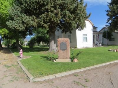
Pioneers and Families who lived in
Fort Alma (later Monroe) 1864-1867
Major Allred, Parley Allred, Wiley Allred, Andrew Anderson, Israel Bale, Benjamin Barney, Walter Barney, Joseph Besswick, George Blacket, John W. Bohman, Thomas Broadbent, . . . — — Map (db m74806) HM
Near this spot in 1865 a rock fort was built as a protection from Indians. It was a cooperative project. Each man who owned a city lot built one rod of the wall which was 3 l/2 feet at base, 12 feet high, 1 foot at top. There were portholes at . . . — — Map (db m74820) HM
Basic History
"The development of the rich precious-metal mines developed in northern Piute County in the late 1880's, encouraged the expansion of the Rio Grande Western Railway lines. In 1890, the narrow gauge Rio Grande Western mainline . . . — — Map (db m260614) HM
It all began in the small community of Circleville, Utah, back in the summer of 1988. Two lifelong friends were sitting on a pick up tail gate, enjoying a Coke, and speculating about the recent closure of Hwy 53 to OHV's. With this closure, they . . . — — Map (db m272244) HM
Bicknell is located in a sparsely populated, remote area of Utah. When settled, this area was difficult to access. Early residents had to build their own roads. People could travel on foot, horseback, or in horse-drawn wagons. The height of the . . . — — Map (db m271858) HM
June 15, 1873 Brigham Young called Albert K. Thurber and George W. Bean, Indian interpreters, WM. B. Pace, William Jex and others to explore Grass Valley for settlement and make peace with the Indians. Chief Tabioonah accompanied the party and acted . . . — — Map (db m142661) HM
The first boat (framed together with wooden pegs) used for passengers and baggage was built and operated by Lars Jensen 2 ½ miles downstream from 1881 to 1909.
It was replaced by a cable ferry for wagons in 1885, and a larger boat in . . . — — Map (db m114450) HM
Axtell, originally called Willow Creek, is a wide-spread, productive farming community located on the boundary of Sanpete and Sevier Counties. It is a living monument to the rugged characteristics of the pioneers who came to this valley. Axtell was . . . — — Map (db m74902) HM
This building has two markers on the east wall of the building.
ZCMI Co-Op Building
1878-1930
Official outlet of ZCMI (Zion's Co-operative Mercantile Institution), "America's First Department Store". This building housed the . . . — — Map (db m74846) HM
Thin black lines indicate changes in relevance. Between each pair of lines entries are ordered geographically but all have the same relevance.
* Inflectional forms of words are their plurals, singulars, and possessives as well as gramatical tenses and similar variations.