On Steele Road 0.1 miles south of Nashville Road (U.S. 31W), on the left when traveling south.
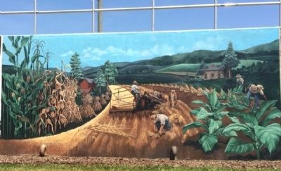
Farming was a way of life in days gone by; harvesting wheat with a steam-powered thresher; laborers at work under the hot sun in corn and tobacco fields; rows of tobacco speared on sticks and corn gathered into shocks. — — Map (db m83904) HM
On Steele Road 0.1 miles south of Nashville Road (U.S. 31W), on the left when traveling south.
The road to prosperity is lined with signs announcing a boom in manufacturing. Franklin's half century of success in recruiting good-wage factory jobs has mom and dad punching the clock and more people eating out. — — Map (db m83900) HM
On Steele Road 0.1 miles south of Nashville Road (U.S. 31W), on the left when traveling south.
Two frontier gentlemen fight a duel with pistols at dawn in a forest glade. In the background is a carriage on the Louisville to Nashville Pike at the Sandford Duncan Inn, a popular stagecoach stop of the day. — — Map (db m83909) HM
On Steele Road 0.1 miles south of Nashville Road (U.S. 31W), on the left when traveling south.
Born near here were two famous men. Jim Bowie invented the Bowie knife. He died at the battle of the Alamo in Texas. Alexander Majors was co-founder of the Pony Express and hauled freight all over the West for the U.S. Cavalry. — — Map (db m83905) HM
On Steele Road 1 mile south of Nashville Road (U.S. 31W), on the left when traveling south.
Surrounding the 1882 Courthouse and its clock tower are Franklin's devious first well; the fire that destroyed an earlier courthouse; the jail and jailer's quarters; portraits of Congressman I.H. Goodnight and his wife, Ella Hoy. — — Map (db m83903) HM
On Steele Road 0.1 miles south of Nashville Road (U.S. 31W), on the left when traveling south.
Mule Day in Franklin was so popular before World War II that it attracted a movie star and a national radio broadcast. Franklin was once the second largest mule market in the U.S. This painting has 120 mules and 230 people. — — Map (db m83902) HM
On Steele Road 0.1 miles south of Nashville Road (U.S. 31W), on the left when traveling south.
A higher standard of living means more leisure time. Local attractions include the drive-in, Kenny Perry's golf course, and horse racing at Kentucky Downs. Interstate 65 spurs commerce and travel. A tech school bolsters education. — — Map (db m83899) HM
On Steele Road 0.1 miles east of Nashville Road (U.S. 31W), on the left when traveling south.
City and county schools consolidated in the 1940s and integrated in the 1960s. Actress Annie Potts was a cheerleader in the early 1970s. Dr. David Patterson was valedictorian a decade later. School teams have won many championships. — — Map (db m83901) HM
On Steele Road 0.1 miles south of Nashville Road (U.S. 31W), on the left when traveling south.
Confederate guerillas raid an L&N freight train on an April morning in 1864. Nearby is Octagon Hall, an 8-sided brick home built by slaves. Both Rebel and Union troops camped on the grounds. The cupola was used by spies. — — Map (db m83908) HM
On Kenny Perry Drive 0.8 miles south of Rapids Road, on the right when traveling south.
Cofounder of the Pony Express, he was born near this site on Oct. 4, 1814. Five years later, his family moved to Mo. Territory. In 1849, he formed a freighting business from
Mo. to Santa Fe. In 1854, became partners with Wm. Russell and Wm. . . . — — Map (db m159143) HM
On West Cedar Street (State Highway 100) at North Main Street (U.S. 31W), on the right when traveling west on West Cedar Street.
Carrie Conn Moore, the first woman to serve in the Kentucky Senate, was born in Logan Co. on January 7, 1904. She moved to Franklin when she married J. Lee Moore. After her husband's death, she won a special election in Nov. 1949 to fill the . . . — — Map (db m159146) HM
Near North Main Street (U.S. 31W) at West Kentucky Avenue.
Born in Virginia, 1809. Came to Simpson County in 1827. Studied law under noted Kentucky lawyer George Robertson. Served in the Kentucky legislature, 1841-42; US Congress, 1847-49. Delegate to Kentucky Constitutional Convention, 1849. US Minister to . . . — — Map (db m83319) HM
On Walker Street west of John J. Johnson Avenue, on the right when traveling west.
A hallmark of the black community, it was dedicated on September 8, 1940 and G.R. Houston served as its first principal. In 1944, county schools merged with Lincoln, which brought about crowded conditions. School added onto several times from . . . — — Map (db m159162) HM
On Midland Trail (U.S. 60) 0.1 miles west of Citizens Boulevard, on the right when traveling west.
Simpsonville and Simpson County, Kentucky, were named for the Captain who fought with Wayne at Fallen Timbers, practiced law in Shelbyville, and was elected to the State Legislature four times. Elected to Congress in 1812. He and another Shelby . . . — — Map (db m161770) HM
On Nashville Road (U.S. 31W) at Tennessee Route 259, on the right when traveling north on Nashville Road.
The Simpson County jog in Kentucky-Tennessee boundary was error of Dr. Thomas Walker's 1780 survey party. Luke Munsell and James Bright resurveyed region fifty years later, but the controversy continued until survey by Austin P. Cox and Benjamin . . . — — Map (db m83298) HM
On West Kentucky Avenue west of North Main Street (U.S. 31W), on the left when traveling west.
(Union side)
Dedicated to the memory of the
52nd Kentucky Infantry Regiment
and the assorted Simpson County
soldiers of the Union army
(Confederate side)
Dedicated to the memory of the
6th Kentucky Infantry Regiment . . . — — Map (db m164861) WM
On East 10th Avenue at College Street, on the right when traveling east on East 10th Avenue.
Warren County
Established by Legislature, 1796, as the 24th county of Kentucky. Formed from part of Logan County. Parts of Barren, Allen, Edmonson, and Simpson counties later taken from original Warren boundaries. Named for Maj. Gen. . . . — — Map (db m83350) HM
Thin black lines indicate changes in relevance. Between each pair of lines entries are ordered geographically but all have the same relevance.
* Inflectional forms of words are their plurals, singulars, and possessives as well as gramatical tenses and similar variations.