On East Fort Avenue at Latrobe Park Terrace, on the left when traveling west on East Fort Avenue.
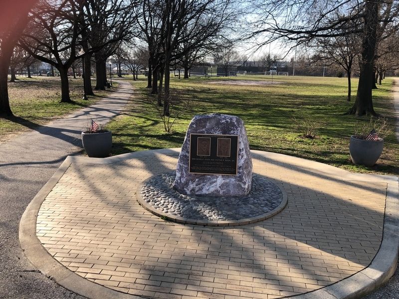
Victor was the first president of the Locust Point Civic Association.
Shirley initiated the Annual Locust Point Community Festival.
Together they worked for 5 years to have the final section of I-95 changed, from the proposed bridge . . . — — Map (db m145538) HM
On Andre Street, 0.1 miles south of East Fort Avenue, on the right when traveling south.
You are standing less than a mile away from Ft. McHenry, where the citizens of Baltimore valiantly defended our freedom back in 1814, inspiring Francis Scott Key to write "The Star-Spangled Banner." To this day, that anthem is played before every . . . — — Map (db m145532) HM
Near Constellation Plaza, 0.3 miles east of Wallace Street, on the right when traveling east.
Two soldiers have finished guard duty and should be cleaning their weapons. Instead, they talk to a servant, enslaved to one of the militia officers. A sergeant overhears their conversation and prepares to rebuke them for talking instead of . . . — — Map (db m145543) HM
To
Col. George Armistead,
April 10, 1779 – April 25, 1818,
commander of this fort
during the bombardment
by the British Fleet,
Sept. 13-14 1814. War of 1812.
Erected Spet. 12, 1914
by the City of Baltimore,
Soc. War of 1812 . . . — — Map (db m2595) HM WM
Near Constellation Plaza, 0.3 miles east of Wallace Street, on the right when traveling east.
The arched chambers on either side of the sally port are identical bomb shelters for the fort's soldiers. They were built immediately after the bombardment of 1814, when it became obvious that such places were needed. Fortunately, Fort McHenry . . . — — Map (db m12246) HM
Near Constellation Plaza, 0.3 miles east of Wallace Street, on the right when traveling east.
Fired by the British Naval Forces during the bombardment of this fort Sept. 13-14, 1814 when by the light of “Bombs bursting in air” the National Anthem – The Star Spangled Banner had its birth. — — Map (db m10882) HM
Near Constellation Plaza, 0.1 miles east of Wallace Street, on the right when traveling east.
"This tree dedicated to Captain Francis Hancock, whose command discovered the attempt of 1200 British Marines to surprise Fort McHenry from the rear and revealed their boats to adjacent batteries by lighting fires on the opposite shore resulting in . . . — — Map (db m145565) HM WM
Fort McHenry has had several guardhouses. This one, built in 1835 and enlarged in 1857, is one of the best preserved buildings in the star fort. Soldiers on duty in this room guarded military offenders in the adjacent cells.
During the Civil . . . — — Map (db m244388) HM
Near Constellation Plaza, 0.1 miles east of Wallace Street, on the right when traveling east.
"This tree dedicated to Colonel Benjamin Fowler, who commanded the 39th Maryland Regiment at the Battle of North Point, September 12th, 1814." — — Map (db m145568) HM
Near Constellation Plaza, 0.1 miles east of Wallace Street, on the right when traveling east.
"This tree dedicated to Colonel James McHenry Secretary of War under Presidents Washington and John Adams and for whom Fort McHenry was named in 1798 when it was offered to the Federal Government." — — Map (db m145548) HM
On Constellation Plaza, 0.1 miles east of Wallace Street.
"This tree dedicated to Colonel William M. McDonald who commanded the 6th Maryland Regiment at the Battle of North Point, September 12th, 1814." — — Map (db m145573) HM WM
The rooms on the left end of this building stood as a separate structure during the 1814 period. This was the residence of Major George Armistead, commanding officer and “Hero of Fort McHenry.”
It was Armistead who directed the successful . . . — — Map (db m244393) HM
Near Constellation Plaza, 0.3 miles east of Wallace Street, on the right when traveling east.
Two men died on this ground. During the afternoon of the bombardment the men on this bastion felt helpless. The mortars on the British bomb ships could fire their 200-pound shells two miles (half way to the modern bridge) while the fort's cannons . . . — — Map (db m145544) HM
Near East Fort Avenue, on the right when traveling east.
After the Battle of Baltimore in 1814, Fort McHenry continued as a military post for more than a hundred years. The U.S. Army constructed buildings outside the star fort and modified existing structures to serve the needs of the time.
During . . . — — Map (db m10881) HM
Funds for developing new weapons decreased after the Civil War, forcing the Army to upgrade the cannon they already had.
These three 19-inch Rodman gun tubes were probably made during the 1870’s, but their carriages are improved versions . . . — — Map (db m2637) HM
1776
Whetstone Point shore battery
1794
Star Fort begun.
Later named for Washington’s Secretary of War
1795
Reservation partly acquired by the United States
1814
Gallant defence during British bombardment inspired the . . . — — Map (db m2569) HM
Near Constellation Plaza, 0.4 miles east of Wallace Street, on the right when traveling north.
As a guardian of Baltimore’s harbor, Fort McHenry is the site of the sucessful defense of the city by American Forces during the British attack on September 13–14, 1814 which inspired Francis Scott Key to write “The Star-Spangled . . . — — Map (db m2568) HM
Near Constellation Plaza, 0.1 miles east of Wallace Street, on the right when traveling east.
This tree dedicated to Francis Scott Key who was inspired to write our National Anthem — The Star Spangled Banner — by the flag which flew from Fort McHenry during its bombardment. — — Map (db m145550) HM
Near Constellation Plaza, 0.3 miles east of Wallace Street, on the right when traveling east.
The successful defense of Baltimore from British attack has been remembered and commemorated every year since 1814.
The Society of the War of 1812 maintains the legacy of remembrance. This society traces its origin to Fort McHenry. On . . . — — Map (db m145540) HM
Near Constellation Plaza, 0.1 miles east of Wallace Street, on the right when traveling east.
"This tree dedicated to Lieutenant H.S. Newcomb, of Barney's Flotilla, who commanded Fort Covington, water front battery supplemental to Fort McHenry, September 12th, 13th, 14th, 1814." — — Map (db m145575) HM WM
Near Constellation Plaza, 0.1 miles east of Wallace Street, on the right when traveling east.
"This tree dedicated to Lieutenant John A. Webster, of Barney's Flotilia, who commanded Fort Babcock, water front battery supplement to Fort McHenry, September 12th, 13th, 14th, 1814." — — Map (db m145564) HM WM
On Constellation Plaza, 0.1 miles east of Wallace Street, on the right when traveling east.
"This tree dedicated to Lieutenant John Frazier of Barney's Flotilla, who commanded the Lazarretto, a water front battery supplemental to Fort McHenry, September 12th, 13th, 14th, 1814." — — Map (db m145552) HM WM
Near Constellation Plaza, 0.1 miles east of Wallace Street, on the right when traveling east.
"This tree dedicated to Lieutenant S. Rutter of Barney's Flotilla who commanded the barges that protected the entrance to the harbor as the left wing of the water battery of Fort McHenry." — — Map (db m145566) HM
Near East Fort Avenue, on the right when traveling east.
When the British attacked in 1814, guns of this type – but larger – were fired from the ramparts and the water batteries near the riverbank. They kept the British warships from entering Baltimore Harbor, but they could not shoot far . . . — — Map (db m10885) HM
Near Constellation Plaza east of Wallace Street, on the right when traveling east. Reported permanently removed.
If you had been standing on this rampart with the American gunners on the morning of September 14, 1814, you would have had a close-up view of the dramatic scene Francis Scott Key described in our National Anthem.
About two miles downstream, . . . — — Map (db m244560) HM
The heroic bronze figure in front of you is not, as many suppose, a likeness of Francis Scott Key. The statue represents Orpheus, the artful poet, musician, and singer of Greek Mythology.
In 1914 Congress appropriated funds for a . . . — — Map (db m707) HM
On East Fort Avenue, on the right when traveling east. Reported permanently removed.
This complex of earthen embankments and masonry structures has been the site of Fort McHenry’s heaviest artillery since about 1840. The U.S. Army kept this battery heavily armed during the Civil War to discourage any Confederate attempts to take . . . — — Map (db m194614) HM
Near East Fort Avenue. Reported permanently removed.
Magazines are structures designed to protect gunpowder and ammunition from moisture, sparks and impact.
In 1814, a much smaller magazine stood here. During the famous bombardment, a British shell crashed into the roof, but miraculously . . . — — Map (db m194446) HM
Near Constellation Plaza, 0.3 miles east of Wallace Street, on the right when traveling east.
Near the end of the Civil War, several large cannon were mounted on the ravelin above, and in the adjacent water battery. The commanding officer ordered that 1,000 rounds of ammunition be kept nearby for each gun. In 1866, this magazine and two . . . — — Map (db m145542) HM
Near East Fort Avenue, on the right when traveling east. Reported permanently removed.
Fort McHenry protected the water approaches to Baltimore for more than a hundred years, but was attacked only once. On September 13-14, 1814, British ships fired rockets and mortars at the fort for twenty-five hours. Fort McHenry withstood the . . . — — Map (db m10875) HM
Near East Fort Avenue. Reported permanently removed.
Sailors provided the backbone of Baltimore’s defense during the War of 1812. A strong detachment of U.S. Navy seamen defended trenches on the outskirts of the city while members of the U.S. Chesapeake Flotilla served Fort McHenry’s largest . . . — — Map (db m194426) HM
Near East Fort Avenue. Reported permanently removed.
By order of the President, the flag of the United States of America flies day and night here at the place where Francis Scott Key saw it when he wrote “The Star-Spangled Banner.”
Without words, the unfurled flag answers Key’s immortal . . . — — Map (db m194615) HM
Near Constellation Plaza, 0.1 miles east of Wallace Street, on the right when traveling east.
Manmade habitats like these can help us understand the past and our relationship with the environment. Wetlands once covered much of Baltimore's shoreline. Today, few of these aquatic habitats remain. As Baltimore grew into a thriving port and an . . . — — Map (db m145570) HM
Near Constellation Plaza, 0.1 miles east of Wallace Street, on the right when traveling east.
Commanded a company of sea fencibles in the upper outside battery of Fort McHenry during its bombardment September 13th and 14th, 1814. — — Map (db m145563) HM WM
Near Constellation Plaza, 0.1 miles east of Wallace Street, on the right when traveling east.
Commanded a company of sea fencibles in the upper outside battery of Fort McHenry during its bombardment September 13th and 14th, 1814. — — Map (db m145561) HM
Near Constellation Plaza, 0.1 miles east of Wallace Street, on the right when traveling east.
An energetic Marylander, who fired the first shot of the War of 1812 and later organized the general artillery defense of Baltimore. — — Map (db m145569) HM
Near Constellation Plaza, 0.1 miles east of Wallace Street, on the right when traveling east.
An able Baltimorean, who organized and commanded the Baltimore Gun Boat Flotilla for counter attack against the British fleet in the Chesapeake. — — Map (db m145567) HM
Near Constellation Plaza, 0.1 miles east of Wallace Street, on the right when traveling east.
This tree dedicated to Edward Johnson, Mayor of Baltimore 1808 - 1816, who organized the resources of the people of Baltimore for the defense of their city. — — Map (db m145574) HM
Near Constellation Plaza, 0.1 miles east of Wallace Street, on the right when traveling east.
Commanded 3rd Maryland Brigade which checked the British Army advance in the Battle of North Point, September 12th, 1814, and prevented the junction of the British Army and Navy opposite Fort McHenry. — — Map (db m145555) HM
Near Constellation Plaza, 0.1 miles east of Wallace Street, on the right when traveling east.
Artillery Engineer, employed by the people of Baltimore in 1794 to draw up plans for the star bastion fort with upper and lower batteries. — — Map (db m145553) HM
Near Constellation Plaza, 0.1 miles east of Wallace Street, on the right when traveling east.
Commanded the Battalion of the 5th MD. Regiment that first engaged the British advance at the Battle of North Point where their general, Sir Robert Ross, was killed September 12th, 1814. — — Map (db m145547) HM
Near East Fort Avenue, 0.3 miles east of Wallace Street, on the right when traveling east.
Fort McHenry, like military bases today, comprised many buildings. If you were here in 1814, you would be standing on the edge of the outer drill field. Behind it stood two buildings: a gun shed, where small field cannons were stored, and a . . . — — Map (db m194435) HM
Near Constellation Plaza, 0.3 miles east of Wallace Street, on the right when traveling east.
While the British attack lasted 25 hours, nature's assault of rain, snow, freezing and thawing continues every day.
Erosion represents a breach in the fort's defenses against the elements. Once the grass dies and the earth is exposed, it . . . — — Map (db m145546) HM