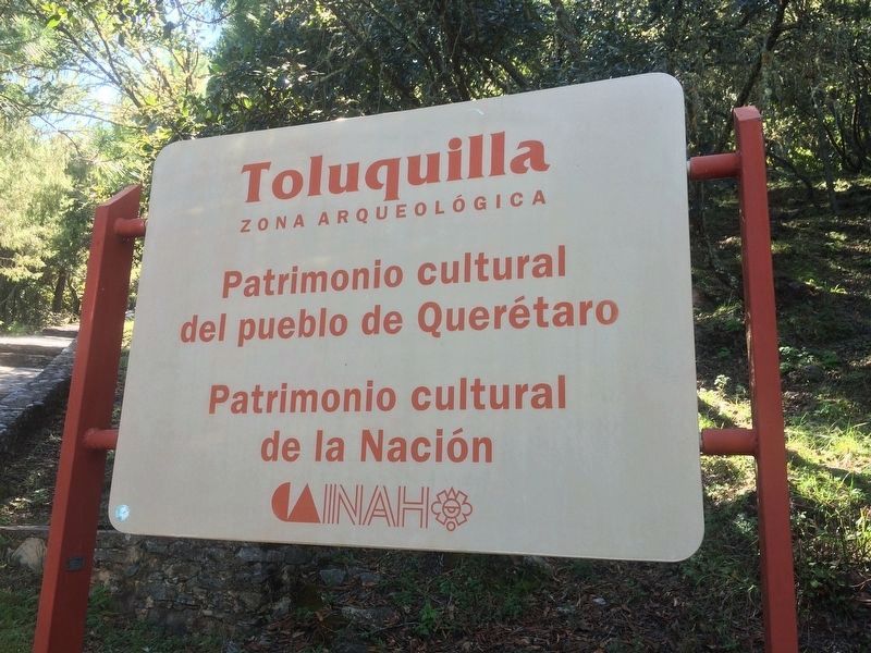
San Joaquín in Cadereyta de Montes, Querétaro, Mexico — The Central Highlands (North America)
The History and Natural Environment of Toluquilla
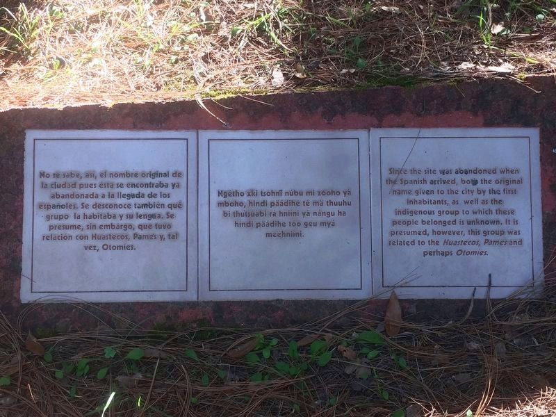
Photographed By J. Makali Bruton, December 9, 2017
1. "The Original Name of the Site" Marker
There are many of these smaller, ceramic markers along the walkway at Toluquilla from the parking area up to the small visitors center. Most are related to natural topics, but some of those shown on this page are related to the site's history.
El Nombre Original del Sitio
No se sabe, así, el nombre original de la ciudad pues esta se encontraba ya abandonada a la llegada de los españoles. Se desconoce también que grupo la habitaba y su lengua. Se presume, sin embargo, que tuvo relación con Huastecos, Pames y, tal vez, Otomíes.
El Nombre Original del Sitio
Ngétho xki tsohni núbu mi zooho yä mboho, hindi päádihe té mä thuuhu bi thútsuäbi rá hniíni yä nángu ha híndi päádihe tóo gue myá meéhniíni.
The Original Name of the Site
Since the site was abandoned when the Spanish arrived, both the original name given to the city by the first inhabitants, as well as the indigenous group to which these people belonged is unknown. It is presumed, however, this group was related to the Huastecos, Pames and perhaps Otomíes.
Erected by Instituto Nacional de Antropología e Historia (INAH).
Topics. This historical marker is listed in these topic lists: Anthropology & Archaeology • Native Americans.
Location. 20° 53.078′ N, 99° 31.866′ W. Marker is in San Joaquín, Querétaro, in Cadereyta de Montes. Marker can be reached from Unnamed road just west of Carretera San Joaquín-Querétaro. Touch for map. Marker is in this post office area: San Joaquín QUE 76529, Mexico. Touch for directions.
Other nearby markers. At least 8 other markers are within 5 kilometers of this marker, measured as the crow flies. Archaeological Work at Toluquilla (within shouting distance of this marker); Ball Court One (within shouting distance of this marker); Place of the Magueyes (about 180 meters away, measured in a direct line); Ball Court Two (approx. 0.2 kilometers away); Observation Post "La Crucita" (approx. 4.6 kilometers away); Historic Tree (approx. 4.6 kilometers away); Monument to the Miner (approx. 4.8 kilometers away); The Round Stone Monument (approx. 4.8 kilometers away). Touch for a list and map of all markers in San Joaquín.
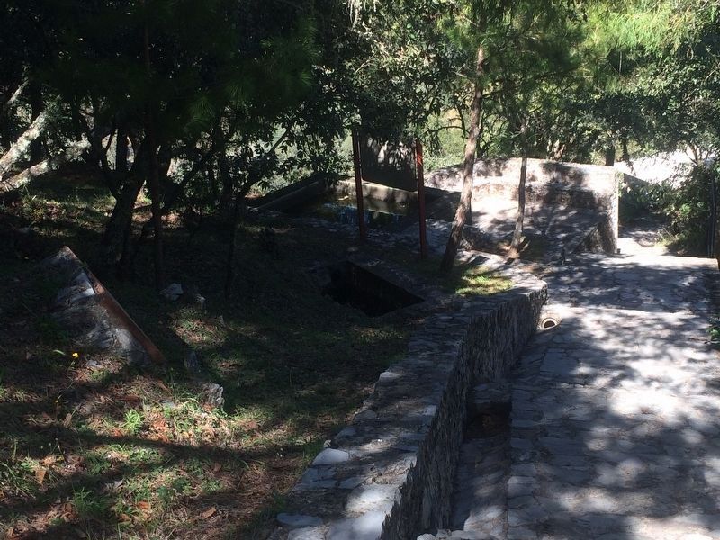
More about this marker. The marker is at Toluquilla Archaeological Site, turning on to an unnamed road some few kilometers from the town of San Joaquín on Route 120 towards Querétaro. This and other similar markers are along the walking path from the parking area up to the small visitors center and site entrance.
Photographed By J. Makali Bruton, December 9, 2017
2. An additional marker, "The Original Name of Toluquilla"
This additional marker is also along the walkway up to the visitors center and site entrance. It reads:
El Nombre de Toluquilla
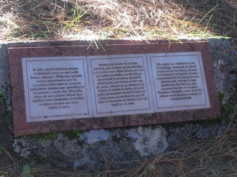
En esta región habitaban grupos Chichimecas entre los que había Pames, Jonaces y Ximpeces, quienes fueron exterminados por los españoles. Estos trajeron entonces pobladores mexicas que renombraron los parajes y cerros. Así, Toluquilla viene de una palabra náhuatl que significa Cerro Jorobado; el nombre se debe a la vista que tiene desde el norte.
Hñähñú:
El Nombre de Toluquilla
Tolukiya brá ñeéhe há rá noya ndeshnä, geä rí boóni rä ndoókä toho o nkoóstha toho. Núbu Monda mí o rá ye tsuthui yä mboho unu bi mäá ge nunä hyódi ja mí bukua yä makhu Chichimecas, geu háraza mí bui ngu yä páme, Jonaces ne yä ximpeses; ya mbóho bi meédi na tuitho xä juaáti gátho yä meémhai ha bá tslí mára yä rayo nangu, yä ndéshnä ha geu, bi yopi bi hñumpäbi yá thuúhu nuya yä hyódi ne yá toho.
English:
The Original Name of Toluquilla
This region was inhabited by the Chichimecas, composed of various groups such as the Pames, Jonaces and Ximpeces. Eventually all were exterminated by the Spaniards who subsequently brought in new inhabitants, the Mexicas, who renamed the sites of the area. Therefore Toluquilla comes from the náhuatl word meaning stooped, or humpbacked hill.
El Nombre de Toluquilla
En esta región habitaban grupos Chichimecas entre los que había Pames, Jonaces y Ximpeces, quienes fueron exterminados por los españoles. Estos trajeron entonces pobladores mexicas que renombraron los parajes y cerros. Así, Toluquilla viene de una palabra náhuatl que significa Cerro Jorobado; el nombre se debe a la vista que tiene desde el norte.
El Nombre de Toluquilla
Tolukiya brá ñeéhe há rá noya ndeshnä, geä rí boóni rä ndoókä toho o nkoóstha toho. Núbu Monda mí o rá ye tsuthui yä mboho unu bi mäá ge nunä hyódi ja mí bukua yä makhu Chichimecas, geu háraza mí bui ngu yä páme, Jonaces ne yä ximpeses; ya mbóho bi meédi na tuitho xä juaáti gátho yä meémhai ha bá tslí mára yä rayo nangu, yä ndéshnä ha geu, bi yopi bi hñumpäbi yá thuúhu nuya yä hyódi ne yá toho.
The Original Name of Toluquilla
This region was inhabited by the Chichimecas, composed of various groups such as the Pames, Jonaces and Ximpeces. Eventually all were exterminated by the Spaniards who subsequently brought in new inhabitants, the Mexicas, who renamed the sites of the area. Therefore Toluquilla comes from the náhuatl word meaning stooped, or humpbacked hill.
Photographed By J. Makali Bruton, December 9, 2017
3. Flora y Fauna, an additional nearby marker
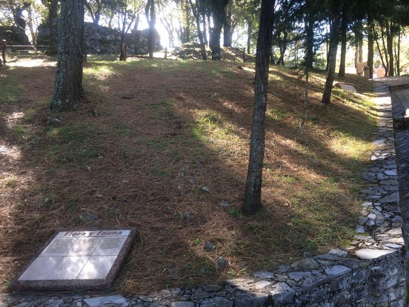
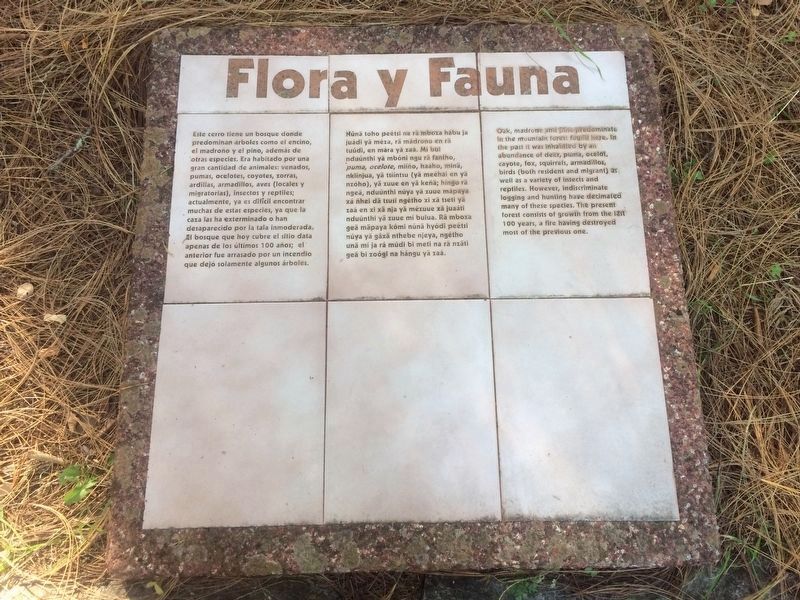
Este cerro tiene un bosque donde predominan árboles como el encino, el madroño y el pino, además de otras especies. Era habitado por una gran cantidad de animales: venados, pumas, ocelotes, coyotes, zorras, ardillas, armadillos, aves (locales y migratorias), insectos y reptiles; actualmente, ya es difícil encontrar muchas de estas especies, ya que la caza las ha exterminado o han desaparecido por la tala inmoderada. El bosque que hoy cubre el sitio data apenas de los últimos 100 años; el anterior fue arrasada por un incendio que dejó solamente algunos árboles.
Flora y Fauna
Núnä toho peétsi na rä mboza hábu ja juádi yä méza, rá mádrono en rä tuúdi, en mára yä zaá. Mí bui nduúnthi yuä mbóni ngu rä fantho, puma, ocelote, miíño, haáho, minä, nkiínjua, yä tsííntsu (yä meéhai en yä nzóho), yä zuue en yä keñä; híngo rä ngeä, nduúnthi núya yä zuue mäpaya xá ñhei dä tsusi ngétho xi xä tseti yä zaá en xi xä nja yä mézuue xä juaáti nduúnthi yä zuue mí buiua. Rä mboza geä mäpaya kómi núnä hyódi peétsi núya yä gáxä nthebe njeya, ngétho unä mí ja rá múdi bi meti na rä nzäti geä bi zoógi na hángu yä zaá.
Flora and Fauna
Oak, madrone and pine predominate in the mountain forest found here. In the past it was inhabited by an abundance of deer, puma, ocelot, cayote, fox, squirrels, armadillos, birds (both resident and migrant) as well as a variety of insects and reptiles. However, indiscriminate logging and hunting have decimated many of these species. The present forest consists of growth from the last 100 years, a fire having destroyed most of the previous one.
Photographed By J. Makali Bruton, December 9, 2017
4. An additional nearby marker on the Valleys of North Querétaro
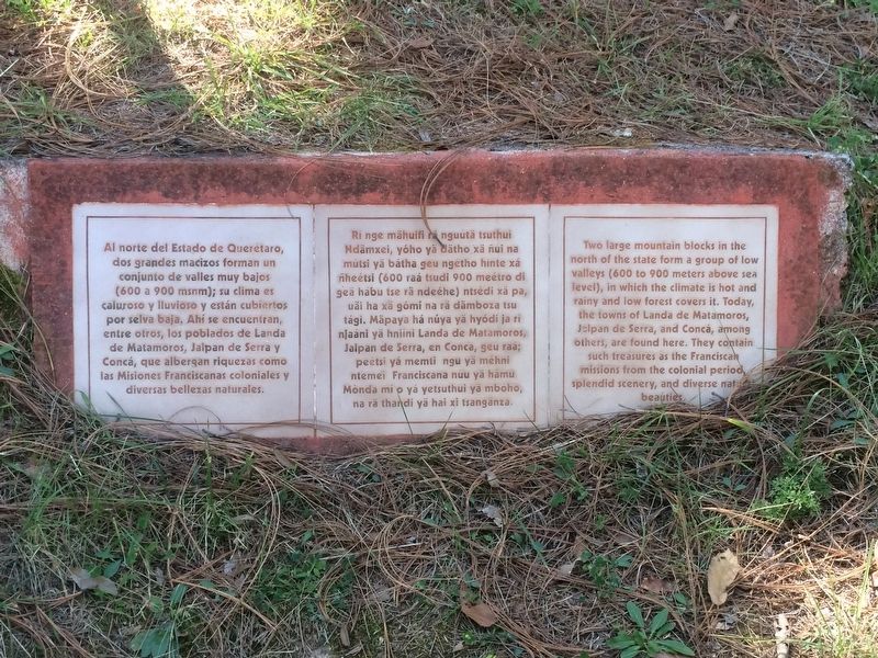
Al norte del Estado de Querétaro, dos grandes macizos forman un conjunto de valles muy bajos (600 a 900 msnm); su clima es caluroso y lluvioso y están cubiertos por selva baja. Ahí se encuentran, entre otros, los poblados de Landa de Matamoros, Jalpan de Serra y Concá, que albergan riquezas como las Misiones Franciscanas coloniales y diversas bellezas naturales.
Valles del Norte de Querétaro
Rin ge mähuifi rä nguútä tsuthui Ndämxei, yóho yä dätho xä ñui na mútsi yä bátha geu ngétho hinte xá ñheétsi (600 raá tsudi 900 meétro di geä hábu tse rä ndeéhe) ntsédi xäpa, uäi ha xä gómi na rä dämboza tsu tági. Mäpaya há núya yä hyódi ja rí njaáni yä hniíni Landa de Matamoros, Jalpan de Serra, en Conca, geu raá; peétsi yá memti ngu yä méhni ntemei Franciscana núu yä méhni ntemei Franciscana núu yä hámu Monda mi o yá yetsuthui yä mbóho, na rä thanki yä hai xi tsangäza.
Valleys of Northern Querétaro
Two large mountain blocks in the north of the state form a group of low valleys (600 to 900 meters above sea level), in which the climate is hot and rainy and low forest covers it. Today, the towns of Landa de Matamoros, Jalpan de Serra, and Concá, among others, are found here. They contain such treasures as the Franciscan missions from the colonial period, splendid scenery, and diverse natural beauties.
Photographed By J. Makali Bruton, December 9, 2017
5. A nearby, additional marker on Geography and Climate of the area
This additional marker is at about the halfway point on the walk up to the site. It reads:
Geografía y Clima
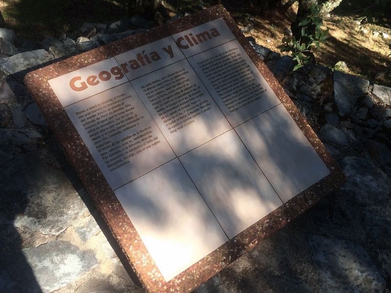
Frente a usted se observa, al fondo, una gran barrera de montañas; se trata del macizo donde se asienta el poblado de Pinal de Amoles. Este macizo, al igual que la loma donde usted se encuentra, son de los de mayor altura; por eso las nubes, el viento y la lluvia chocan formando un clima frío, húmedo, neblinoso y templado. El fondo de las cañadas de la Sierra es seco, caluroso, esto es semidesértico. Por ejemplo, a su derecha, atrás de las montañas, se encuentra el Valle del Mezquital, Hidalgo, que es una región semidesértica.
Hñähñú:
Geografía y Clima
Há núnä nhoke, mä ri ñhote ha na rä rä däángä njuxä tohó, rä ndätho hábu xrä tei rä hniíni Pinal de Amoles. Núnä ndätho, njani ngu núä rä kati hábu di buhu, gehyu mäna xi yá ñheétsi, rá ngeéä unbu di mfántui yä gui, rä ndähi en rä yeé zóhnä rä tse, rä xaáha, rä bóngui en rä pa. Rí ñhoteni há yä hñemtharä Peéhnä Toho xá ñóti, xá pa, gehni, rä yomhai. Nguä ri njaáni há rä ñei, ri ñhoteni há yä toho ri njaáni rä Bátha rä Boótähi, Ñhunthe, rä nguúti rä yomhai ngétho rí maáni híngi tsóni rä xaáha.
English:
Geography and Climate
From here one can see in the distance a great wall of mountains and the village of Pinal de Amoles. Both the site of this village and the ridge on which you stand are the highest parts of the range and therefore the most exposed to passing clouds, wind and rain, all which combine to form the cold, humid and foggy conditions of the temperate clima found there. The bottoms of the canyons of the mountain range are hot and dry, making them semi-arid. To the right behind the mountains one finds the Valley of the Mezquital in the state of Hidalgo, a semi-desert region.
Geografía y Clima
Frente a usted se observa, al fondo, una gran barrera de montañas; se trata del macizo donde se asienta el poblado de Pinal de Amoles. Este macizo, al igual que la loma donde usted se encuentra, son de los de mayor altura; por eso las nubes, el viento y la lluvia chocan formando un clima frío, húmedo, neblinoso y templado. El fondo de las cañadas de la Sierra es seco, caluroso, esto es semidesértico. Por ejemplo, a su derecha, atrás de las montañas, se encuentra el Valle del Mezquital, Hidalgo, que es una región semidesértica.
Geografía y Clima
Há núnä nhoke, mä ri ñhote ha na rä rä däángä njuxä tohó, rä ndätho hábu xrä tei rä hniíni Pinal de Amoles. Núnä ndätho, njani ngu núä rä kati hábu di buhu, gehyu mäna xi yá ñheétsi, rá ngeéä unbu di mfántui yä gui, rä ndähi en rä yeé zóhnä rä tse, rä xaáha, rä bóngui en rä pa. Rí ñhoteni há yä hñemtharä Peéhnä Toho xá ñóti, xá pa, gehni, rä yomhai. Nguä ri njaáni há rä ñei, ri ñhoteni há yä toho ri njaáni rä Bátha rä Boótähi, Ñhunthe, rä nguúti rä yomhai ngétho rí maáni híngi tsóni rä xaáha.
Geography and Climate
From here one can see in the distance a great wall of mountains and the village of Pinal de Amoles. Both the site of this village and the ridge on which you stand are the highest parts of the range and therefore the most exposed to passing clouds, wind and rain, all which combine to form the cold, humid and foggy conditions of the temperate clima found there. The bottoms of the canyons of the mountain range are hot and dry, making them semi-arid. To the right behind the mountains one finds the Valley of the Mezquital in the state of Hidalgo, a semi-desert region.
Photographed By J. Makali Bruton, December 9, 2017
6. An additional marker on the walkway about the Sierra Gorda
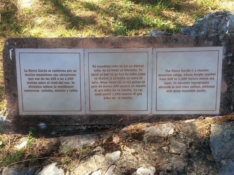
La Sierra Gorda se conforma por un macizo montañoso con elevaciones que van de los 600 a los 3,200 metros sobre el nivel del mar. Su dinámico relieve lo constituyen numerosas cañadas, mesetas y valles.
La Sierra Gorda
Rä mpeéhnä toho xä ñui yä däángä toho, ha xä thétsi yä hñemtha. Xä njutsi yä kati há yá hyo ha hábu mäna xá ñheétsi ja yä bátha en mára yä toho. Núyu hánja nja xä nja gehyu xä yote dä meétsi 600 meétro yá ñheétsi di geä hábu tse rä ndeéhe, ha raá studi peétsi 3,200 meétro di geä hábu tse rä ndeéhe.
The Sierra Gorda
The Sierra Gorda is a massive mountain range, whose height reaches from 600 to 3,2000 meters above sea level. Its dynamic topography abounds in lush river valleys, plateaus and steep mountain peaks.
Photographed By J. Makali Bruton, December 9, 2017
7. Another additional marker on the Sierra Gorda
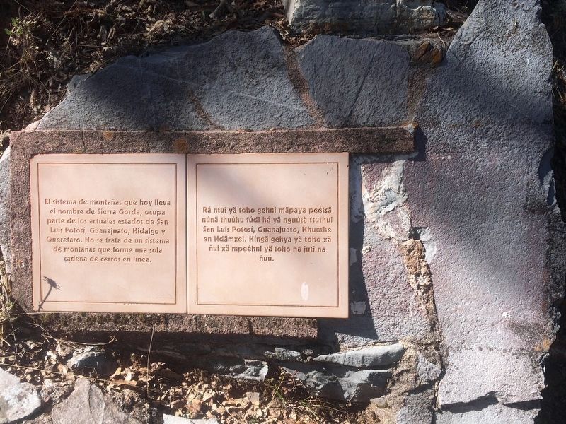
El sistema de montañas que hoy lleva el nombre de Sierra Gorda, ocupa parte de los actuales estados de San Luis Potosí, Guanajuato, Hidalgo y Querétaro. No se trata de un sistema de montañas que forme una sola cadena de cerros en línea.
La Sierra Gorda
Rá ntui yä toho gehni mäpaya peétsä núnä thuúhu fúdi há yä nguútä tsuthui San Luis Potosí, Guanajuato, Ñhunthe en Ndämxei. Hínä gehya yä toho xä ñui xä mpeéhni yä toho na juti na ñuú.
The Sierra Gorda
The system of mountains that today is known as the Sierra Gorda occupies a part of the current states of San Luis Potosí, Guanajuato, Hidalgo and Querétaro. It is not a mountain system formed by only one chain of hills in a narrow line.
Photographed By J. Makali Bruton, December 9, 2017
8. An additional marker on the Formation of the Sierra Gorda
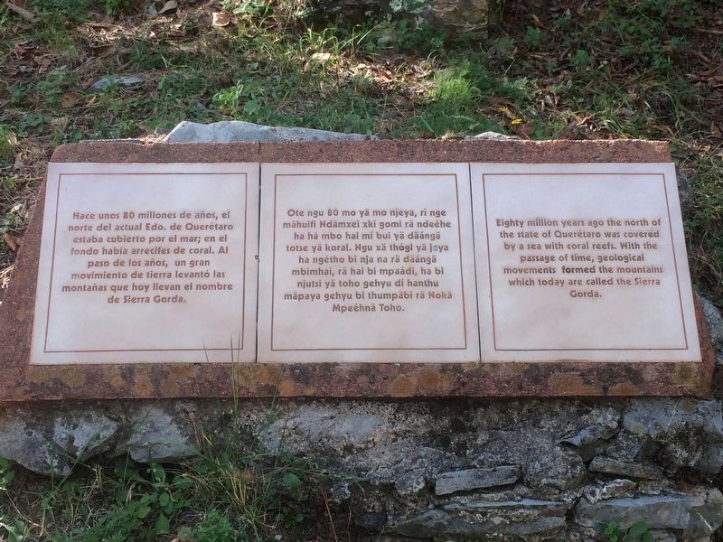
Hace unos 80 millones de años, el norte del actual Edo. de Querétaro estaba cubierto por el mar; en el fondo había arrecifes de coral. Al paso de los años, un gran movimiento de tierra levantó las montañas que hoy llevan el nombre de Sierra Gorda.
Formación de la Sierra Gorda
Ote ngu 80 mo yä mo njeya, rí nge mähuifi Ndämxei xki gomi rä ndeéhe ha há mbo hai mí bui yä däángä totse yä koral. Ngu xä thógi yä jeya ha negétho bi nja na rä däángä mbimhai, rä hai bi mpaádi, ha bi njutsi yä toho gehyu dí hanthu mäpaya gehyu bi thumpäbi rä Nokä Mpeéhnä Toho.
Formation of the Sierra Gorda
Eighty million years ago the north of the state of Querétaro was covered by a sea with coral reefs. With the passage of time, geological movements formed the mountains which today are called the Sierra Gorda.
Photographed By J. Makali Bruton, December 9, 2017
9. An additional marker, interestingly on the languages used on markers at Toluquilla
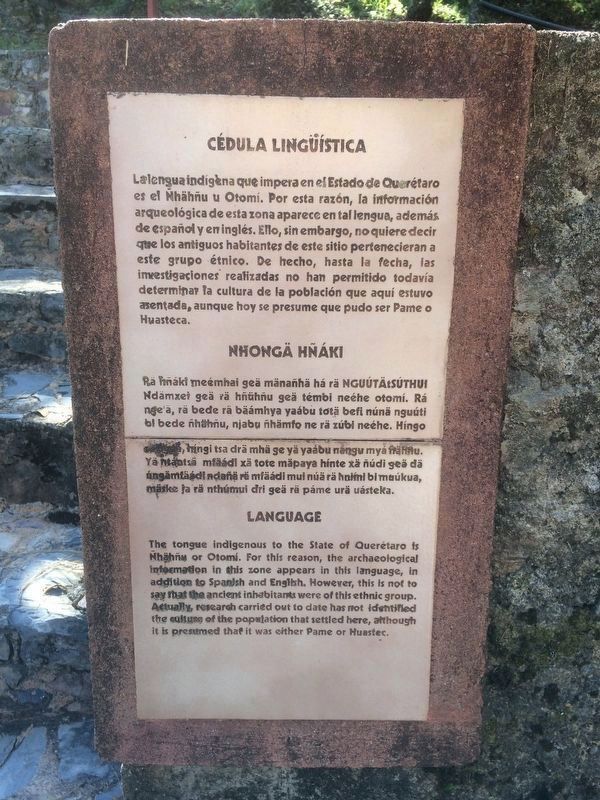
La lengua indígena que impera en el Estado de Querétaro es el Ñhähñu u Otomí. Por esta razón, la información arqueológica de esta zona aparece en tal lengua, además de español y en inglés. Ello, sin embargo, no quiere decir que los antiguos habitantes de este sitio pertenecieran a este grupo étnico. De hecho, hasta la fecha, las investigaciones realizadas no han permitido todavía determinar la cultura de la población que aquí estuvo asentada, aunque hoy se presume que pudo ser Pame o Huasteca.
Nhongä Hñáki
Rä hñáki meémhai geä mänañhä há rä nguútätsúthui Ndämxei geä rä hñühñu geä témbi neéhe otomí. Rá nge'ä, rä bede rä bäámhya yaábu totä befi núnä nguúti bi bede ñhähñu, njabu ñhämfo ne rä zúbi neéhe. Híngo …, híngi tsa drä mhä ge yä yaábu nángu myá ñähñu. Yä ntántsä mfäádi xä tote mäpaya hínte xä ñúdi geä dä úngämfäádi ndañä rä mfäádi mui núä rä hmimi bi muúkua, mäske ja rä nthúmui dri geä rä páme urä uásteka.
Language
The tongue indigenous to the State of Querétaro is Ñhähñu or Otomí. For this reason, the archaeological information in this zone appears in this language, in addition to Spanish and English. However, this is not to say that the ancient inhabitants were of this ethnic group. Actually, research carried out to date has not identified the culture of the population that settled here, although it is presumed that it was either Pame or Huastec.
Credits. This page was last revised on February 2, 2018. It was originally submitted on February 1, 2018, by J. Makali Bruton of Accra, Ghana. This page has been viewed 133 times since then and 7 times this year. Photos: 1, 2, 3, 4, 5, 6, 7, 8, 9, 10, 11, 12. submitted on February 1, 2018, by J. Makali Bruton of Accra, Ghana.
