16th Century Bastle House Ruined buildings were adapted and new ones built at Housesteads in the centuries after the Romans left, when the land around became an upland farm. In the 16th century a local family built a fortified house onto the . . . — — Map (db m126423) HM
A Changing Fort
During its 280-year life, many changes were made in the fort, no more so than to building XV. Over the years, it served as a workshop, a barracks, a stable, and a storehouse before a small bathhouse (balneae) was placed . . . — — Map (db m126449) HM
A military community Villages like Vindolanda were a vital part of the military occupation of Hadrian's Wall, and were planned extensions of the forts themselves. They provided extra space for facilities such as shops, workshops, additional . . . — — Map (db m126419) HM
To the Glory of God
And in Proud and Loving Memory
Of the Men of This Parish, Who
Gave Their Lives in the Great War
1914 — 1918
William Frederick Pearson.
Gilbert Graham.
William Vickers.
George Sparke.
“Greater love . . . — — Map (db m126414) WM
Barracks: the Last Hundred Years at Housesteads
Archaeology has revealed radical changes to the fort beginning around AD 300. One of the most important was the reconstruction of the barracks from single long buildings into smaller individual . . . — — Map (db m126447) HM
The remains of the stone buildings that you see around you are but a fraction of what was once here at Vindolanda in ancient times. Before the last stone fort was built around AD213, eight forts had preceded it. Most of the earlier forts were . . . — — Map (db m126354) HM
Vindolanda Charitable Trust
Chesterholm Museum
In 1831, Vindolanda's first excavator, Rev. Anthony Hedley, removed the remains of the derelict Scotsholm fulling mill, and built an ornate cottage for his family, calling it Chesterholm. Designed by . . . — — Map (db m126356) HM
Crindledykes
Limekiln
This is one of several limekilns built in this area in the nineteenth century to convert local limestone to quicklime for use in farming and building.
Limestone and coal were hauled up the ramp and tipped into the pot for . . . — — Map (db m126420) HM
Dolichenum — Temple to Jupiter Dolichenus
fanum livi Dolicheno dedicatum
This was an extremely rare temple dedicated to the god Jupiter Dolichenus, built around AD220 inside the walls of the fort, probably by a commanding officer of . . . — — Map (db m126416) HM
Mediterranean Style in Northern Climes
All Roman forts included a large prestigious house (praetorium) for the commanding officer (praefectus), his family and servants.
The praetorium was the largest building in the fort. The design came . . . — — Map (db m126424) HM
North West Quadrant barracks — excavated 2009-2011
These standard Roman Army barracks were constructed in cAD213 by the 4th cohort of Gauls and remained in use until the end of the 3rd century, after which they were demolished and replaced . . . — — Map (db m126362) HM
Vindolanda Charitable Trust
Roman Pottery Kiln
This fully functional replica of a Roman up-draft pottery kiln, is based on information gained from the excavation of such kilns at archaeological sites across the North of England. The body of the . . . — — Map (db m126355) HM
S.P.Q.R.
In Memory of the Soldiers
Who Served Rome on the
Frontier at Vindolanda.
A.D. 85 — 400
Cohorts:
I Tungrorvm
III Batavorvm
VIII Batavorvm
II Nerviorvm
III Nerviorvm
IV Gallorvm
And Detachments . . . — — Map (db m126358) HM WM
Severan Circular Huts
Below the NW quadrant of the fort the remains of a series of circalar huts dated to cAD208-212 have been uncovered. These huts appear to have been living accommodation for an unknown group of people during a time of . . . — — Map (db m126415) HM
The Comanding Officer and his House
Each commanding officer (praefectus) of the fort was a nobleman of the equestrian class (equites), who might have been in charge of the soldiers at Housesteads for as little as three years before . . . — — Map (db m126431) HM
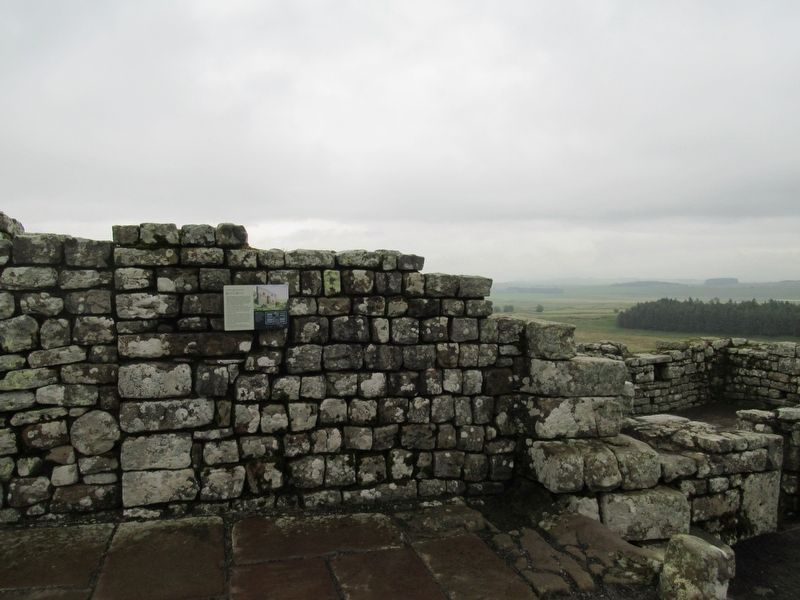
The Fort and its Design
Roman soldiers began to build Housesteads around AD 124 to a design used for forts across the Roman Empire. This fort is one of the best surviving examples, anywhere.
Housesteads follows a text-book template, . . . — — Map (db m126422) HM
The Fort Food Supply
Roman forts had granaries to store the huge quantities of food required by hundreds of soldiers. The food supply had to be safe, dry and constantly replenished.
The granary (horreum) was essential for storing foods of . . . — — Map (db m126439) HM
Three buildings dominated a Roman military settlement and these were all placed in the middle of the fort. The principia, praetorium and the horrea formed a central range of imposing buildings which could easily have been identified and located by . . . — — Map (db m126360) HM
The Heart of the Fort
The headquarters building (principia) was the administrative, ceremonial and symbolic heart of the fort – where regimental organisation and the imperial state religion were focussed. The building was in the . . . — — Map (db m126450) HM
The Milestone
Three hundred yards to the north of this place, at the side of the Stanegate road, stands the only Roman milestone from Britain to survive intact in its original position (although without an inscription).
This replica milestone . . . — — Map (db m126357) HM
The North Gate
The north gate (porta principalis sinistra) is the only one of the original four which opened onto land beyond the Wall. However, the approach from the north was steep and the gate was eventually reduced to a minor . . . — — Map (db m126444) HM
The Severan fort
Castellum Severianum
These buildings belonged to an earlier fort, used between AD208 – 211, during the reign of the African emperor Septimius Severus. The series of long rectangular buildings now on display were . . . — — Map (db m126417) HM
The Vicus
Life Outside the Fort
Soldiers and civilians mixed in the vicus, a settlement outside the fort. It was a lively community of people from many places in the Empire, engaged in trade, leisure and worship. Soldiers' sweethearts and . . . — — Map (db m126421) HM
You are approaching the edge of the village (vicus), looking east towards the heart of the settlement where the vicus met the walls of the fort. Where you are standing today was the main temple precinct in the 3rd century. Temple buildings . . . — — Map (db m126345) HM
The Wall Arrives
In AD 122, the Emperor Hadrian's decision to build the Wall was transformed into action all along the frontier. The foundation for the Wall and a lookout tower were begun here at Housesteads, before everything changed... . . . — — Map (db m126438) HM
Exact Replicas of Vindolanda Inscriptions
The three great altars and the tombstones were found built Anthony Hedley at Vindolanda in the early nineteenth century, and they are now in Chesters Museum.
RIB 1685
Translation:
Sacred to the . . . — — Map (db m126359) HM
Where the Soldiers Lived
Most of the space within the fort was occupied by barracks where the soldiers and their officers lived.
In front of you are the wall foundations of building XIII, one of ten identical fort barracks completed under . . . — — Map (db m126446) HM
Workshops fabricae vel officinae
These buildings, flanking a major roadway through the village (vicus), were 3rd century industrial workshops. Excavated in 2004, they appear to have been used in the initial stages of iron production. A number of . . . — — Map (db m126344) HM