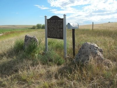
About July 1, 1867, Lt. Lyman S. Kidder with ten men of the 2nd U.S. Cavalry, and an Indian guide, were attacked by Indians one mile east of this marker. On July 12 their mutilated bodies were found by Lt. Col. George A. Custer, who ordered the . . . — — Map (db m78880) HM
"The area from Great Bend westward for a hundred miles or so was a famous hunting ground for all the plains tribes, as its excellent pasturage made it the home of vast herds of buffaloes, besides plenty of antelopes and deer." - N. H. . . . — — Map (db m40105) HM
This Kansas limestone relief sculpture, by Cherokee sculptor Eddie Morrison, depicts the variety of cultures which have occupied and influenced this area. Each group, from Native Americans to early pioneers, farmers, and adventurers, have shared the . . . — — Map (db m96551) HM
Hired as assistant marshal in 1882 and later promoted to marshal. Henry Brown had failed to tell the city council about his interesting past which included cattle rustling, riding with Billy the Kid, and a trivial murder charge during the Lincoln . . . — — Map (db m96524) HM
Red Light Saloon
On the NE corner of Chisholm and Ave A stood the Red Light Saloon which helped give Caldwell its reputation as the most lawless cowtown. In April, 1880 George and Mag Wood literally disassembled their Wichita . . . — — Map (db m96528) HM
The Last Land Rush
On September 16, 1893, 15,000 land hungry whites gathered here to make "the Run" into the Cherokee Outlet to the south. Caldwell was 1 of 9 places where over 100,000 potential settlers awaited cavalry soldiers' . . . — — Map (db m96535) HM
Front
The "Real" Cherokee Strip
Under treaties made in 1828 and 1833 with the Federal Government, the Cherokee Tribe of Indians exchanged their homelands in the southeastern part of the United States for land in the . . . — — Map (db m96599) HM
Beginning in 1858 with Pike's Peak Gold Rush, a Native American trail along the Smoky Hill River provided the shortest route through Kansas, though often not the safest. This "Smoky Hill Trail" became the path for the Butterfield Overland Despatch . . . — — Map (db m200978) HM
Discovered by
Coronado 1541
———————
Rediscovered by
J.V. Brower 1896
Erected by
John T. Keagy
for
Quivira Historical Society
1904 . . . — — Map (db m64873) HM
Kansas has long been oil country. There are legends that Indians held council around the lights of burning springs. Immigrants, it is known, skimmed "rock tar" from such oil seeps to grease the axles of their wagons.
Three blocks southeast, on . . . — — Map (db m57638) HM
Kansas has long been oil country. There are legends that Indians held council around the lights of burning springs. Emigrants, it is known, skimmed "rock tar" from such oil seeps to grease the axles of their wagons.
A mile southeast is the site . . . — — Map (db m57598) HM
In June, 1804, Lewis and Clark, exploring the Louisiana Purchase, camped where the Kansas river empties into the Missouri. Forty years later the Wyandot Indians were moved here from Ohio. Their tribal burial ground, Huron cemetery, may still be . . . — — Map (db m46303) HM
When the Pilgrims landed at Plymouth Rock, many different Indian nations occupied what is now the United States. European settlement gradually resulted in many of these native peoples being pushed to the west.
In 1825 the U.S. government . . . — — Map (db m46324) HM
In commemoration of the
ethnic communities present
in the new
Wyandotte County
created in 1859
Shawnee-Delaware • Wyandot • African • German
Irish • English • Scottish • Danish
1909
Within this 50 year span
the following . . . — — Map (db m46296) HM
She was not at Kaw's Mouth
in June 1804, but joined the expedition later in April of 1805 at the Mandan villages in what is now North Dakota. — — Map (db m54007) HM
As early as the 1600s, the Kanza (or Kaw) Indians migrated from their home east of the Mississippi River and up the Missouri River into what is now northeastern Kansas. In the 1700s, the Kanza occupied two villages on the west bank of the Missouri: . . . — — Map (db m53945) HM
As a young child, Charles Curtis lived on a Kaw Indian reservation. He attended law school and became prosecuting attorney of Shawnee County, Kansas from 1885-1889. He served in the House of Representatives from 1893-1907 and as a senator from the . . . — — Map (db m201455) HM
The semi-nomadic Osage (Wazhazhe) Indians lived along the Osage and Missouri, hunted on the Great Plains and fiercely guarded their land. Women foraged and grew vegetables in summer village gardens. The U.S. Government took the tribe's land in 1808 . . . — — Map (db m200957) HM
Just east of this marker, at a point where an old Indian trail led to the water's edge, Moses Grinter established the first ferry on the Kansas River. The year was 1831, and Grinter became the earliest permanent white settler in the area. His ferry . . . — — Map (db m46329) HM
In memory of
Moses Grinter
who was sent here by the government in 1831 to establish the first ferry on the Kansas River. He operated a trading post for the Delaware Indian tribe until 1860, when it was closed. Delaware was the first post . . . — — Map (db m46340) HM
The pioneer of the Wyandot Indians to the Kansas Valley in 1842. The leading man and constant friend of the Indian. A devout Christian and a good Mason. He leaves the craft on Earth and goes with joy to the great architect. — — Map (db m69393) HM
Tablet 1
The Origins of the Wyandots
The story of the Wyandot Nations is both heroic and bitter. Once among the greatest of Indian tribes in northeast America, a warrior race whose influence reached from Canada to Kentucky, the . . . — — Map (db m72957) HM
Where the Kaw river joins the mighty Missouri in its sweep eastward, has witnessed many events of historical significance to this area, among them:
1804. Lewis and Clark, on their epic exploring trip assaying the new Louisiana Purchase, . . . — — Map (db m69478) HM
The Indian Removal Act of 1830 forced certain eastern tribes westward into Kansas. In recognition of past acts of friendship by the Wyandots, the Delaware agreed to sell them 36 sections of their holdings. The Delaware also graciously donated 3 . . . — — Map (db m69400) HM
226 entries matched your criteria. Entries 201 through 226 are listed above. ⊲ Previous 100