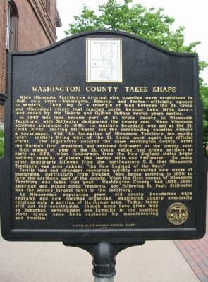
Minnesota Territory 1849 – 1858
On March 3, 1849, during his last hours in office, President James K. Polk signed a bill adding a new name to the American political landscape – Minnesota Territory. A vast land, it stretched from . . . — — Map (db m43908) HM
About 1843, six years before Minnesota became a territory, Lemuel Bolles erected on this creek the first commercial flour mill in the Minnesota country. Bolles salvaged wood from the shore of Lake St. Croix and carried it on his back to the mill . . . — — Map (db m21729) HM
Minnesota's first courthouse, a three-room frame structure erected at the corner of 4th and Chestnut Street in Stillwater in 1849, had become inadequate by 1866. On November 6 of that year, Washington County voters approved funds for the . . . — — Map (db m171962) HM
In 1849, the Governor of the new Territory of Minnesota, Alexander Ramsey, urged the Territorial Legislature to provide for a "proper and safe place of confinement" for prisoners of the territory. Because of Ramsey's request, the Legislature . . . — — Map (db m43747) HM
In 1864, the Northern Pacific Railroad was charted to build a line from the Great Lakes to Puget Sound. The initial funding for construction would come from the sale of Northern Pacific bonds. However, in 1873 lack of funding halted construction, . . . — — Map (db m239986) HM
The complexity of the company's history reflects the transformation of the electric power industry since the late nineteenth century as smaller utilities were consolidated into larger ones.
Created in 2000 by the merger of Northern States . . . — — Map (db m235069) HM
For more than 10,000 years, people have lived near the Mississippi River. The first cultures relied on hunting, fishing, and gathering for survival. As early as 1,000 years ago, however, Indian peoples were farming portions of the river valley near . . . — — Map (db m49801) HM
Dedicated to the
Soldiers and Sailors of the
United States
Enlisting or Residing in
Washington County
———
Erected by the Citizens of
Washington County
1916
center panel
Minnesota
Alcorn James 2nd Cav. •
Barrisford . . . — — Map (db m72153) WM
All of the land seen from this bridge and beyond is part of millions of acres ceded under an 1837 treaty between Ojibwe and Dakota bands and the United States government. The acreage contained vast tracts of the prized white pine that grew north of . . . — — Map (db m233476) HM
Preserving the Past for the Future
Listed on the National Register of Historic Places this is one of five known remaining iron bridges in Minnesota. In the 1890s steel replaced iron as the primary bridge building material making iron bridges . . . — — Map (db m233655) HM
Thin black lines indicate changes in relevance. Between each pair of lines entries are ordered geographically but all have the same relevance.
* Inflectional forms of words are their plurals, singulars, and possessives as well as gramatical tenses and similar variations.