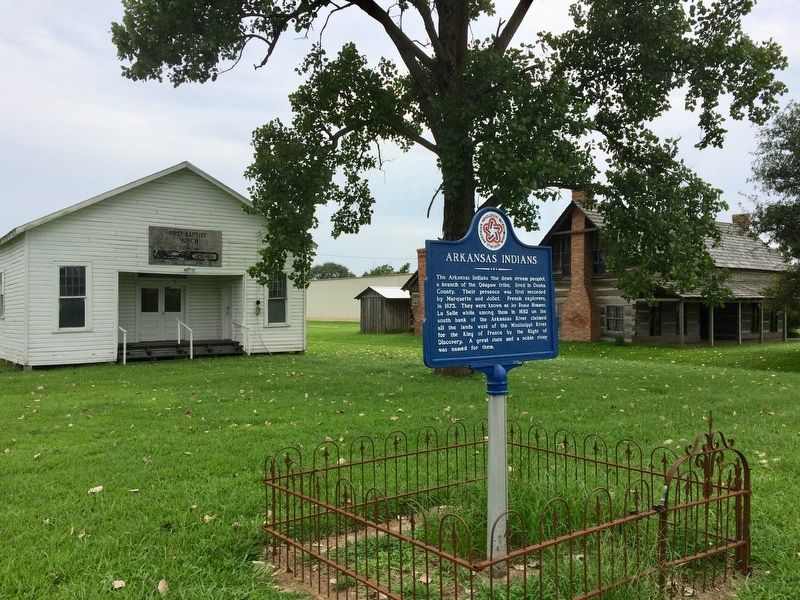
On Pickens Street (U.S. 165) east of Jack Dante Drive, on the right when traveling east.
The Arkansas Indians (the down stream people), a branch of the Quapaw tribe, lived in Desha County. Their presence was first recorded by Marquette and Joliet, French explorers, in 1673. They were known as les Beaux Hommes. La Salle while . . . — — Map (db m107809) HM
On Desoto Avenue at Sprague Street, on the right when traveling east on Desoto Avenue.
Between the years of 1873 and 1927, Arkansas
City had one of the most important ports on the
Mississippi River. Before being an established
port, a steamboat landing was located at this
site as early as 1834, This port was also known
as the . . . — — Map (db m299004) HM
On Kelso Road 0.3 miles east of State Route 1, on the right when traveling east.
In mid-February 1863, Confederate troops at Cypress Bend fired on Union transports on the Mississippi River. On Feb. 19, a force of Union cavalry and mule-mounted infantry set out in pursuit. The Union troops drove off enemy pickets before . . . — — Map (db m107693) HM
This important river port, county seat of Desha County from 1838 to 1874, was located 24 miles east at the junction of the Arkansas River with the Mississippi. The town was finally abandoned after most of it washed into the Mississippi River. — — Map (db m107758) HM
On Robert S Moore Avenue at Natchez Street, on the left when traveling east on Robert S Moore Avenue.
The county seat of Desha County, named for Captain Ben Desha. Was located in 1838, soon after the creation of the county, at Napoleon where it remained until 1874. — — Map (db m299001) HM
On Morning Star Avenue, on the right when traveling west.
Johnny Johnson was born January 19,
1918 to Leroy and Gertrude Johnson in
Arkansas City, Arkansas. This house is his
boyhood home. Johnny Johnson and his
mother relocated to Chicago, Illinois in
1933. He was a renowned
entrepreneur , . . . — — Map (db m299919) HM
On North Arkansas Street at East Iowa Street, on the right when traveling north on North Arkansas Street.
The first railroad through this area was the Mississippi, Ouachita and Red River, begun in 1854 and extending westward from the Mississippi River. In 1875 it became the Little Rock, Mississippi and Texas railroad. In 1887 the north-south main line . . . — — Map (db m229488) HM
A) Ashbrook Cutoff
Mile 549.0 AHP
Rowdy Bend was the first of four consecutive loops, in this stretch of the river that pilots called the “Greenville Bends.” Rowdy Bend kept getting longer despite efforts to stabilize it, and Ashbrook . . . — — Map (db m115526) HM
On Arkansas Route 1 at Front Street, on the right when traveling east on Arkansas Route 1.
Watson became the county seat of Desha County after Napoleon was abandoned to the Mississippi River. Lewis W. Watson donated the land and built the courthouse near this site. The county seat was moved to Arkansas City in 1880. Watson remained the . . . — — Map (db m107757) HM
Near State Highway 1 north of Rohwer Road, on the left when traveling north.
The Rohwer internment camp included a 500-acre area for internee living quarters and more than 10,000 acres of surrounding land for farming and timber harvesting. Officially labeled a relocation center, the internment camps for Japanese . . . — — Map (db m167628) HM
Thin black lines indicate changes in relevance. Between each pair of lines entries are ordered geographically but all have the same relevance.
* Inflectional forms of words are their plurals, singulars, and possessives as well as gramatical tenses and similar variations.