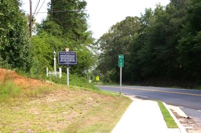
On South College Street (U.S. 27 at milepost 12) at Foggy Cedar Drive, on the right when traveling north on South College Street.
The Hamilton Female College was chartered in 1853 in southern Harris County. It was located on what was known as College Hill. Asbury Johnston and Stephen A. Borders donated the property for the college. The Hamilton Female College was the first . . . — — Map (db m22420) HM
On East Magnolia Avenue at South Gay Street, on the right when traveling east on East Magnolia Avenue.
In 1836 Judge John Harper with 34 other Methodists from Harris County, Georgia settled here. They built a log structure on this site, the first church and school in Auburn. In 1856 church leaders inspired the Methodist Conference to open East . . . — — Map (db m74442) HM
On Warm Springs Road (Alternate U.S. 27) at Talbotton Road (Georgia Route 315), on the right when traveling north on Warm Springs Road.
This road marks the route of the first telegraph lines from Washington to New Orleans, via Columbus, completed in 1848. The road entered Harris County at Mount Airy (later Ridgeway), 5 miles from here. A stagecoach inn, stores, houses, and schools . . . — — Map (db m22377) HM
On Georgia Route 208 at Warm Springs Road ( Route 85), on the right when traveling west on Georgia Route 208. Reported missing.
This town was named by its first postmaster. William Osborne, appointed February 2, 1829. In 1827, Mt. Zion Methodist Church was built 1 ½ miles E. on the Old Indian Trail and Stagecoach Road from the Flint River via Talbotton and Waverly Hall . . . — — Map (db m50926) HM
On Carver Circle (U.S. 27) west of Parker Street, on the right when traveling west.
Emerging from a union of two church schools maintained by Methodists and Baptists during the Reconstruction Period, once located on the premises of Friendship Baptist Church, Hamilton, Georgia. Carver had several name changes during its existence. A . . . — — Map (db m245227) HM
On Emancipation Avenue at Tuam Street, on the right when traveling south on Emancipation Avenue.
David Elias Dibble was born enslaved in Darien, Georgia and brought to Texas in 1837. He was self-educated and was a carpenter by trade. Dibble became a respected religious and community leader. In 1864, he became an anointed preacher. A year . . . — — Map (db m171242) HM
On South College Street (Alabama Route 147) at Magnolia Avenue, in the median on South College Street.
Settled by Judge J. J. Harper and others from Harris County, Georgia, in 1836.
This region was opened to settlement
in 1836-37 by the removal of the
Creek Indians to lands west
of the Mississippi River.
Erected by
The Alabama . . . — — Map (db m39830) HM
On East Magnolia Avenue 0.1 miles east of North College Street ( Route 15), on the right when traveling west.
Side 1
Auburn
1865~Present
Only one house was built in the village in the decade after the Civil War, and though the state took over the bankrupt college in 1872, the institution received no state appropriation until 1883. . . . — — Map (db m79947) HM
On South Debardeleben Street at East Magnolia Avenue, on the left when traveling south on South Debardeleben Street.
(Side 1)
Colonel Nathaniel J. Scott, from Harris County Georgia, built this house, which he called Pebble Hill, on 100 acres in 1847. With its pyramidal roof and symmetrical lines, the frame house reflects the Greek Revival . . . — — Map (db m74446) HM
On Union Street at East Depot Street, on the right when traveling south on Union Street.
Lynching in America
Thousands of black people were the victims of lynching and racial violence in the United States between 1877 and 1950. The lynching of African Americans during this era was a form of racial terrorism intended to . . . — — Map (db m103140) HM
On Dowdell Knob Road 1.3 miles south of Pine Mountain Highway (Georgia Route 190), on the left when traveling south.
This overlook, named Dowdell's Knob, was one of the dearest spots on earth to Franklin D. Roosevelt. Named for an early Harris County family, Dowdell's Knob rises to 1,395 feet above sea level and is the highest point on Pine Mountain. Here, on . . . — — Map (db m69519) HM
Near Capitol Avenue Southwest south of M.L.K. Junior Drive Southeast, on the left when traveling north.
Expelled Because of Color” is dedicated to the memory of the 33 Black state legislators who were elected, yet expelled from the Georgia House because of their color in 1868.
The cinder block forms at the base of the sculpture symbolize the . . . — — Map (db m130191) HM
Thin black lines indicate changes in relevance. Between each pair of lines entries are ordered geographically but all have the same relevance.
* Inflectional forms of words are their plurals, singulars, and possessives as well as gramatical tenses and similar variations.