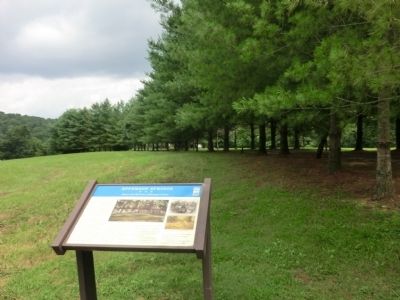
On Epperson Springs Road 0.2 miles west of Tooley Branch Road, on the left when traveling west. Reported missing.
The Epperson Springs Hotel, built by local businessmen so that residents and visitors could enjoy bathing and soaking in a mineral springs, stood here. Most of the state’s early resorts grew up around mineral springs; physicians often touted the . . . — — Map (db m182801) HM
On Old Highway 52 north of Russell Drive, on the left when traveling south.
Thousands of Tennessee families were caught in the crossfire of the Civil War. Dempsey Parker’s family, which lived in the Hillsdale community here in Macon County, is one of many examples of a family sharply divided between North and South. . . . — — Map (db m68525) HM
On Public Square at West Locust Street, on the left when traveling east on Public Square.
This monument dedicated in memory of the men who served in the Confederate States Army from Macon County, Tennessee during the war between the states 1861-1865
These units were comprised of local men serving in the Army of Tennessee
2nd TN . . . — — Map (db m68526) WM
On Calderwood Highway (U.S. 129) 3 miles north of Deals Gap (the North Carolina state line). Reported permanently removed.
The chimney nearby marks the location of a tollhouse on the Tennessee
River Turnpike, which operated in 1829. Connecting Blount County, Tenn.,
with Macon County, N.C., across the Great Smokies, it was an important
route in livestock commerce . . . — — Map (db m264840) HM
On Main Street (State Highway 56) at Hillcrest Drive, on the right when traveling south on Main Street.
Red Boiling Springs has long been a landmark in Macon County. It was a central crossroads for both Federal and Confederate forces during the Civil War.
The war came home for local residents on September 24, 1861, when Capts. Ridley R. West and . . . — — Map (db m39584) HM
Near 4th Avenue South at Oak Street, on the right when traveling south.
With the outbreak of the Civil War, Tennessee allied with the South in June 1861, making Nashville a Confederate capital. Unable to defend the city after the fall of Ft. Donelson, Nashville was surrendered to the Federal army in February 1862. . . . — — Map (db m256526) HM
Macon was one of 22 Tennessee host counties for World War II maneuvers before the invasion of Europe in 1944. The county was chosen because its terrain was similar to that in Europe. The war games prepared soldiers for active combat after the . . . — — Map (db m80395) HM
On East Main Street (Tennessee Route 151), on the left when traveling east.
Named by early pioneers traversing thru the region, this designated Indian trail led these settlers into this area during Western migration. This mainly Cherokee trail, (although used some by the Shawnee), originated at Rockwood in Roane County, . . . — — Map (db m180021) HM
This Monument Was erected by the liberality of the Citizens of the County of Sumner to the memory of her Patriotic Sons: who sacrificed their lives in the defense of the Flag of their country in the war with Mexico. In 1846. 1847 & 1848. . . . — — Map (db m85162) WM
On East Dixie Avenue (Kentucky Route 61) at South Crestwood Street, on the left when traveling north on East Dixie Avenue.
"The Parrott gun was placed in the pike; it was opened as soon as the last message from Colonel Smith was received; and, as suddenly as if its flash had ignited them, Palmer's four guns roared out from the hill on the left of the road, about six . . . — — Map (db m170819) HM
On Red Boiling Springs Road at West Locust Street, on the right when traveling south on Red Boiling Springs Road.
Songwriter and singer Russell Smith led the Amazing Rhythm Aces country rock group, who scored a Top 20 pop hit in 1975 with Smith's song "Third Rate Romance." Later, he became a successful country songwriter.
Howard Russell Smith was born in . . . — — Map (db m224677) HM
On Chatham Street (Georgia Route 49) at Asbury Road, on the right when traveling west on Chatham Street.
Horace T. Lumpkin (1857-1930) A Virginia native and son of exslaves, is credited with introducing formal education to black children in Macon County. Lumpkin, who was educated at Knoxville College, Tennessee and Atlanta University, founded the . . . — — Map (db m27258) HM
On 6th Avenue North, on the left when traveling north.
Western Highland Rim
The Western Highland Rim coupled with the Eastern Rim is the upland surrounding the Central Basin. Its 7,5000 square miles is a broad, tilted plateau about 900 feet above sea level on the eastern edge sloping down to 700 . . . — — Map (db m206498) HM
On West Main Street (Business U.S. 441) west of Phillips Street, on the left when traveling west.
Confederate Col. William H. Thomas organized Thomas’s Legion of Cherokee Indians and Mountaineers is western North Carolina in September 1862. The people of this area were sometime referred to as highlanders, and local residents called Thomas’s unit . . . — — Map (db m75455) HM
On Ferguson Hill Road at Hartsville Road (Tennessee Route 10), on the left when traveling east on Ferguson Hill Road.
During the Civil War, Macon County experienced internal strife as did many other areas of Tennessee. In the spring of 1863, a Confederate partisan band established itself in this part of the county, where it harassed Federal units and threatened . . . — — Map (db m151149) HM
On Longview Street at Jackson Street, on the right when traveling north on Longview Street.
Russell County was one of several counties created by the Alabama legislature in December, 1832 from land that had been part of the Creeks' ancestral homeland. The community of Girard (modern Phenix City) along the Chattahoochee River became the . . . — — Map (db m111609) HM
Thin black lines indicate changes in relevance. Between each pair of lines entries are ordered geographically but all have the same relevance.
* Inflectional forms of words are their plurals, singulars, and possessives as well as gramatical tenses and similar variations.