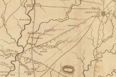
Near Mt. Carmel Road (State Highway 823) at State Highway 40. Reported missing.
Built ca. 1854 on a mill site in use since the 1770s, this large brick building on Little River was used for grinding corn, wheat, and other grains. A post office and various commercial enterprises operated near the mill during the 1800s. The . . . — — Map (db m18890) HM
Thurmond Dam and Lake
A Magnificent Recreation and Energy Resource
J. Strom Thurmond Dam and Lake offers a variety of recreational activities. You may enjoy boating, swimming and fishing on Thurmond Lake, the largest U.S. Army Corps of . . . — — Map (db m42127) HM
On Main Street (State Highway 81) at State Highway 95, on the right when traveling north on Main Street.
Mount Carmel, located on the northwestern portion of McCormick County, takes visitors on a trip back in time. The Mount Carmel Historic District is a picturesque example of a late 19th century village.
In the early 1880s Mount Carmel turned . . . — — Map (db m11665) HM
McCormick County: Gem of the Freshwater Coast
McCormick County was named or Cyrus McCormick, a 19th century agricultural equipment inventor, who purchased Dorn's Gold Mine (Town of McCormick) after the Civil War. While it is one of the last . . . — — Map (db m11398) HM
On SC Road 33-7, on the right when traveling north.
The town of New Bordeaux, the last of seven French Huguenot colonies founded in colonial S.C. and the only one in the upcountry, was established 1 mi. E in 1764. After Protestants fleeing religious persecution in France petitioned the British . . . — — Map (db m51286) HM
On Augusta Street Extension (State Highway S-33-54) 0.1 miles south of Mine Street (U.S. 221).
[East]:
In Honor of the
Confederate Soldiers
from
McCormick County
This monument perpetuates
the memory of those who,
true to the instincts of
their birth, faithful to the
teachings of their fathers,
constant in their love . . . — — Map (db m14888) HM
On SC Highway 81, on the right when traveling north.
The community of Willington is significant as a reminder of the role of the railroad in community development in rural South Carolina at the close of the nineteenth century and beginning of the twentieth century. During this period Willington was . . . — — Map (db m11458) HM
On Main Street West near Twigg Street (South Carolina Highway 10).
4.5 miles northwest is Long Cane Church. Organized in 1771 as Associate Presbyterian, with the Rev. William Ronaldson as first stated supply. It united with Cedar Springs, March 7, 1786, under Dr. Thos. Clark; withdrew Sept. 15, 1808; part of . . . — — Map (db m9719) HM
On State Highway 81 at Moss Avenue (Road 196), on the left when traveling west on State Highway 81.
[Front]:
One half mile west is the pioneer home of Andre Guillebeau, a member of the original Huguenot group which settled New Bordeaux in 1764, having fled from the persecution in France under the leadership of the Reverend Jean Louis . . . — — Map (db m9377) HM
Less than a mile from this point, close to the Georgia shoreline of Lake Thurmond, lays the remains of Fort Charlotte now 50 feet under water. Named after the wife of King George III, Fort Charlotte was a British fort built in 1766. It was . . . — — Map (db m168566) HM
On Main Street (State Highway 81) at State Highway 33-91 on Main Street.
6.6 miles southwest are the ruins of Fort Charlotte, built of local stone, 1765-1767, to protect the French, British, and German settlements near Long Canes. Maj. James Mayson's seizure of it, defended by Capt. George Whitfield and Lieut. St. . . . — — Map (db m9185) HM
Three miles west is the site of an attack by Cherokee Indians upon settlers of Long Canes in the Cherokee War of 1759-1761. There on February 1, 1760, about 150 settlers, refugeeing to Augusta, were overtaken by 100 Cherokee warriors. . . . — — Map (db m11640) HM
On this land settled by his father Patrick Calhoun in the 1750s, defended against the Indians in the Cherokee War and the enemies of liberty in the American Revolution, John Caldwell Calhoun, American statesman and champion of the old South, was . . . — — Map (db m10626) HM
Near here, from 1807 to 1817, were
situated the law offices of
John C. Calhoun.
Born in the Long Canes District of Abbeville March 18, 1782.
Died, Washington D.C.
March 31, 1850.
Member of Congress
1811-1817
Secretary of War . . . — — Map (db m7352) HM
John Caldwell Calhoun
Born March 18, 1782, Abbeville District, S.C.
Died March 31, 1850, Washington, D.C.
Buried St. Philip's Churchyard, Charleston, S.C.
His Wife
Floride Colhoun Calhoun
Born February 15, 1792, Charleston, . . . — — Map (db m51067) HM
On Old Greenville Highway (State Highway 93) west of Newman Road, on the right when traveling west.
Clemson University was founded in 1889 as the Clemson Agricultural College of S.C., with its origins in the Morrill Land Grant Act of 1862 creating public land-grant colleges. It was established by a bequest from Thomas Green Clemson (1807-1888), . . . — — Map (db m9572) HM
On Fort Hill Street, on the right when traveling west.
Home of
John C. Calhoun
1825-1850
----- • -----
United States Congressman 1811-1817
Secretary of War 1817-1825
Vice President of the United States 1825-1832
United States Senator 1832-1843
Secretary of State 1844-1845
United States . . . — — Map (db m9540) HM
On Fort Hill Street, on the left when traveling west.
Fort Hill plantation, home of John C. Calhoun and later Thomas Green Clemson, enjoys a rich history with Clemson University, the state of South Carolina and the United States.
John C. Calhoun, former U.S. House of Representative and . . . — — Map (db m51284) HM
On Calhoun Memorial Highway, on the right when traveling east.
Named in honor of John Caldwell Calhoun, (1782-1850), the Old South's most admired statesman and profound philosopher and America's most influential spokesman for state's rights.
From 1808 to 1810 he served his state as a member of the S.C. . . . — — Map (db m14099) HM
On Six Mile Highway (State Highway 133) at Old Six Mile Road, on the left when traveling north on Six Mile Highway.
Keowee
2¼ miles west is the site of Keowee built by John Ewing Colhoun as his upcountry seat in 1792. His sister, Mrs. Andrew Pickens, lived nearby at Hopewell. His daughter, Floride, married her cousin, John C. Calhoun, and lived at Fort . . . — — Map (db m9529) HM
Lethe Farm was a colonial and early federal period plantation owned by Dr. John de la Howe, founder of John de la Howe School. The farm was operated from about 1770 until 1806.
An archeological survey and limited test excavations were . . . — — Map (db m9411) HM
On North Mine Street, on the left when traveling south.
Dorn's Mill. Built ca. 1899, this steam-powered mill employed a milling process pioneered earlier by inventor Oliver Evans, which virtually eliminated manual labor. First known as the McCormick Enterprise Ginnery, the mill became the . . . — — Map (db m243241) HM
On State Highway 28 at Old Charleston Road (Local Road 38), on the left when traveling south on State Highway 28.
About four miles southeast is the site of the American Revolutionary Battle of Long Cane. On December 12, 1780, Lieutenant Colonel Isaac Allen and a British force of 400-500 men defeated Colonel Elijah Clarke and 100 Americans, an advanced . . . — — Map (db m241074) HM
Building History
Built in the 1930s by Frank R. Thompson, this building was the main street depot for the Anderson Petroleum Company and Dixie Distributors, Inc., both successful petroleum distributors in Anderson, Oconee, Pickens, . . . — — Map (db m42762) HM
To persons familiar with the history of McCormick, the Dorn Mill stands as a symbol of the influence of the Dorn family in the region. It rests on land previously owned by Gold Mine "Billy" Dorn and Cyrus McCormick, inventor of the reaper.
. . . — — Map (db m11391) HM
The establishment of John de la Howe School, the second oldest institution in the Carolinas, is one of the first examples of individual philanthropy that is found in the history of child-caring institution in the United States. The purpose of Dr. . . . — — Map (db m20887) HM
On Savannah River Scenic Byway (State Highway 28) at Barksdale Ferry Road (County Route S-33-61), on the left when traveling west on Savannah River Scenic Byway.
Badwell
Three miles west is the site of "Badwell," home of James Louis Petigru (1789-1863), leader of opposition to secession in South Carolina, outstanding Charleston lawyer, and S.C. Attorney General. He studied at Willington Academy under . . . — — Map (db m11456) HM
Near Stumphouse Tunnel Road near State Highway 28, on the right when traveling west.
[Listed from north to south]
Oconee Located on the edge of the Blue Ridge Mountains, Oconee County is known for nature-based activities such as boating, birding, backpacking, and camping
Pickens Pickens County has many beautiful . . . — — Map (db m185421) HM
On Main Street West near Twigg Street (South Carolina Highway 10).
Three miles west is the site of an attack by Cherokee Indians upon settlers of Long Canes in the Cherokee war of 1759-1761. There on February 1, 1760, about 150 settlers, refugeeing to Augusta, were overtaken by 100 Cherokee warriors. Twenty-three . . . — — Map (db m9433) HM
[Front]:
This school, often called Retreat Colored School, was built in 1923 for the African-American students in and near Westminster. A two-room, two-teacher, elementary school, it was built by local builder William Walker Bearden of . . . — — Map (db m53235) HM
Thin black lines indicate changes in relevance. Between each pair of lines entries are ordered geographically but all have the same relevance.
* Inflectional forms of words are their plurals, singulars, and possessives as well as gramatical tenses and similar variations.