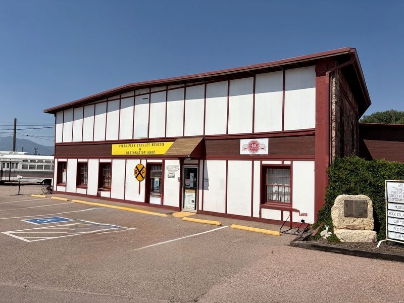
On Steel Drive 0.7 miles south of West Fillmore Street, on the right when traveling south.
This Plaque is dedicated to the fond memory of the men and families
who operated and maintained the Roswell Yards and kept the Chicago,
Rock Island & Pacific Railroad moving.
The Roswell Yards included a depot, 16 stall roundhouse, water . . . — — Map (db m304545) HM
Panel 1
Arriba
In frontier Arriba (locally pronounced "AIR-uh-buh"), the only thing
more scarce than water was whiskey. Charles Creel, who founded
the town in 1888 to greet the advancing Chicago, Rock Island &
Pacific . . . — — Map (db m89381) HM
On York Street at Maple Avenue, on the right on York Street.
Conrad Kich arrived in Blue Island in 1849 at age 11. His father, Peter, was among the first Germans to settle in Blue Island. Kich worked as a "section boss" for the Chicago, Rock Island & Pacific Railroad. He was also a volunteer fireman, and . . . — — Map (db m275014) HM
On Old Western Avenue north of Western Avenue, on the right when traveling north.
George F. Fiedler opened a Dodge dealership at the southwest corner of Western Avenue and York Street in 1921 with his neighbor George Burmeister. Its original name was Central Auto Sales. According to Fiedler, it took 5 months in business before he . . . — — Map (db m274431) HM
On 99th Street at South Walden Parkway, on the right when traveling east on 99th Street.
This is a rare surviving example of a nineteenth-century commuter railroad station in Chicago, one of six in a landmark district stretching from 91st to 115th streets. Stations such as these helped promote the development of many of the city's, . . . — — Map (db m248805) HM
On Erie Street east of Wabash Avenue, on the right when traveling east.
Designed in the Richardsonian Romanesque style by an eminent architectural partnership, this house was built for the president of the Chicago, Rock Island and Pacific Railway Company. The Cable House is among only a few remaining structures that . . . — — Map (db m262724) HM
On 67th Avenue north of 173rd Street, on the right.
[Front side:]
The Brueggemann House is an example of an American foursquare, a style which was popular between the late 1890s and the 1930s. This particular home was built by Philip Mager for Henry Brueggeman in 1913. Five generations of the . . . — — Map (db m264046) HM
On Oak Park Avenue 0.1 miles south of 167th Street, on the right when traveling south.
John and Jane Fulton came to Bremen Township from New York State in 1844. During his lifetime, Fulton assembled over 1,000 acres of farm land in the area. His holdings included property north and northeast of the present Village of Tinley Park that . . . — — Map (db m264055) HM
On Oak Park Avenue south of Hickory Street, on the right when traveling south.
It is currently believed that this large, two-story brick and limestone structure was built approximately 1865 by John Lewis or his brother Allen Cleveland Lewis in the Italianate style (which was popular during the 1850s to 1880s). This house . . . — — Map (db m264044) HM
[Front side:]
The building now housing the Vogt Visual Arts Center was built in the Victorian style by Henry Vogt, Sr. in 1882. Four generations of the family lived in this home, and the home remained within the family for 112 years. The stained . . . — — Map (db m295375) HM
In the 1920's, Chicago had six major "steam road" passenger depots, along with numerous rapid transit and electric interurban stations.
The main building, or "headhouse," of only one of the six grand old stations (Dearborn) has survived, though . . . — — Map (db m39155) HM
On Chicago Street at Jefferson Street, on the right when traveling south on Chicago Street.
Rock Island Lines
in commemoration of its
hundredth anniversary
October Tenth
dedicates this marker to the memory of
Nelson D. Elwood of Joliet, Illinois
one of the founders of the original
Rock Island and La Salle Railroad . . . — — Map (db m304348) HM
[Left Panel]
Steam railroad history began in 1869 for Mason City when the McGregor & Missouri River Rwy laid track from Nora Springs to Clear Lake and became part of the effort to link Chicago with South Dakota, and in 1870-71 when the . . . — — Map (db m89655) HM
On 4th Street at Kd Avenue, on the right when traveling south on 4th Street.
The memorial tree planted nearby
is dedicated by the Rock Island
in affectionate memory of
Charles M. Martin
who by his industry courage and
loyalty through every vicissitude
signally aided in the development
of the
Chicago . . . — — Map (db m90296) HM
On North Hiawatha Avenue north of 4th Street Northwest, on the right when traveling south.
The Rock Island Depot was built in 1890, using cream color bricks and Sioux quartzite trimming. It featured a slate roof and two waiting rooms; one for men and one for women. It was built by the Burlington Cedar Rapids and Northern Railway but . . . — — Map (db m235413) HM
On U.S. 69 north of 1st Street, on the right when traveling north.
In the 1920's Cameron boasted over 40 trains a day and three active stations, including the elaborate Cameron Junction, described as one of the most popular and elegant eating houses in the West.
Two Cameron men are credited with initiating the . . . — — Map (db m86717) HM
On Cherry Street at 3rd Street, on the right when traveling south on Cherry Street.
The memorial tree planted nearby
is dedicated by the Rock Island
in affectionate memory of
John T. Walker
who by his industry courage and
loyalty through every vicissitude
signally aided in the development
of the
Chicago Rock . . . — — Map (db m67375) HM
On Main Street (Missouri Route 6) at Polk Street ( Highway A), on the right when traveling west on Main Street.
DeKalb County, 270,720 acres of rolling prairie land, is one of 19 Missouri counties organized in February, 1845. The name is for German-born Johann Kalb, member of the French army and general in the American Revolution, known as Baron de Kalb. . . . — — Map (db m88146) HM
Near Barrett Station Road east of Old Dougherty Ferry Road, on the right when traveling east.
One of the two experimental demonstrator "Aerotrains" (#2 and #3) built by GM with a new light weigh construction and low center of gravity concept, powered by 1,200 h.p. futuristic locomotives. Initially in mainline service, they rode poorly at . . . — — Map (db m133024) HM
On River Road 0.1 miles north of East 10th Street (State Highway 42), on the right when traveling north.
The depot and bridge located to the east were constructed by the Burlington, Cedar Rapids, and Northern Railroad Co. (the Rock Island Line). This was the third railroad line in Sioux Falls and was established on October 26, 1886. The architectural . . . — — Map (db m184837) HM