9 entries match your criteria.
Related Historical Markers
Valley City Historic Bridges Tour
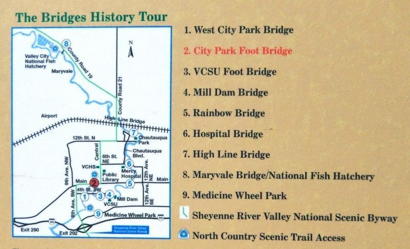
Marker detail: Historic Bridges Tour Map
SHOWN IN SOURCE-SPECIFIED ORDER
| Near 4th Street Southwest at 5th Avenue Southwest, on the right when traveling west. |
| On West Main Street (Business U.S. 10/52) 0.1 miles west of Central Avenue South, on the left when traveling west. |
| Near 4th Avenue Southwest at Central Avenue South, on the right when traveling east. |
| On 3rd Avenue Southeast at College Street Southeast, on the left when traveling south on 3rd Avenue Southeast. |
| On Main Street East (Business U.S. 10/52) at 8th Avenue Southeast, on the right when traveling east on Main Street East. |
| On 6th Street Northeast at 8th Avenue Northeast, on the right when traveling east on 6th Street Northeast. |
| Near 12th Street Northeast, 0.2 miles east of 6th Avenue Northeast (Chautauqua Boulevard), on the left when traveling east. |
| Near 12th Street Northeast, 0.2 miles east of 6th Avenue Northeast (Chautauqua Boulevard), on the left when traveling east. |
| Near River Road, 1.5 miles north of 117 Avenue Southeast (County Highway 21), on the left when traveling north. |
Jun. 16, 2024