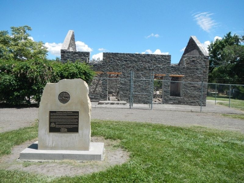
Near Canyon Creek/Mayfield Road near Memory Lane, on the right when traveling west.
John C. Fremont reported using the Canyon Creek crossing in 1843 and Lansford Hastings's 1845 Emigrant's Guide to Oregon and California listed the site as an important Oregon Trail crossing and campsite. Emigrant diaries report frequent use of . . . — — Map (db m125784) HM
On Sun Valley Highway (U.S. 20 at milepost 124) near North Cat Creek Road, on the right when traveling west.
Up toward Camas Prairie, a road goes by Castle Rock and other eroded granite outcrops that were landmarks on Goodale's Cutoff, an Oregon Trail route that came this way.
Emigrants generally had not seen large granite rock formations of . . . — — Map (db m110143) HM
On Sun Valley Highway (U.S. 20 at milepost 126) near Old Highway 68, on the left when traveling west.
More than a century ago, Rocky Bar, Happy Camp, and a number of other South Boise mining towns flourished in a remote mountain wilderness 30 miles northwest of here.
Discovered early in 1863, they were so hard to get to that the could not be . . . — — Map (db m110142) HM
On Sun Valley Highway (U.S. 20 at milepost 124) near North Cat Creek Road, on the right when traveling west.
An old emigrant road headed west across Camas Prairie and then descended to the valley below on its way to rejoin the Oregon Trail 28 miles west of here.
This route, discovered by Donald Mackenzie's fur trade party in 1820, came into use for . . . — — Map (db m125603) HM
On North Main Street/Old U.S. 30 at American Legion Boulevard on North Main Street/Old U.S. 30.
Eight miles east of here, Rattlesnake Station, was an important stop for wagon trains and travelers along the Oregon Trail because of its sure supply of fresh water. Later, a stage station with a post office called "The Mountain Home" was . . . — — Map (db m129572) HM
Near American Legion Boulevard (State Highway 51) near East 8th Street North, on the left when traveling west.
The Town site of Mountain Home was chosen by the Union Pacific Railroad as a stop because of a readily available supply of water. The railroad utilized steam operated pumps in trench wells to fill storage tanks with this water in order to supply the . . . — — Map (db m110156) HM
On Sun Valley Highway (U.S. 20 at milepost 102.7) north of Industrial Way, on the left when traveling south.
At the junction of the Rocky Bar Road with the Oregon Trail, this was a major stage line stop for 20 years.
Stage service commenced in 1864, and a road to the Rocky Bar mines was opened 2 months later. In 1878 the station owners thought . . . — — Map (db m70449) HM
On Northeast Teapot Road near Worth Lee Road, on the right when traveling west.
Saturday August 16 "...we passed a hot springs near the foot of the same range, the water of which was nearly at a boiling temperature, so that one could not hold is finger in it, and a dog careless stepping across it put one foot in and ran . . . — — Map (db m125752) HM
Friday September 10th "...Traveled along the foot of the mountain about 5 miles to another creek and stopped for the night. Plenty of dry bunchgrass. No timber, but willows and sage. Found eight graves here. Made fifteen miles." Parthenia . . . — — Map (db m125754) HM
On Immigrant Road at Canyon Creek Road, on the right when traveling west on Immigrant Road.
August the 13th "...the road to day way level but very rocky A long chain of mountains on our right and we travel close to them to day..." -- Absolom B. Harden, 1847
After the transcontinental railroad was completed in 1869, . . . — — Map (db m125755) HM
On Canyon Creek/Mayfield Road near Memory Lane, on the right when traveling west.
August 4th "This day we traveled nineteen miles over tolerably rough road ... After watering, we traveled eight and a half miles, which brought us to a barrel creek (Canyon Creek). Here we found a small creek running through a barrel-shaped . . . — — Map (db m125756) HM
On Mayfield Road near East Rumsley Lane, on the right when traveling west.
Monday October 9th "This evening yellowish granite appeared in needle form fragments and masses. Country mountainous, good grass, water in the creek on which we are camped partially dried up. We struck a large and much travelled Banak trail . . . — — Map (db m125785) HM
On Mayfield Road near Bowns Creek Road, on the right when traveling west.
August 5th "This morning our road was very hilly for three miles. Here we found water and grass plenty, and brush for fire wood. Having had no water since we left Barrel creek we halted here for a rest. We halted here till 1 o'clock in the . . . — — Map (db m125786) HM
On Sun Valley Highway (U.S. 20 at milepost 107) near Immigrant Road, on the right when traveling west.
An 1868 Toll Road to Rocky Bar provided better access to early gold mines 40 miles north of here.
Julius Newberg's South Boise wagon road had reached Rocky Bar in 1864, but a route through this canyon was needed to avoid steep Syrup . . . — — Map (db m110154) HM