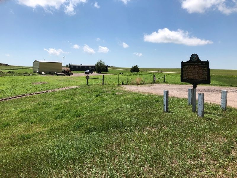
On U.S. 18 at 230th Avenue (State Highway 73), on the right when traveling west on U.S. 18.
Camp BF-3: located 1 mile E, 4 miles S, 1 mile W & 5 miles S
Company: 4723 May 1937-Fall 1939
The Civilian Conservation Corps was a federal relief program during 1933-1942 that gave jobless men work renovating abused lands. The Army . . . — — Map (db m137082) HM
On Main Street at East 5th Street, on the right when traveling north on Main Street.
The Dixon, SD town hall was built in 1916 in anticipation of a railroad line that was never built. The building was used for church services, school, and public meetings before it was converted into a silent movie house in the late twenties. The . . . — — Map (db m234975) HM
On East Oak Street at South Center Avenue, on the right when traveling east on East Oak Street.
On June 2, 1983, a meeting to save rail service was organized by area shippers and community leaders at the American Legion Hall in Philip that began a three year struggle which culminated in the creation of the Dakota, Minnesota & Eastern . . . — — Map (db m125975) HM
On North Larimer Avenue (State Highway 73) at Bryan Street, on the right when traveling north on North Larimer Avenue.
Built in the Black Hills by Cyrus M. Molyneux in 1888.
Moved in 1896 to North Fork, in Haakon County. Three terms of school were held in it with Molyneux as teacher. Donated by Allen Gee. Reconstruction completed, on Museum plot in 1982.
. . . — — Map (db m125166) HM
Peacekeepers used in this missile field served in two
primary roles: providing armed response in an 'Area
Security' (backup) role, and serving as armed convoy
escort vehicles.
In the first role, Fire Teams in Peacekeeper . . . — — Map (db m314365) HM WM
The land you see before you is a vast prairie, once home
to herds of bison, bighorn sheep, and deer. Coteries of
prairie dogs dug their holes, and packs of coyotes and
wolves hunted jackrabbits and other game.
Today, much of the prairie of . . . — — Map (db m314350) HM
This vehicle, best known to the US Air Force as the
PEACEKEEPER, was a five-ton (4535.9 kg) lightly-armored
truck, using a late 1970s-model Dodge pickup chassis, and
originally powered by a 360 cu.in. (approx. 5.9 liter) V-8 engine.
In . . . — — Map (db m314366) HM
Someday, an ultimate class of warriors will evolve,
too strong to be contested. They will win battles
without having to fight, so that at last, the day
may be won without shedding a single drop of blood.
—adapted from Sun Tzu, . . . — — Map (db m314363) HM WM
On State Highway 240 0.9 miles south of Interstate 90, on the right when traveling south.
Camps NP-2: 8 miles S of Wall on SD 240, 13 miles W (1 mile W of Sage Creek); and NP-3: 3/4 mile S. of Cedar Pass Visitor Center. Company: 2754 (NP-2) -- 11/1/39 - 10/24/41; (NP-3) -- 10/24/41 - 3/25/42. The Civilian Conservation Corps was a . . . — — Map (db m45287) HM
On State Highway 240 1.3 miles south of Interstate 90, on the right when traveling south.
Edgar I. Brown, born in 1854, came here with wife, Alice, and son, Charles, to homestead in the Badlands when he was 55. Their first and only home was a side hill, sod wall, dirt roofed house. About it they built up a humble homestead. Intact today, . . . — — Map (db m45288) HM
On State Highway 47 0.2 miles south of 266th Street, on the left when traveling south.
Iona established 11 Feb. 1898, Ray Gooder, Postmaster. Here E. L. Senn, newspaper crusader fought the cattle rustlers and lost his newspaper by fire in early days. — — Map (db m184644) HM
This memorial is dedicated to those men and women of Mellette County who served our Country in times of War and Peace and
Especially to those who lost their lives in that service.
— — Map (db m234821) WM
Near CS-23A (at milepost 127), 0.6 miles north of Interstate 90.
…(for) people who are on alert at the launch missile control centers it's very much an invisible thankless job.…nobody sees what they do, nobody cares about it. I see them as almost invisible warriors, the security police that are there, the . . . — — Map (db m113088) HM
Honor
In Memory
of
Chauncey Eaglehorn
Member of Company M
167th Infantry
Born 1874
Enlisted April 1917
Killed in Action
at Chateau Thierry
France July 29th, 1918
Those who knew him best
loved him most.
He fought in . . . — — Map (db m234826) WM
On Oak Street at K Avenue, on the right when traveling south on Oak Street.
The virtues of Tekakwitha
were heroic. Pius XII
Dedicated to the
Unknown Saints,
past, present and future
of the
American Indian People — — Map (db m314327) HM
Near Oak Street south of K Avenue, on the right when traveling south.
Take, Lord, and receive all my liberty, my memory,
my understanding, and my entire will. All that I have
and possess, You have given to me. To You, O Lord,
I return it. All is Yours, dispose of it wholly
according to Your will. Give me . . . — — Map (db m314325) HM
Near 317th Avenue north of U.S. 18, on the right when traveling north.
The first Protestant church organized in Tripp County was located near Dog Ear Lake. The church was first constructed out of sod and later rebuilt with wood in 1916. The church was dedicated to "those who had a vision and laid the cornerstone for . . . — — Map (db m235032) HM
On East 7th Street east of South Main Street, on the right when traveling east.
This park has been given to the children of Winner by George C. "Shorty" McDonald.
He left two-fifths of his estate ($8,000) to the community to build a park for the children. McDonald was 68 years old when he died Jan. 1948. He was orphaned in . . . — — Map (db m234976) HM
Near 317th Avenue at U.S. 18, on the right when traveling north.
In 1873 the territorial legislature designated part of this area as Tripp County, in honor of the outstanding lawyer and territorial judge, Bartlett Tripp. The present boundaries of the county were adopted in 1907. After federal consultations with . . . — — Map (db m234930) HM
On 317th Avenue at U.S. 18, on the right when traveling north on 317th Avenue.
In November 1969, with the help of the Winner Women's Club, the Tripp County Historical Society was organized. The purpose of this organization was to establish a museum for the care and display of items of historical value. In 1975, a metal . . . — — Map (db m235030) HM
Near 317th Avenue north of U.S. 18, on the right when traveling north.
The depot was donated to the Tripp County Historical Society by Chicago and Northwestern Railroad officials and moved to the current site in 1980. It served as a link to the outside world for the homesteaders to receive and distribute livestock, . . . — — Map (db m235031) HM
On East 3rd Street, on the right when traveling west.
To Honor and Remember All Veterans who Served our Country and Nation in Times of War and Peace. All Gave Some, Some Gave All.
American Military History Timeline
Conflict Date | Conflict
1775 – 1783 | American Revolution
1812 – 1815 . . . — — Map (db m234822) WM
On East 3rd Street, on the right when traveling west.
1917 - 1919
Erected in honor of the five hundred and fifty men of Tripp County who answered their country's call in the World War and in memory of the following who made the Supreme Sacrifice.
Titus Arrow ·
William H. Bartels · . . . — — Map (db m234823) WM