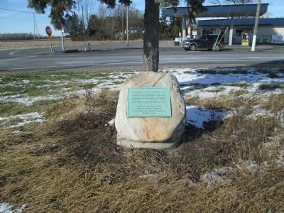
On Ottawa Road (Ohio Route 65) at North West Street ( Route 115), in the median on Ottawa Road.
In honor of those founders and
patriots of the northwest territory
who settled in Ohio and Allen County
1803 Ohio Sesquicentennial 1953 — — Map (db m77680) HM
On Main Street at North Street ( Route 81), on the right when traveling south on Main Street.
Allen County was originally Indian territory not opened for settlement until 1817, and was formally surveyed in 1820. County government was organized in 1831 and with the improvement of roads, settlers came and established communities in every part . . . — — Map (db m22930) HM
On Thayer Road at Mirror Lake Drive, on the left when traveling north on Thayer Road.
Ward Cemetery Burial Site
in the fall of 1825, Samuel McCluer
built a log cabin near this site and
began the arduous task of clearing
away the dense forest for farming.
Not until the following summer did
he learn from hunters, who . . . — — Map (db m80275) HM
On Rockport Road, on the left when traveling west.
Rockport Methodist Church in the community of Rockport (formerly Cranberry) was believed to be one of the oldest churches in northern Allen Co. According to the records of the church, it was formed sometime around 1840, perhaps earlier. It was a . . . — — Map (db m195864) HM
On North Elizabeth Street, on the right when traveling north on North Elizabeth Street.
Ohio's first electric
Street Car Line
and
one of the first in the U.S.
Began operation in
Lima, Ohio July 4, 1887.
Operated by B.C. Faurot
as the Lima Street Rail-
way and Power Co. This
line served the city
. . . — — Map (db m79481) HM
On East North Street at North Sugar Street, on the right when traveling west on East North Street.
In 1885, Benjamin Faurot struck oil near here after drilling into the Trenton Rock Limestone at a depth of 1,251 feet, sparking the great Oil Boom of northwest Ohio. Speculators quickly followed, drilling hundreds of wells in what became the vast . . . — — Map (db m298300) HM
On West Market Street at North Metcalf Street, on the right when traveling west on West Market Street.
At 13 years of age, Peter Faze traveled with his family in a one-horse wagon for five weeks from York County, Pennsylvania to settle in Allen County in 1833. Here, he met his first wife Aurelia McCullough, whose Conestoga wagon from a similar trip . . . — — Map (db m298274) HM
In 1885, 800 feet north of this marker, Benjamin Faurot struck oil after drilling into the Trenton Rock Limestone formation at a depth of 1,251 feet. This event marked the beginning of the great Oil Boom of northwest Ohio. The ensuing rush brought . . . — — Map (db m22931) HM
One of America's largest steam locomotive builders, the Lima Locomotive Works, built 7,752 locomotives between 1879 and 1951. It rose to success building the patented Shay geared locomotive, an innovative design that became the standard for . . . — — Map (db m22935) HM
Near Ada Road (Ohio Route 81), on the right when traveling east.
The Johnny Appleseed Apple Tree is grown from softwood cuttings from the last known surviving tree planted in Nova, Ohio, by this larger-than-life American hero. John Chapman, known as Johnny Appleseed, roamed the vast Ohio. Territory planting apple . . . — — Map (db m250809) HM
On Ohio Route 66 0.2 miles north of Deep Cut Road, on the right when traveling south.
Miami & Erie Canal, Deep Cut
You are on that section of the Miami and Erie Canal where the greatest excavation was made – a section that has been known over the years as “Deep Cut.” The huge ditch, 6,600 feet long and 5 to . . . — — Map (db m22848) HM
Near West Market Street at North Metcalf Street, on the right when traveling west.
Sam Kamin and James Howestine launched Neon Products, Incorporated in 1930, beginning with window signs and clocks. Over the years, the company grew steadily, and in 1949, it shifted to neon and fluorescent-lit plastic signs, keeping pace with . . . — — Map (db m298804) HM
The Lima Chapter of the American Women's Voluntary Services Organization established a community-based, free canteen during World War II for troops traveling on the Pennsylvania Railroad and adjacent Baltimore & Ohio-Nickel Plate Railroads. Meeting . . . — — Map (db m22951) HM
On West Kibby Street at South Metcalf Street, on the right when traveling west on West Kibby Street.
Northeast corner of The Shawnee Indian Reservation of 25 square miles in present-day Shawnee Township. Home of the Hog Creek Shawnees from 1817 to their removal to Kansas in 1833. Granted to the Shawnees by treaty September 29, 1817. . . . — — Map (db m63069) HM
On South Main Street at Circular Street, on the right when traveling north on South Main Street.
This street follows the course of an Old Indian Trail that joined the Tawa Indian town on the Auglaize River to the Black Swamp Trail near Lafayette. At one time, this corner was the junction of Three Early Roads, Wapakoneta Rd. - Main St. - . . . — — Map (db m63077) HM
On Fort Amanda Road at Sunderland Road, on the right when traveling west on Fort Amanda Road.
Site of the 86 acre homestead of Dye Sunderland who served in Captain Samuel McCormick's Company of The War of 1812
Here in 1820, on the site of the Indian town of Tawa the Sunderland family established the First Permanent Home in . . . — — Map (db m91455) HM
On Smith Grove Road (South Court Street) at West Main Street (Kentucky Route 2152), on the left when traveling north on Smith Grove Road (South Court Street).
On August 29, 1862 at the beginning of the Confederate Invasion of Kentucky. Colonel John Hunt Morgan rode into Scottsville, leading a brigade of 1,100 cavalrymen. Morgan and his men were on their way to Lexington, where they planned to join . . . — — Map (db m131263) HM
On Washington Street north of Madison Avenue, on the left when traveling north.
Frederick Funston was born in Ohio and moved to Kansas with his parents in the spring of 1868 at the age of 2. Nicknamed "Fearless Freddy," he was of slight build - be sure to check out the life size statue in front of the Funston Home and Museum . . . — — Map (db m83656) HM
In 1964, the Detroit, Toledo, and Ironton Railroad donated an equipped station to the Lincoln Park Railroad Exhibit. The depot behind you was moved from its original location at Uniopolis, Ohio ten miles to the south. It came complete with signal . . . — — Map (db m203819) HM
Near West Main Street west of South Greenlawn Avenue, on the left when traveling west.
Sacred to the memory of
Abraham Doner
1795-1854
Founder of several Lutheran Congregations in Allen County, Ohio Buried with other Lutheran Pioneers on this site — — Map (db m196321) HM
On Buckeye Road 0.5 miles west of South Dixie Highway, on the left when traveling west.
The Veterans Freedom Flag Monument dedicated May 22, 2010 to Veterans who made the sacrifice for freedom around the world, those who currently serve in the military and those who will serve in the future. Built entirely through the donations of . . . — — Map (db m63076) WM
On Bellefontaine Road (Ohio Route 117) 0.5 miles north of Madden Road, on the right when traveling north.
Welcome to Haver Ridge Metro Park
This 61 acre tract of land is dedicated to long time Park Director Kevin Haver. Kevin dedicated forty two (42) years of his life to public service for the citizens of Allen County. He saw the transformation . . . — — Map (db m238509) HM
On U.S. 136 at 192nd Avenue, on the right when traveling west on U.S. 136.
Here in the undulating glacial plains of north central Missouri, Harrison is one of 9 counties forming the State's border with Iowa. Twenty-sixth in size of Missouri's 114 counties, and second largest on the border, it was organized 1845, and . . . — — Map (db m66588) HM
Near North Bedelia Street (Kentucky Route 1386) 0.1 miles west of Dumont Hill Street, on the right when traveling west.
1860 – A Bustling County Seat Town
Imagine Scottsville in 1860. A fine two-story octagonal brick courthouse dominates the busy court square. The prosperous rural town of 403 residents boasts a public spring, at least one church, a . . . — — Map (db m152751) HM
On Shawnee Road, on the left when traveling north.
In memory of PHT and the Hawg Creek Shawnee. This area was their home until the 1830's when they were forcibly removed by the U.S. government. Some stayed and their descendants live here to this day. Chief PHT died before the removal and was buried . . . — — Map (db m79664) HM
Thin black lines indicate changes in relevance. Between each pair of lines entries are ordered geographically but all have the same relevance.
* Inflectional forms of words are their plurals, singulars, and possessives as well as gramatical tenses and similar variations.