THE HISTORICAL
MARKER DATABASE
“Bite-Size Bits of Local, National, and Global History”


7 entries match your criteria.  


Entries Containing All of the Phrases «camden county» AND «north carolina»

This list will also include matches for inflectional* forms of the words.
 
By Devry Becker Jones (CC0), January 18, 2021
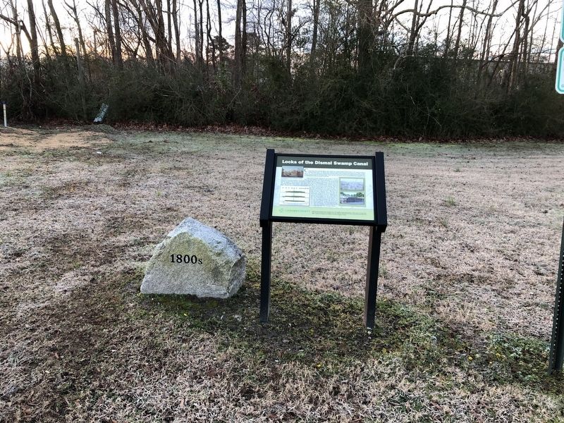
Locks of the Dismal Swamp Canal Marker
RANKED BY RELEVANCE
1 ► North Carolina, Camden County, Camden — Locks of the Dismal Swamp Canal —
On State Highway 343 0.1 miles north of Plank Bridge Road, on the right when traveling south.
Colonel William Byrd II proposed digging a series of ditches and a channel through the Dismal Swamp in 1728. Construction began on the Dismal Swamp Canal in 1793, after the North Carolina and Virginia General Assemblies passed similar acts for . . . — — Map (db m165196) HM

2 ► Virginia, Chesapeake, Pleasant Grove West — Great Dismal Swamp National Wildlife Refuge — Dismal Swamp Canal Trail —
Near Dismal Swamp Canal Trail 0.4 miles south of George Washington Highway South (Business U.S. 17), on the right when traveling south.
Across the canal lies the US Fish & Wildlife Service's Great Dismal Swamp National Wildlife Refuge. The Great Dismal Swamp was once a vast ecosystem that covered as much as one million acres of southeastern Virginia and northeastern . . . — — Map (db m114525) HM

3 ► North Carolina, Camden County, Camden — Eastern North Carolina — Civil War Trails —
On McPherson Road (State Highway 1231) 0.1 miles south of U.S. 17, on the right when traveling south.
North Carolina's Civil War stories are as diverse as its landscape. Northeastern North Carolina, including Camden County, the Outer Banks, and the coastal rivers, saw action early in the war as Union forces occupied it. Stories abound of naval . . . — — Map (db m165188) HM

4 ► North Carolina, Currituck County, Shawboro — Indiantown — Chasing “Guerrillas” —
On South Indiantown Road 0.4 miles north of Trotman Road, on the left when traveling south.
Indiantown, a commercial center with a shipyard, store, and mill, became a focal point for military activity during the Civil War. On June 10, 1862, U.S. Navy Lt. Charles W. Flusser led several gunboats up the North River to capture a prominent . . . — — Map (db m56814) HM

5 ► North Carolina, Currituck County, Shawboro — A-62 — Henry M. Shaw —
On Shawboro Road (Route 34) at North Indiantown Road, in the median on Shawboro Road.
Member N.C. Assembly and U.S. Congress. Confederate colonel. Killed in attack on New Bern, Feb. 1, 1864. Home & grave about 150 feet West. — — Map (db m9507) HM
6 ► North Carolina, Currituck County, Shawboro — A-66 — McKnight’s Shipyard —
On Shortcut Road (U.S. 158) at Indiantown Road, on the right when traveling east on Shortcut Road.
Thomas McKnight, colonial merchant and legislator; Loyalist during Revolution. Operated large shipyard which stood near here. — — Map (db m2765) HM
7 ► North Carolina, Currituck County, Shawboro — A-47 — Yeopim —
On Indiantown Road at Shortcut Road (U.S. 158), on the left when traveling south on Indiantown Road.
Reservation established for Yeopim Indians in 1704; sold after 1739. Northern boundary nearby; village was 2 miles S.E. — — Map (db m2766) HM
 
    Thin black lines indicate changes in relevance. Between each pair of lines entries are ordered geographically but all have the same relevance.
* Inflectional forms of words are their plurals, singulars, and possessives as well as gramatical tenses and similar variations.
 
CeraNet Cloud Computing sponsors the Historical Marker Database.
This website earns income from purchases you make after using our links to Amazon.com. We appreciate your support.
Paid Advertisement
Nov. 13, 2026
