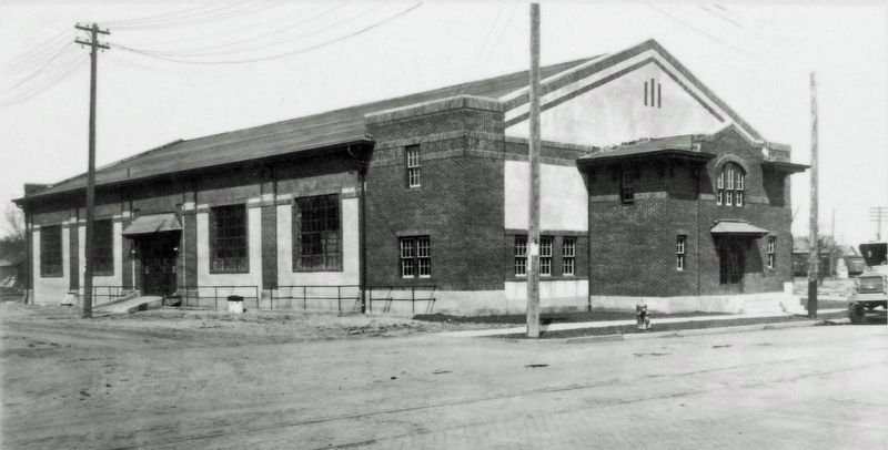
On 15th Avenue North just west of 10th Street North, on the right when traveling west.
For over 100 years, local men and women have served their country and community through service in the Minnesota National Guard. Members have been called to federal service in combat and support roles during World War 2, the Korean Conflict, in the . . . — — Map (db m266797) HM
On Minnesota Avenue west of Pope Street, on the right when traveling west.
Breckenridge
Headwaters of the Red River of the North
Breckenridge, founded in 1857, has a current population of 3559 (2000 census). A progressive city, located at the juncture of three rivers, it is the gateway to the . . . — — Map (db m261716) HM
On County Highway 36, on the left when traveling west.
Old Georgetown A Tranportation Crossroads
In 1857 the Hudson's Bay Company received United States government permission to
ship furs and trade goods across the United States. They contracted with the Burbank
brother's Minnesota Stage . . . — — Map (db m205727) HM
On 7th Street North just south of 11th Avenue North, on the left when traveling south.
In the late winter of 1871, 22-year-old John Bergquist was one of very few settlers living in this area. Far from his native Sweden, he chose this spot for his new home. Like many immigrants, John was drawn to the Minnesota Frontier by the . . . — — Map (db m266999) HM
On Minnesota Avenue west of Pope Street, on the right when traveling west.
The Red River of the North is designated by the State of Minnesota as an official canoe and boating route. The Red River meanders northward 550 miles from its source in Breckenridge, Minnesota to Lake Winnipeg in Canada. The designated portion . . . — — Map (db m261709) HM
On 36th Avenue North just west of 11th Street North (County Road 96), on the right when traveling west.
M.B. Johnson Park is located on the Red River in north Moorhead, Minnesota. In 1971, the City of Moorhead and Clay County purchased 107.9 acres from the Martin Johnson family estate for $107,000 to provide a regional park. M.B. Johnson Park has a . . . — — Map (db m266993) HM
On 7th Street North just south of 11th Avenue North, on the left when traveling south.
Moorhead-Fargo grew up around this home. But the building didn't always look this way. It has undergone many changes as new owners added their touches. Some of the residents built additions to the house. By 1915, modern construction completely . . . — — Map (db m267000) HM
Near 36th Avenue North just north of 11th Street North, on the left when traveling north.
Many visitors and residents of the area are amazed to find that steamboats on the Red River provided an important local transportation link 150 years ago. "The river must have been wider or deeper or straighter then," many people have suggested. . . . — — Map (db m266798) HM
Near 36th Avenue North just north of 11th Street North, on the right when traveling north.
The Red River of the North starts In Breckenridge, Minnesota, where the Otter Tail and Bois de Sioux rivers flow together then winds a sinuous 548.7 miles to Lake Winnipeg, a straight-line distance of 286 miles. The Red River watershed is about . . . — — Map (db m266799) HM
We are willing to pay the price as far as the good need arises.
—Cpl. Maurice Masterson, 151st Field Artillery, 42nd "Rainbow" Division, writing to his father, September 19, 1918
Maurice Masterson at Fort Riley, August 10, . . . — — Map (db m230607) HM
On 2nd Avenue North at Broadway North, on the left when traveling east on 2nd Avenue North.
At one time the Red River was home to over a dozen steamboats including the Anson Northup (later renamed the Pioneer), the International, the Selkirk, the Dakota, the Alpha, the Cheyenne, the . . . — — Map (db m239995) HM
Near Main Avenue West (U.S. 10) east of 21st Street Northwest, on the right when traveling east.
German homesteaders John and Dora Maier left Odessa, Russia and entered Eureka, South Dakota in the late 1880s. They first farmed near fellow Germans from Russia before moving to Moorhead, Minnesota. The Maier's built a house on their new homestead . . . — — Map (db m278723) HM
On 8th Street (U.S. 75), on the right when traveling north.
Born in Maine in 1842, Solomon G. Comstock worked on the family farm until he came of age and then followed the pioneers west. After reading law in Bangor, he studied at the University of Michigan, then went to Omaha and Minneapolis. Finally, in . . . — — Map (db m207124) HM
Near Main Avenue West (U.S. 10) east of 21st Street Northwest, on the right when traveling east.
Land claims in Fargo, North Dakota were filed soon after it was determined the
railroad would cross at that point. Homesteader A. H. (Harry) Moore entered the Red River Valley area in 1869 and filed one of the earliest claims. Moore built an oak . . . — — Map (db m278744) HM
Near Tower Avenue east of Bloomington Road, on the left when traveling east.
I will bear true faith and allegiance to the United States of America.
—from the volunteer enlistment form of Felix Battles, August 8, 1864
Felix Battles was 20 years old when he enlisted. He was born into slavery near Memphis, . . . — — Map (db m231429) HM
Thin black lines indicate changes in relevance. Between each pair of lines entries are ordered geographically but all have the same relevance.
* Inflectional forms of words are their plurals, singulars, and possessives as well as gramatical tenses and similar variations.