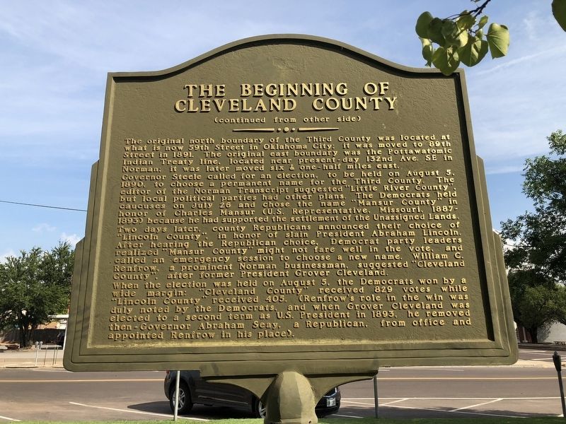
On East Comanche Street at South Peters Avanue, on the right when traveling east on East Comanche Street.
Although the Norman townsite was settled during the Land Run on April 22, 1889, Cleveland County did not exist for another year, and almost wasn't named Cleveland County. In fact, if not for the efforts of Norman's early citizens and civic . . . — — Map (db m121630) HM
On North Jones Avenue north of East Tonhawa Street, on the left when traveling north.
As they were throughout the state, the 1980s were a challenge to Norman and Cleveland County. The decade began on an upbeat note as the major industries – York, Shaklee and Totco – all reported strong production. But later troubles in the national . . . — — Map (db m279810) HM
Near South Jones Avenue south of Castro Street, on the right when traveling south.
The town site of Norman came into existence with a very dramatic event that occurred April 22, 1889 at high noon when the Great Land Rush originally began. Before that moment, the original town site of 320 acres had been planned by Charles . . . — — Map (db m278967) HM
On North Jones Avenue north of East Tonhawa Street, on the left when traveling north.
A football championship can quickly alter the skyline of a university community. In 2000 under the direction of Coach Bob Stoops, the University of Oklahoma Sooners won their 7th
national football title which then encouraged the expansion of the . . . — — Map (db m279828) HM
On North Jones Avenue north of East Tonhawa Street, on the left when traveling north.
Oklahoma became the 46th state on Saturday, November 16, 1907 when President Theodore Roosevelt signed a proclamation officially joining the “Twin Territories” – Indian Territory and Oklahoma Territory – into a brand new state. As of that time, the . . . — — Map (db m279772) HM
Near South Jones Avenue south of West Eufaula Street, on the right when traveling south.
U.S. Naval Air Station
Norman, Oklahoma
Commissioned on July 28, 1942
De-commissioned on March 4, 1946
On March 20, 1942, the U.S. Navy announced that an aviation base to train Navy pilots would be constructed in Norman located on . . . — — Map (db m279420) HM
On North Jones Avenue north of East Tonhawa Street, on the left when traveling north.
Citizen participation characterized much of the municipal government dialogue during the 1970s. It was a time of government questioning nationwide and Norman residents were no exception. More than 9,000 citizens signed a petition to lower Norman's . . . — — Map (db m279808) HM
On East Main Street at North Jones Avenue, on the left when traveling east on East Main Street.
On Saturday, November 16, 1907, Oklahoma became the 46th state. As of that time, the City of Norman, having been established since April 22, 1889, as part of the Great Land Run, was a pretty eighteen-year-old prairie settlement of 3,040 people.
. . . — — Map (db m279755) HM
On North Peters Avenue at Acres Avenue, on the right when traveling south on North Peters Avenue.
Banker and real estate investor, William S. Moore
and his wife Agnes, built this house in December
1899. In November 1908, Moore sold the house to
Harry Ginter Lindsay and his wife Daisy, the
niece of Agnes Moore. The Lindsay's owned a . . . — — Map (db m278261) HM
On East Eufaula Street at South Peters Avenue, on the left when traveling east on East Eufaula Street.
Norman was designated as the seat of Cleveland County shortly after the Land Run of 1889. The first permanent courthouse was located in the Original Townsite of Norman at the corner of Gray Street and Ponca Avenue. This structure was destroyed by . . . — — Map (db m121720) HM
Thin black lines indicate changes in relevance. Between each pair of lines entries are ordered geographically but all have the same relevance.
* Inflectional forms of words are their plurals, singulars, and possessives as well as gramatical tenses and similar variations.