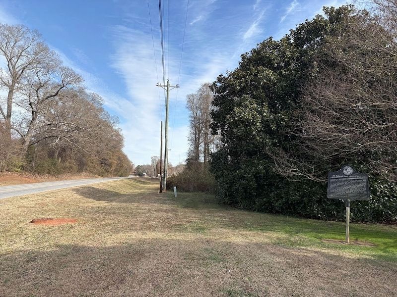
On Georgia Route 59 0.2 miles north of Sandy Cross Road ( Route 51), on the right when traveling north.
Development along Indian trails of the Old Federal Road began in the early 19th century to improve transportation between South Carolina and Tennessee. Although European settlement in this area began in the late 1700s, the road increased populations . . . — — Map (db m15020) HM
On Georgia Route 106 at Red Hill School Road, on the left when traveling west on Georgia Route 106.
In 1912, William Thomas Sosby donated 1.4 acres near this site for the Red Hill School. Originally for grades 1-6, the school added grades 7-9 in 1922. After consolidation in 1925, a new school building was constructed here on land donated by Sosby . . . — — Map (db m15156) HM
On Mill River Road at Old Quarry Road., on the left when traveling west on Mill River Road.
Boyrereau Brinch "Jeffrey Brace". Born in 1742 in West Africa, Boyrereau Brinch was sold into slavery at age 16. Renamed Jeffrey Brace, he fought in the Seven Years War as an enslaved sailor and endured the cruelty of masters in Connecticut. . . . — — Map (db m230581) HM
Near East Broad Street east of First Street, on the right when traveling east.
In 1783 the Oconee River basin was the western boundary of the new United States of America. The first U.S. frontiersmen included surveyors, mapmakers, native guides, and naturalists.
To entice farmers to the new territory, the U.S. . . . — — Map (db m206381) HM
On Shoal Creek Church Road (County Route 245) 0 miles south of Bill Lucas Road, on the right when traveling north. Reported missing.
Parkertown was founded in 1832 in what was then Franklin County, now Hart County, by Joseph A. Parker who was born in Virginia in 1774 and moved to Elbert County, Ga. in 1796. He later moved to Big Shoal Creek where Jacob Parker & Co. founded by his . . . — — Map (db m45081) HM
On Wagener Road (State Highway 302), on the right when traveling west.
(Left)
Herbert Boyd (H.B.) Crawford
U.S. Navy
Honorably Discharged
April 8, 1946
During World War II with Japan
his back was broken & both
legs were paralyzed when his
cargo ship was torpedoed
(Right)
Mabel . . . — — Map (db m56751) HM
On Farm to Market Road 1011 1 mile north of North Main Street, on the right when traveling north.
Delegate to the Second Convention of Texas, 1833 Alcalde of Liberty Municipality, 1835 First Judge of the Municipality Born in Franklin County, Georgia March 25, 1801 Died in Galveston June 28, 1839 — — Map (db m195713) HM
On Virgil H. Goode Hwy. (U.S. 220) south of Virginia Route 635, on the right when traveling south.
Here through the Maggoty Gap, the Great Wagon Road from Philadelphia to Georgia, known locally as the Carolina Road, passes through the Blue Ridge. Originating as the Great Warrior Path of the Iroquois centuries before, the path was frequently used . . . — — Map (db m63203) HM
On 4th Street at Avenue D, on the right when traveling east on 4th Street.
The Franklin Guards, a company of Infantry organized in Apalachicola in 1884 by J. H. Coombs and Fred Betterfield, erected the first building in the city to be used solely as an armory in 1898. Made of simulated brick, it was located at the corner . . . — — Map (db m26120) HM
On North Railroad Street at Route 53, on the right when traveling north on North Railroad Street.
John Tate, born in Ireland in 1758, came to America in 1763. He volunteered for the Pennsylvania Militia in December 1776 from Shippensburg, Cumberland County, PA. He served as a private with Captain Robert Culbertson and later, at the Battle of . . . — — Map (db m315011) HM
Born in Franklin County, Georgia
January 25, 1803 Died at Liberty, Texas, April 20 1878 An officer at the Siege of Bexar and at San Jacinto 1837 appointed by Congress Surveyor of Liberty County 1841, Colonel of the 2nd Regiment of the 2nd . . . — — Map (db m195844) HM
On South Main Street (Business U.S. 220) near Old Furnace Road, on the right when traveling south.
Here stands the furnace and ironmaster’s house of the Washington Iron Works, Franklin County’s first industry. Originally established in 1773 by Col. John Donelson, father-in-law of President Andrew Jackson, the iron plantation was acquired in 1779 . . . — — Map (db m65983) HM
On Main Street at Newnan Street, on the right when traveling east on Main Street.
This, the Franklin Methodist Church, erected in 1831, is one of the earliest permanent church buildings in this area. Constructed of 12x12 handhewn pine beams, the church has been extensively remodelled through the years except the steeple, which . . . — — Map (db m32779) HM
On Avenue D at Market Street, on the right when traveling north on Avenue D.
Thomas Orman (1799-1880) was an ambitious entrepreneur and significant member of the Apalachicola mercantile community. In his lifetime, Orman held title to over 39,000 acres in Franklin County. Of the many cotton warehouses once located on Water . . . — — Map (db m275855) HM
Near Lawndale Drive just west of South Main Street (Business U.S. 220).
Here at the house and ordinary of Col. James Callaway, proprietor of the Washington Iron Works, the first Franklin County court met to organize the new county on Monday, Jan. 2, 1976. The iron works had been established here by 1773 by Col. John . . . — — Map (db m65984) HM
Near Water Street at Bay AVenue, on the right when traveling east.
Apalachicola Bay is considered one of the least polluted, most undeveloped, resource rich systems in the U.S. The Apalachicola drainage basin includes upland, floodplain, riverine, estuarine, and barrier island environments all of which are . . . — — Map (db m276187) HM
On 1st Avenue NW at South High Street, on the left when traveling west on 1st Avenue NW.
When Tennessee failed to secede from the Union on February 9, 1861, Franklin County residents met here at the courthouse. They listened to attorney Peter Turney’s forceful speech offering resolutions in favor of secession and reportedly adopted them . . . — — Map (db m75226) HM
On East River Street east of South 1st Street, on the right when traveling east.
[Stone monument]
Trail of Tears
1832-1840
Arkansas River valley
routes
Choctaw – Chickasaw
Muscogee Creek
Seminole – Cherokee
[Panel]
Trail of Tears Routes through Franklin County
1. Northern Route through . . . — — Map (db m236869) HM
On West 8th Street west of Jefferson Street, on the left when traveling west.
The John B. Busch Washington Brewery And Malt House
In about 1854 John Baptiste Busch together with his older brother, Henry Busch, and a friend, Fred Gersie, started the Washington Brewery and Malt House at Jefferson and Eighth Street. John . . . — — Map (db m268728) HM
Founding Father
Born in Massachusetts, Benjamin Franklin (1706-1790) is
remembered as the elder statesman of the American cause
during the Revolutionary War. Beyond the political arena, he
pursued many interests, including higher . . . — — Map (db m309137) HM
Thin black lines indicate changes in relevance. Between each pair of lines entries are ordered geographically but all have the same relevance.
* Inflectional forms of words are their plurals, singulars, and possessives as well as gramatical tenses and similar variations.