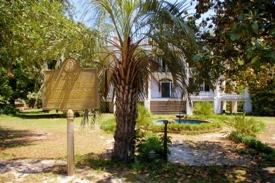
On 18th Avenue 0.1 miles south of St. Elmo Drive, on the left when traveling south.
“St. Elmo,” one of the most exquisite examples of the classic houses of America, stands in view of this point. It was built on the old Stagecoach Road, by Colonel Seaborn Jones, for his wife, Mary Howard Jones. Completed in 1833, it was . . . — — Map (db m43119) HM
On 2nd Avenue north of 11th Street, on the left when traveling north.
Organized October 9, 1828, Columbian Lodge was chartered by the Grand Lodge of Georgia in December 1828, as No. 28. In 1849 it became No. 7. It is the oldest Lodge in western Georgia. First Worshipful Master was Luther Blake. The Lodge was organized . . . — — Map (db m23053) HM
On 2nd Avenue at East 10th Street, on the right when traveling south on 2nd Avenue.
The modern Civil Rights Movement in Georgia began on July 4, 1944, when Primus E. King, an African-American barber and minister, attempted to vote at the Muscogee County Courthouse in the Democratic Party’s primary election, which barred blacks from . . . — — Map (db m101279) HM
On East 10th Street at 2nd Avenue, on the right when traveling east on East 10th Street.
In 1890, Augusta Howard founded the Georgia Woman Suffrage Association in Columbus at her family's antebellum mansion. It was Georgia's first organized effort to gain the vote for women. In 1894, Howard persuaded the National American Woman . . . — — Map (db m173538) HM
On Veterans Parkway (U.S. 27) 0 miles north of 6th Street, on the right when traveling north.
The first public library for African Americans in segregated Columbus, the Colored/Fourth Avenue Library, opened on January 5, 1953. The existence of
this facility resulted from covenants and restrictions barring the use of the city’s new public . . . — — Map (db m22410) HM
Near South Lumpkin Road, on the right when traveling south.
Cusseta was both an important political center for the Lower Creeks and a critical place for interaction with European colonial officials and later, American settlers. Occupying a strategic position in a vast trading network stretching from the Gulf . . . — — Map (db m113780) HM
On Warm Springs Road at Miller Road, on the right when traveling north on Warm Springs Road.
Born in Maryland, Cooper served in the South Carolina Militia during the American Revolution and participated in battles at Brandywine, Germantown and Stony Point. After the War he moved to Putnam County, Georgia and later to Muscogee County where . . . — — Map (db m17811) HM
On 9th Street 0 miles west of First Avenue, on the right when traveling west.
Site of the last armory of the Columbus Guards, a noted military company chartered by the Georgia Legislature in 1843 and organized in 1835. They served voluntarily in the Indian War, 1836; the War with Mexico, 1846; the War Between the States, the . . . — — Map (db m43951) HM
On Victory Drive (U.S. 27) at Marathon Drive, on the right when traveling south on Victory Drive.
On August 15, 1945, celebrating the surrender of Japan which ended World War II, the Muscogee County Commission unanimously voted to rename the boulevard extending from Columbus to Fort Benning as Victory Drive. Commissioner L.R. Aldridge stated, . . . — — Map (db m22139) HM
Near 14th Street north of Front Avenue, on the right when traveling west.
Confederate Command: Major General Howell Cobb Federal Command:
Major General James H. Wilson
The Last Battle
Even though the Confederacy teetered on the verge of collapse by early 1865 the Union worried that the South would never . . . — — Map (db m217749) HM
On Victory Drive (U.S. 27) at Benning Drive, on the right when traveling north on Victory Drive.
Side 1
Baker High School, originally Baker Village School, opened in 1943 to serve primarily military and Muscogee County students. It was named for Newton D. Baker, U.S. Sec.
of War during World War I. During World War II the school contained a . . . — — Map (db m173498) HM
Near Front Avenue north of West 6th Street, on the right when traveling south.
Built in 1843, the Wynnton Male Academy (now Wynnton School Library) is considered the oldest such school facility in continuous use in the state. This building was listed on the National Register of Historic Places in 1972. Industrial High School, . . . — — Map (db m101326) HM
On Wynnton Road west of Blandford Avenue, on the left when traveling west.
The Columbus Museum traces its history back to the efforts in the 1920s of several local citizens and civic groups to raise awareness of the need for a museum in the city. Formal efforts at establishing the Museum got underway in 1940, culminating . . . — — Map (db m113895) HM
Near Capitol Avenue Southwest south of M.L.K. Junior Drive Southeast, on the left when traveling north.
Expelled Because of Color” is dedicated to the memory of the 33 Black state legislators who were elected, yet expelled from the Georgia House because of their color in 1868.
The cinder block forms at the base of the sculpture symbolize the . . . — — Map (db m130191) HM
Thin black lines indicate changes in relevance. Between each pair of lines entries are ordered geographically but all have the same relevance.
* Inflectional forms of words are their plurals, singulars, and possessives as well as gramatical tenses and similar variations.