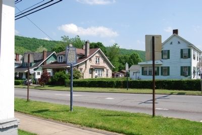
On 8th Street (U.S. 322) at Elk Street, on the right when traveling west on 8th Street.
Built by the French in 1756 to guard the route to the Ohio; it was evacuated and burned by them after the siege and fall of Fort Niagara in 1759. Site of fort is one block south. — — Map (db m42936) HM
On 8th Street (U.S. 322) at Elk Street, on the left when traveling west on 8th Street.
To assert control over the area, Fort Venango was built near this point by the British in 1760. The fort was attacked and destroyed by Indians in 1763 during Pontiac's uprising. — — Map (db m42938) HM
On Liberty Street (U.S. 322) at 12th Street, on the right when traveling west on Liberty Street.
Formed March 12, 1800 out of Allegheny and Lycoming counties. The name (an Indian term) refers to French Creek. Franklin, county seat, was laid out in 1795. It became a city in 1868, as did Oil City in 1871. At Drake Well the oil industry was born, . . . — — Map (db m42943) HM
On North Main Street (Pennsylvania Route 8) 0.1 miles south of Meadville Road (U.S. 6), on the right when traveling north.
Near Titusville. The Park and Museum are owned by the State. On the site Col. Edwin Drake struck oil Aug. 27, 1859, marking the birth of the petroleum industry. Historical and museum material center. — — Map (db m64581) HM
On Elk Street south of 12th Street, on the left when traveling south.
Brig. Gen. McCalmont was a Franklin attorney whose law office was at this location. He was the Assistant Attorney General under President James Buchanan, serving from 1858 through 1861. In 1862, as a Captain in the Union Army, he . . . — — Map (db m138137) HM
On 4th Avenue at Market Street (U.S. 62), on the right when traveling east on 4th Avenue.
[Header]
Walkable Warren
Walkable Warren is a local initiative intended to promote healthy lifestyles by encouraging foot traffic and bicycling as alternative modes of travel in and around the City of Warren. Warren has a wealth of . . . — — Map (db m307074) HM
On Fox Chapel Road, on the right when traveling north.
It took a lot of clams (among other marine invertebrates) to make up the Ames Limestone bed, which extends westward into Ohio and eastward through Pennsylvania. Evidence of the vastness of the sea is shown in the speculative map.
This map at . . . — — Map (db m248323) HM
On Smock Boulevard (Pennsylvania Route 8), on the right when traveling north.
ATLANTIC REFINING COMPANY
1859: Charles Lockhart and William Frew came to this region to drill for oil on the south bank of the Allegheny across from the mouth of Oil Creek in Venango County. Subsequently they bought out the Tarr Farm and . . . — — Map (db m134083) HM
On 4th Street Southwest at Court Avenue Southwest, on the left when traveling west on 4th Street Southwest.
John Chapman, better known as Johnny Appleseed, was an American pioneer gardener and missionary who introduced apple trees to the Midwest States of Ohio, Indiana, Illinois and Pennsylvania. In 1809, John Chapman came to Canton, Ohio, and . . . — — Map (db m214700) HM
Near Chestnut Street (Pennsylvania Route 66) at West Spruce Street.
First called "Blood's Settlement", and then later Marien, then Marienville, after Marien (Blood) Hunt, daughter of Cyrus Blood, the founder of Forest County. Marienville is located on a flattened ridgeline known as the "Big Level", . . . — — Map (db m138604) HM
Near Pithole Road 2.2 miles east of Rouseville Road (Route 227).
Declining oil production, destructive fires, inequitable lease terms, and competition from new oil fields killed Pithole. On First Street, 18 buildings burned in April 1866.
Oil production fell below 1,000 barrels a day, and the population . . . — — Map (db m314700) HM
On County Route 153 east of Sandusky Street (County Route 5S), on the right when traveling east.
Earl Sloan's accumulation of a fortune from the formulation and sale of "Sloan's Liniment" resulted in the creation of a living legacy. To "honor the place of his nativity" Dr. Earl Sloan donated funds to build the Sloan Library for the people of . . . — — Map (db m82605) HM
[Marker is primarily informational; historical tidbits are transcribed as follows]
The Foxburg Library, built in 1909, was endowed to the town by the Fox family. Lincoln Hall stands on the upper level [and is] home to concerts and cultural . . . — — Map (db m170882) HM
On Liberty Street (U.S. 62) east of 12th Street, on the left when traveling east.
This Civil War Monument commemorates 400 Venango County soldiers who died during the war. These soldiers fought in many battles including Lookout Mountain, Bull Run, Yorktown, Fredericksburg, Chancellorsville, Gettysburg, and Antietam. . . . — — Map (db m138134) HM WM
Thin black lines indicate changes in relevance. Between each pair of lines entries are ordered geographically but all have the same relevance.
* Inflectional forms of words are their plurals, singulars, and possessives as well as gramatical tenses and similar variations.