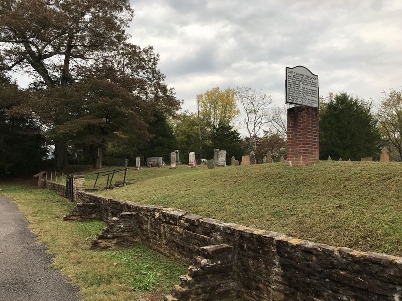
On Monterey Highway (State Highway 84) 1.4 miles north of Mack Floyd Road, on the right when traveling north.
Champ Ferguson (1821–1865) was born in Kentucky, the oldest of ten children. He moved to White County, Tennessee, in the 1850s. During the Civil War, he showed passionate loyalty to the Southern cause and extreme hatred for the Union. The alleged . . . — — Map (db m157780) HM
On North Main Street (State Highway 71) at Greenville Street (State Highway 20) on North Main Street.
Burt-Stark House When Jefferson Davis, President of the Confederacy, left Richmond after its fall in April 1865, he traveled south, trying to reach and rally the remnants of his army. On May 2, he spent the night at the home of Col. Armistead . . . — — Map (db m10564) HM
On Main Street at Greenville Street, in the median on Main Street.
This tablet was placed here to commemorate the last meeting of the Confederate States Cabinet which was held in the Burt House near by directly in front of this stone.
The following cabinet members were present:
Jefferson Davis, President . . . — — Map (db m73949) HM
On Cumberland Street at South Cross Street, on the left when traveling west on Cumberland Street.
Champ Ferguson born here in 1821. Guerrilla leader with Confederate leaning, but attacked supporters of both sides thruout Civil War in southern Ky., Tenn. Over 100 murders ascribed to Ferguson alone. Hunted by both CSA and USA. Taken after end of . . . — — Map (db m136581) HM
Near Office Drive at Pigeon Ridge Road (Tennessee Route 419).
When the war began, the residents of the Upper Cumberland Plateau were divided in their loyalties. In Cumberland County, for instance, the numbers of Confederate and Union enlistments were about equal.
Some Confederate supporters joined Co. B, . . . — — Map (db m107097) HM
White County, named for Revolutionary War veteran John White, is balanced in the Cumberland Plateau and the Eastern Highland Rim. Karst, a limestone topography pitted by caves, sinkholes, and underground drainage, covers most of the county. It . . . — — Map (db m201281) HM
On Crossville Highway (U.S. 70) at Coal Bank Road, on the right when traveling west on Crossville Highway.
William Earl Webb was born in White County, Tennessee, on September 17, 1897. His family moved to Bon Air and then Ravenscroft, where Earl worked in the coal mines and played baseball for local teams. He began in the minor leagues in 1921, and . . . — — Map (db m48664) HM
On Liberty Square at North Main Street (TN84) on Liberty Square.
This historical monument honors Joseph Kerr hero of the battle of Kings Mountain who lived and died in White County and those soldiers who fought in the American Revolution and who also made their home in White County *** Erected with deep pride and . . . — — Map (db m107641) WM
On West Brockman Way (US70) at North Main Street (TN84) on West Brockman Way (US70).
The Double Eagle celebrates our Country’s founding. One eagle looks proudly back on a glorious past, the other eagle gazes confidently to an unlimited future---Proudly presented to the people of White County by the members of the White County . . . — — Map (db m107644) WM
On 6th Avenue North, on the left when traveling north.
Ridge and Valley
The Ridge and Valley physiographic province is an area between the Cumberland Plateau on the west and the Mountains on the east. This 9,000 square mile great valley extends diagonally across east Tennessee from Virginia to . . . — — Map (db m206495) HM
On Public Square at East Main Street, on the left when traveling north on Public Square.
Established 1837; named in honor of Baron Johann De Kalb, the Bavarian officer who accompanied Lafayette to America in 1777. Appointed a Major General in the Continental Army, he was killed at the Battle of Camden in 1780 while commanding Delaware . . . — — Map (db m129993) HM WM
On 5th Avenue North, on the left when traveling north.
Eastern Highland Rim
The Eastern Highland Rims coupled with the Western Rim is the upland surrounding the Central Basin of Tennessee. It is separated from the Western Rim on the north by the passage of the Cumberland River into Tennessee . . . — — Map (db m206497) HM
On Depot Street at North Cedar Avenue, on the right when traveling west on Depot Street.
Putnam County was a divided land during the Civil War as local residents enlisted in either Federal or Confederate units. It also was a crossroads, as both armies passed through the county numerous times over such important historic roads as the . . . — — Map (db m159208) HM
On West Maple Street near South Main Street, on the right when traveling west.
“Brother against brother” sums up the divided loyalties families faced in White County during the Civil War. In 1862, Confederate Gen. Braxton Bragg’s troops marched through the Sparta town square en route north to invade Kentucky. . . . — — Map (db m83165) HM
Near Interstate 40 2.8 miles Exit 329 (Interstate 40), on the right when traveling west. Reported permanently removed.
Samuel "Champ" Ferguson was the most notorious Confederate guerilla leader in the Upper Cumberland mountains. In 1861, he formed a company and began attacking Unionist partisans. Such irregular forces were common on both sides during the war, . . . — — Map (db m270278) HM
Near Buffalo Valley Road east of Deer Creek Drive, on the left when traveling east.
Major Richard Fielding Cooke was one of the most prominent pioneer citizens of Putnam County. As a member of the General Assembly in its 1853-54 session he was untiring in his efforts to secure the re-establishment of Putnam County. On February 11, . . . — — Map (db m182566) HM
On Georgia Route 255, on the left when traveling north.
The Nacoochee slave cabin is one of only a few slave dwellings to survive in Georgia. Built on a stacked stone foundation and framed with hand-hewn timbers and lumber bearing the telltale marks of a sash saw, it saw for more than 150 years on the . . . — — Map (db m173152) HM
Near Old Mulkey Park Road 0.2 miles west of Old Mulkey Road.
Hannah Boone was the youngest child born to Squire Boone and Sarah Morgan Boone.
The Boones were members of the Friends Society (Quakers) and Squire served as first a trustee and then an overseer of the Oley Meeting. The Boones moved to the Yadkin . . . — — Map (db m184060) HM
On Great Falls Road (Tennessee Route 287) south of H G Hill Road, on the right when traveling south.
The circa 1910 Webb Hotel served early commercial lodging in Rock Island, Tennessee. Great Falls Dam, which opened in 1917, resulted in making the community one of Tennessee's premier resort towns. Sunday dinners, the floating Collins River swimming . . . — — Map (db m184522) HM
Thin black lines indicate changes in relevance. Between each pair of lines entries are ordered geographically but all have the same relevance.
* Inflectional forms of words are their plurals, singulars, and possessives as well as gramatical tenses and similar variations.