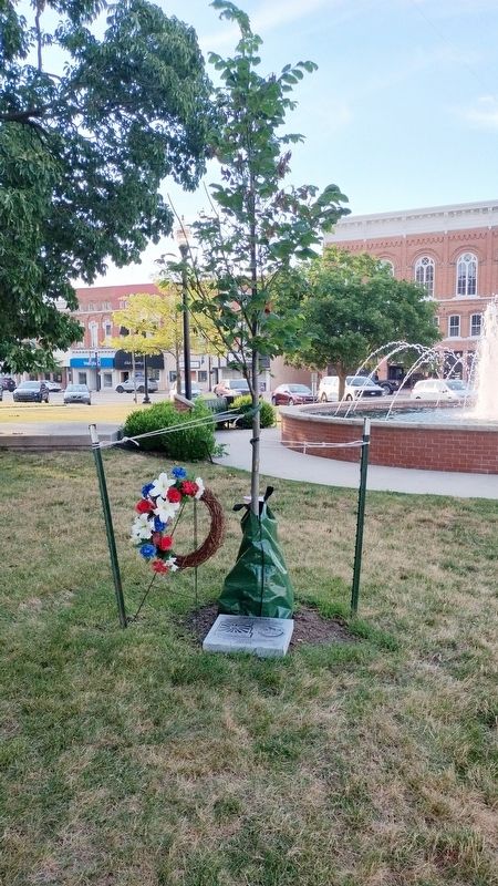
On County Road C.75 0.1 miles east of County Road 5, on the left when traveling east.
The Cedar Hill Farm Homestead story began in 1864 when John Burchard purchased the farmland. It has been in the Kisseberth family since 1903 and gained centennial status in 2003. In 2008, the Ohio Centennial Farm of Cedar Hill became the first farm . . . — — Map (db m69047) HM
Near County Road D 0.4 miles east of County Road 16, on the right when traveling east. Reported missing.
Richard E. Schreder grew up in Toledo, Ohio and graduated from the University of Toledo with a degree in Mechanical Engineering. He was a decorated navy pilot and iconic aviation figure who helped shape the American soaring movement, . . . — — Map (db m178433) HM
On Ohio Route 66 0.2 miles south of County Road H, on the right when traveling south.
The Wabash Cannonball Trail is a 63-mile non-motorized, multi-use trail traversing four counties. Ownership is divided among six separate entities, which include Metroparks Toledo, Lucas County, Maumee, Whitehouse, Wauseon, and the Northwestern Ohio . . . — — Map (db m254415) HM
Paul Allman Siple was born here on December 18, 1908. In 1927, he was chosen from thousands of ambitious Eagle Scouts to accompany Admiral Richard E. Byrd on his first Antarctic Expedition. Twelve years later, while attending Clark University in . . . — — Map (db m4009) HM
On N. Depot Street at Pleasant Street, on the left when traveling west on N. Depot Street.
Like many nineteenth century communities in Ohio, Stryker owes its birth and early growth to the railroad industry. Stryker, named for Rome, New York, attorney and railroad executive John Stryker, was surveyed on September 19, 1853, beside the . . . — — Map (db m69030) HM
On East Main Street (Ohio Route 107) just east of Henry Street, on the left when traveling east.
Honoring and recognizing Robert Walkup, Robert Reamsnyder, Robert Frey and Robert Bauer for their patriotism and dedication to the memory of the veterans of Williams County, Ohio, in the establishment and construction of the Williams County . . . — — Map (db m182389) HM WM
On Tremont Road near Kenny Road, on the right when traveling north.
Born in a log cabin in Williams County, Ohio in
1877, educated at Tri-state College and
Hillsdale College, graduated from Ohio Medical
College, Columbus, Ohio, 1906, and practiced in
Columbus for 44 years.
Co-founder of St. Clair Hospital . . . — — Map (db m223608) HM
On Wabash Cannonball Trail (North and South Fork) at County Road 23, on the left when traveling north on Wabash Cannonball Trail (North and South Fork).
The Wabash Cannonball Trail is a 63-mile non-motorized, multi-use trail traversing four counties. Ownership is divided among six separate entities:
- Toledo Metroparks
- Lucas County
- Maumee
- Whitehouse
- Wauseon
- . . . — — Map (db m235461) HM
On Wood Street just north of Mulberry Street, on the right when traveling north.
The Wabash Cannonball Trail is a 63-mile non-motorized,
multi-use trail traversing four counties. Ownership is divided
among six separate entities:
- Toledo Metroparks
- Lucas County
- Maumee
- Whitehouse
- Wauseon
- . . . — — Map (db m170875) HM
On Lakeview Parkway near Shoosmith Road, on the left when traveling north.
During the first 18 months of the Civil War, President Abraham Lincoln chose not to act upon recommendations of Frederick Douglass, and others, to enlist Black men in the Union Army in the fight against the Confederacy. After the much-needed Union . . . — — Map (db m314862) HM
On N. Williams Street (U.S. 127) at E. Perry Street, on the right when traveling north on N. Williams Street.
Named for John Paulding, a Revolutionary War soldier whose capture of a British spy implicated Benedict Arnold in treason, Paulding County was formed in 1820 from the last remaining unorganized area of Ohio. Sparsely settled, it remained under the . . . — — Map (db m69009) HM
On Laurel Mills Road (County Route 618) at Richmond Road (County Route 729), on the left when traveling east on Laurel Mills Road.
Dangerfield Newby (ca. 1820-1859), a free mulatto for whose family this crossroads is named, was the first of John Brown’s raiders killed during the attack on Harpers Ferry on October 16, 1859. He was the eldest child of Henry Newby and a slave, . . . — — Map (db m50611) HM
Near North Dixie Highway (U.S. 31W) 0.1 miles south of Diecks Drive, on the right when traveling north.
Five generations of the Helm family lived on the land where the Helm House commonly known as Helm Place, stands today. Five generations of Helm men and women, working as surveyors, lawyers, church activists, soldiers, judges, bankers, public . . . — — Map (db m249555) HM
On Ohio Route 114 at Route 694, on the right when traveling north on Ohio Route 114.
Home in the wilderness 1821-1870. Built in 1821 downstream a quarter mile on the Auglaize west bank by Sebastian Sroufe, War of 1812 veteran, and wife Mary, this home was postal stop Sugar Grove on the Ft. Recovery-Ft. Defiance route and in 1828, . . . — — Map (db m79533) HM
On East Main Street (Ohio Route 107) just east of Henry Street, on the left when traveling east.
This project was born with a simple thought of creating a
memorial to honor all veterans of Williams County, Ohio.
The first question to be answered was "what is an
appropriate memorial for those that have served". Some
served in . . . — — Map (db m182390) HM WM
On East Main Street (Ohio Route 107) just east of Henry Street, on the left when traveling east. Reported permanently removed.
History Of The Williams County Veterans Memorial
This project was born with a simple thought of creating a
memorial to honor all veterans of Williams County, Ohio.
The first question to be answered was "what is an
appropriate . . . — — Map (db m183404) HM WM
Thin black lines indicate changes in relevance. Between each pair of lines entries are ordered geographically but all have the same relevance.
* Inflectional forms of words are their plurals, singulars, and possessives as well as gramatical tenses and similar variations.