19 entries match your criteria.
Related Historical Markers
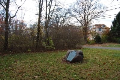
By Mike Wintermantel, November 11, 2011
Friedensstadt Marker
SHOWN IN SOURCE-SPECIFIED ORDER
| On Donald Road at Pennsylvania Route 18, on the right when traveling north on Donald Road. |
| On Main Street at Mallarnee Road, on the right when traveling west on Main Street. |
| Near South Cherry Street, 0.2 miles south of West Indian Street. |
| On East High Avenue (County Route 259), on the right when traveling south. |
| On Commercial Avenue SE (Ohio Route 416) south of Cookson Avenue SE, on the left when traveling south. |
| On U.S. 36 at Salem Park Road (Local Route 213), on the left on U.S. 36. |
| On East Mansfield Street at North Walnut Street (Ohio Route 100), on the left when traveling east on East Mansfield Street. |
| On Ohio Route 19, 0.3 miles east of Parcher Road (Local Route 43), on the left when traveling east. |
| On Leesville Road, 0.4 miles east of Ohio Route 598, on the right when traveling east. |
| On East Wyandot Avenue, on the right when traveling east. |
| On Ohio Route 53 at Ohio Route 67, on the right when traveling north on State Route 53. Reported missing. |
| On County Route 47 near Ohio Route 67, on the left when traveling south. |
| On Ohio Route 199 at County Route 29, on the left when traveling north on State Route 199. |
| On State Highway 199 at County Highway 29, on the left when traveling north on State Highway 199. |
| On County Route 29 at Township Highway 300, on the right when traveling east on County Route 29. |
| On Township Highway 300, 0.2 miles north of County Route 29, on the right when traveling north. |
| On Longwoods Road (Provincial Highway 2) east of Victoria Road (Provincial Highway 21), on the right when traveling east. |
| On Longwoods Road (Provincial Highway 2) east of Victoria Road (Provincial Highway 21), on the right when traveling east. |
| On Longwoods Road (County Route 2), on the right when traveling east. |
Jun. 16, 2024