On Kelly's Ford Road (Virginia Route 674) at Kelly's Ford Road (Virginia Route 620), on the right when traveling south on Kelly's Ford Road.
Civil War cavalry battles could be huge, shifting, sprawling engagements, spread across miles of countryside. For instance, the Battle of Brandy Station, named for a railroad town eight miles away, began at historic Kelly’s Ford in front of you. . . . — — Map (db m203004) HM
Near Edwards Shop Road, on the right when traveling south.
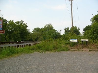
At this site in 1863 the federal forces charged across the river to begin the Battle of Kelly's Ford & Brandy Station. Traces of the ford & John P. Kelly's toll, 1837 to 1862, may still be seen at this point. — — Map (db m21330) HM
On Beverly Ford Road (County Route 676), on the right when traveling north.
On June 9, 1863, the Civil War visited the river fords, farmer's fields and rolling hills near Brandy Station. During the intense daylong fighting that swirled all around the little town, Confederate and Union horsemen clashed in the largest cavalry . . . — — Map (db m156293) HM
On Beverly Ford Road (County Route 676), on the right when traveling north.
Rivers and river crossings played an important role in many Civil War battles, including the Battle of Brandy Station. A mile northwest of this spot is the site of Beverly Ford, where the cavalry of both the Confederate Army of Northern Virginia . . . — — Map (db m203006) HM
On Beverly Ford Road (County Route 676), on the right when traveling north.
Both Union and Confederate armies used horse artillery to assist cavalry. When firing erupted at Beverly Ford on the morning of June 9, 1863, Major Robert F. Beckham's battalion of Confederate horse artillery (16 guns and some 500 men) was encamped . . . — — Map (db m4415) HM
Near Beverly Ford Road (Route 676), on the right when traveling north.
Failing to break through Maj. Gen. J.E.B. Stuart's Confederates at St. James Church, Brig. Gen. John Buford swung his force north and west to turn the Confederate left flank. Confederate Brig. Gen. William Henry Fitzhugh "Rooney" Lee, son of Robert . . . — — Map (db m167004) HM
Near Beverly Ford Road (Route 676), on the right when traveling north.
The Federal forces of Brig. Gen. John Buford, Brig. Gen. David Gregg, and Col. Thomas Devin (whose command held the area around St. James Church) had almost encircled the Confederates, though none of the Union commanders had planned it so. Unknown . . . — — Map (db m4418) HM
On Beverly Ford Road (County Route 677) at St. James Church Road (County Route 676) on Beverly Ford Road.
Confederate horsemen numbering 9500 under the command of Gen. J.E.B. Stuart were concentrated around Brandy Station in preparation of the upcoming raid into Pennsylvania - which would culminate at Gettysburg. The Federal army, being aware of the . . . — — Map (db m4364) HM
On Beverly Ford Road (County Route 677) at St. James Church Road (County Route 676), on the left when traveling north on Beverly Ford Road.
On the night of December 1, 1863, following its unsuccessful advance against Robert E. Lee's Confederate Army of Northern Virginia during the Mine Run Campaign, a cold and tired Army of the Potomac withdrew across the Rapidan River and returned to . . . — — Map (db m4370) HM
Near Beverly Ford Road (County Route 677) at St. James Church Road (County Route 676), on the left when traveling north.
The 1863-1864 winter encampment proved a busy time for the Army of the Potomac. "There was something fascinating about our winter city of 100,000 men," a staff officer recalled. "Many pleasant recollections cluster around the old camp at Brandy . . . — — Map (db m190831) HM
Near Beverly Ford Road (County Route 677) at St. James Church Road (County Route 676), on the left when traveling north.
By 7 a.m. on June 9, Brig. Gen. John Buford had his Union troops in position. Brig. Gen. Adelbert Ames' Federal brigade of infantry straddled the Beverly Ford Road. To Ames' left (where the airport is now) was the 1st Cavalry Division, commanded by . . . — — Map (db m202996) HM
On St. James Church Road (Route 676) at Beverly Ford Road (Route 677), on the right when traveling west on St. James Church Road.
Several hundred yards behind you, in the copse of trees, is the site of the St. James Church. Union soldiers tore down the small brick structure for materials to make their quarters during the winter of 1863-1864, when the Army of the Potomac . . . — — Map (db m154488) HM
On James Madison Highway (U.S. 15/29) south of Berry Hill Road, on the right when traveling south.
Here on 9 June 1863, the largest cavalry battle in North America occurred when 9,500 troopers fought 8,000 cavalrymen under Union Brig. Gen. Alfred Pleasonton. This daylong battle, the opening engagement of the Gettysburg campaign, erupted when the . . . — — Map (db m2574) HM
On Fleetwood Heights Road (County Route 685), on the right when traveling east.
Greatest cavalry battle of the Civil War • Fought June 9, 1863 • Gen. J.E.B. Stuart defeated Gen. A. Pleasonton Confederates engaged 10,200. Federals 10,900 Casualties, Confederates, 485, Federals 866 This is Fleetwood Hill The crucial position . . . — — Map (db m154490) HM
On Fleetwood Heights Road (County Route 685), on the right when traveling east. Reported missing.
Here the old Carolina Road crosses the southern part of Fleetwood Hill, some of the highest ground in the area. On the slope ahead of you Maj. Gen. James Ewell Brown (J.E.B.) Stuart, commander of Robert E. Lee's cavalry, pitched his headquarters . . . — — Map (db m4424) HM
On Fleetwood Heights Road (County Route 685), on the right when traveling east. Reported missing.
After Col. Wyndham's assaults, Col. Judson Kilpatrick's Federal brigade crossed the Orange and Alexandria Railroad and stormed Fleetwood Hill from the southeast. The fight for Fleetwood Hill - a classic cavalry battle fought on horseback - became a . . . — — Map (db m4421) HM
On Brandy Road (County Route 762), on the right when traveling east.
On this plain Lee reviewed his cavalry, June 8, 1863. The next day the cavalry battle of Brandy Station was fought. On June 10, Ewell's Corps, from its camp near here, began the march to Pennsylvania. — — Map (db m4428) HM
War has many faces and the residents of Culpeper County saw them all. Brandy Station played an important role in the Battle of Brandy Station on June 9, 1863, though the Union and Confederate armies never clashed in the streets of the little town. A . . . — — Map (db m4427) HM
On Stevensburg Road (County Route 663), on the right when traveling north.
The Battle of Brandy Station actually occurred in several locations, miles apart. A mile in front of you is Hansborough Ridge. Late in the morning of June 9, 1863, a division of the Union Cavalry under Col. Alfred Duffie approached the ridge from . . . — — Map (db m103534) HM
On Stevensburg Road near County Route 663, on the right when traveling north.
June 9, 1863 - 12:30 pm to 3:00 pm This map prepared from the first hand account of Col. Butler, other historians, and the personal account of the family, who in the early 1950s cleared, leveled and ditched this bottom for cultivation, . . . — — Map (db m103533) HM